


<< Text Pages >> Museo Vittorino Cazzetta - Museum in Italy in Veneto
Submitted by Megalithic89 on Friday, 30 April 2021 Page Views: 531
MuseumsSite Name: Museo Vittorino CazzettaCountry: Italy
NOTE: This site is 40.862 km away from the location you searched for.
Region: Veneto Type: Museum
Nearest Town: Selva di Cadore Nearest Village: Cortina d´Ampezzo
Latitude: 46.451040N Longitude: 12.039140E
Condition:
| 5 | Perfect |
| 4 | Almost Perfect |
| 3 | Reasonable but with some damage |
| 2 | Ruined but still recognisable as an ancient site |
| 1 | Pretty much destroyed, possibly visible as crop marks |
| 0 | No data. |
| -1 | Completely destroyed |
| 5 | Superb |
| 4 | Good |
| 3 | Ordinary |
| 2 | Not Good |
| 1 | Awful |
| 0 | No data. |
| 5 | Can be driven to, probably with disabled access |
| 4 | Short walk on a footpath |
| 3 | Requiring a bit more of a walk |
| 2 | A long walk |
| 1 | In the middle of nowhere, a nightmare to find |
| 0 | No data. |
| 5 | co-ordinates taken by GPS or official recorded co-ordinates |
| 4 | co-ordinates scaled from a detailed map |
| 3 | co-ordinates scaled from a bad map |
| 2 | co-ordinates of the nearest village |
| 1 | co-ordinates of the nearest town |
| 0 | no data |
Internal Links:
External Links:
Museum in Veneto
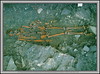
This Museum hosts a breathtaking view of the original skeleton of “the Man of Mondeval”. Preserved remarkably intact, supine, it is kept inside a glass case properly conditioned, reproducing the highest altitude burial site ever found in Europe.
The burial was discovered at Mondeval de Sora (Northern Italy) in 1987, 2150 m above sea level.
Address:
Via 4 Novembre No. 51
32020 Selva di Cadore
Italy
Telephone: +39.0437.521068
Website: Museo Selvadicadore
Source: Museo Vittorino Cazzetta.
You may be viewing yesterday's version of this page. To see the most up to date information please register for a free account.
Do not use the above information on other web sites or publications without permission of the contributor.
Nearby Images from Flickr
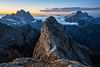

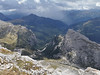
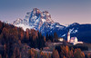
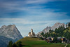
The above images may not be of the site on this page, but were taken nearby. They are loaded from Flickr so please click on them for image credits.
Click here to see more info for this site
Nearby sites
Click here to view sites on an interactive map of the areaKey: Red: member's photo, Blue: 3rd party photo, Yellow: other image, Green: no photo - please go there and take one, Grey: site destroyed
Download sites to:
KML (Google Earth)
GPX (GPS waypoints)
CSV (Garmin/Navman)
CSV (Excel)
To unlock full downloads you need to sign up as a Contributory Member. Otherwise downloads are limited to 50 sites.
Turn off the page maps and other distractions
Nearby sites listing. In the following links * = Image available
36.4km WNW 282° Schlern Natural Stone / Erratic / Other Natural Feature
41.9km NW 317° Bildstein (Elvas)* Rock Art
47.3km W 280° Der Menhir von Wolfsgruben* Standing Stone (Menhir)
53.1km W 276° South Tyrol Museum of Archaeology* Museum
74.2km WNW 290° Stone Age 2001* Modern Stone Circle etc
77.8km WNW 294° Spronser Seen (Sprons Lakes)* Rock Art
79.9km N 350° Stoanerhof stones* Standing Stones
88.5km NW 309° Windachtal Schalenstein II Rock Art
90.9km WNW 283° Untere Grübelplatte (Schalenstein)* Rock Art
92.5km NW 304° Lenzenalm Schalenstein Rock Art
93.1km NE 41° Hochtor Ancient Road* Ancient Trackway
93.4km NW 323° Cupstone Menhir Viggar Valley Tyrol* Rock Art
93.4km NNW 331° Cupstone Slabs-Graveyard Tarzens* Rock Art
94.2km NW 322° Cupstone Lithagrub-Profegl Alm* Rock Art
95.2km NW 307° Windachtal Schalenstein I Rock Art
95.4km WNW 289° ArcheoPark and Museum Val Senales* Museum
95.9km WNW 303° Heiligkreuz Teufelsfelsen Rock Art
96.0km WNW 297° Kaser Menhir Standing Stone (Menhir)
96.3km WNW 299° Mutsbichl Schalensteine Rock Art
96.8km WNW 298° Hohler Stein Kaser Natural Stone / Erratic / Other Natural Feature
97.0km NW 307° Schlangenfelsen (Snake's rock) Rock Art
97.2km NNW 331° Goldbichl Natural Stone / Erratic / Other Natural Feature
97.3km NW 307° Sölden menhir* Standing Stone (Menhir)
98.0km NNW 332° Igls Hinkelstein Standing Stone (Menhir)
98.2km NNE 20° Hexenstein Felberturm Standing Stone (Menhir)
View more nearby sites and additional images


 We would like to know more about this location. Please feel free to add a brief description and any relevant information in your own language.
 Wir möchten mehr über diese Stätte erfahren. Bitte zögern Sie nicht, eine kurze Beschreibung und relevante Informationen in Deutsch hinzuzufügen.
 Nous aimerions en savoir encore un peu sur les lieux. S'il vous plaît n'hesitez pas à ajouter une courte description et tous les renseignements pertinents dans votre propre langue.
 Quisieramos informarnos un poco más de las lugares. No dude en añadir una breve descripción y otros datos relevantes en su propio idioma.