


<< Text Pages >> Hoher Stein Fichtelgebirge - Natural Stone / Erratic / Other Natural Feature in Germany in Bavaria
Submitted by KaiHofmann on Tuesday, 18 July 2017 Page Views: 757
Natural PlacesSite Name: Hoher Stein FichtelgebirgeCountry: Germany
NOTE: This site is 10.463 km away from the location you searched for.
Land: Bavaria Type: Natural Stone / Erratic / Other Natural Feature
Nearest Town: Schwarzenbach an der Saale Nearest Village: Kirchenlamitz
Latitude: 50.150700N Longitude: 11.891800E
Condition:
| 5 | Perfect |
| 4 | Almost Perfect |
| 3 | Reasonable but with some damage |
| 2 | Ruined but still recognisable as an ancient site |
| 1 | Pretty much destroyed, possibly visible as crop marks |
| 0 | No data. |
| -1 | Completely destroyed |
| 5 | Superb |
| 4 | Good |
| 3 | Ordinary |
| 2 | Not Good |
| 1 | Awful |
| 0 | No data. |
| 5 | Can be driven to, probably with disabled access |
| 4 | Short walk on a footpath |
| 3 | Requiring a bit more of a walk |
| 2 | A long walk |
| 1 | In the middle of nowhere, a nightmare to find |
| 0 | No data. |
| 5 | co-ordinates taken by GPS or official recorded co-ordinates |
| 4 | co-ordinates scaled from a detailed map |
| 3 | co-ordinates scaled from a bad map |
| 2 | co-ordinates of the nearest village |
| 1 | co-ordinates of the nearest town |
| 0 | no data |
Be the first person to rate this site - see the 'Contribute!' box in the right hand menu.
Internal Links:
External Links:
Natural Stone / Erratic / Other Natural Feature in Bavaria
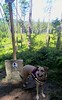
A 25m tall rock outcrop in the Fichtelgebirge. In medieval times it serves as a landmark.
for more info:
This is a wikipedia-link
You may be viewing yesterday's version of this page. To see the most up to date information please register for a free account.
Do not use the above information on other web sites or publications without permission of the contributor.
Nearby Images from Flickr

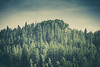
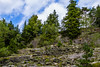
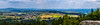
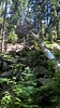
The above images may not be of the site on this page, but were taken nearby. They are loaded from Flickr so please click on them for image credits.
Click here to see more info for this site
Nearby sites
Click here to view sites on an interactive map of the areaKey: Red: member's photo, Blue: 3rd party photo, Yellow: other image, Green: no photo - please go there and take one, Grey: site destroyed
Download sites to:
KML (Google Earth)
GPX (GPS waypoints)
CSV (Garmin/Navman)
CSV (Excel)
To unlock full downloads you need to sign up as a Contributory Member. Otherwise downloads are limited to 50 sites.
Turn off the page maps and other distractions
Nearby sites listing. In the following links * = Image available
3.1km NE 44° Hallerstein* Standing Stone (Menhir)
7.7km ESE 108° Marktleuthen Stone Cross* Ancient Cross
7.7km ESE 109° Marktleuthen Church Stone* Early Christian Sculptured Stone
11.1km NE 35° Quellenreuth Stein* Standing Stone (Menhir)
11.7km NE 34° Das Quellenreuther Steinkreuz* Ancient Cross
14.5km ENE 66° Müllerstein* Standing Stone (Menhir)
15.0km E 96° Herrgottstein (Hendelhammer)* Rock Art
15.2km ENE 65° Kleinen Kreuzsteine* Marker Stone
17.9km SSE 158° Großer Haberstein* Rock Outcrop
24.6km E 89° Polná Propitiatory Cross 2* Ancient Cross
25.6km E 90° Polná Propitiatory Cross 1* Ancient Cross
25.8km E 86° Lipná propitiatory cross* Ancient Cross
27.5km E 89° Hazlov Stone Crosses* Ancient Cross
27.8km E 94° Poustka Wells* Holy Well or Sacred Spring
31.7km SSE 147° Summstein Fuchsmühl Modern Stone Circle etc
32.1km E 100° Komorní Hůrka stone cross* Ancient Cross
32.4km E 92° Žírovice prehistoric graveyard and settlement* Cairn
32.4km NW 319° Zwölf Apostel* Stone Row / Alignment
32.9km ENE 76° Plesná stone crosses* Ancient Cross
34.5km ESE 109° Stone Cross Háje* Ancient Cross
35.8km ENE 77° Lomnička Stone Cross* Ancient Cross
36.7km E 93° Dvorek propitiatory cross* Ancient Cross
37.3km ESE 106° Podhrad stone crosses* Ancient Cross
37.8km W 273° Schamelstein Sculptured Stone
38.3km E 92° Povodí propitiatory cross* Ancient Cross
View more nearby sites and additional images


 We would like to know more about this location. Please feel free to add a brief description and any relevant information in your own language.
 Wir möchten mehr über diese Stätte erfahren. Bitte zögern Sie nicht, eine kurze Beschreibung und relevante Informationen in Deutsch hinzuzufügen.
 Nous aimerions en savoir encore un peu sur les lieux. S'il vous plaît n'hesitez pas à ajouter une courte description et tous les renseignements pertinents dans votre propre langue.
 Quisieramos informarnos un poco más de las lugares. No dude en añadir una breve descripción y otros datos relevantes en su propio idioma.