 with our Megalithic Portal iPhone app")


<< Text Pages >> Kolmberg - Artificial Mound in Germany in Thuringia
Submitted by Klingon on Friday, 26 November 2010 Page Views: 1699
Multi-periodSite Name: KolmbergCountry: Germany
NOTE: This site is 6.915 km away from the location you searched for.
Land: Thuringia Type: Artificial Mound
Latitude: 50.891180N Longitude: 11.659490E
Condition:
| 5 | Perfect |
| 4 | Almost Perfect |
| 3 | Reasonable but with some damage |
| 2 | Ruined but still recognisable as an ancient site |
| 1 | Pretty much destroyed, possibly visible as crop marks |
| 0 | No data. |
| -1 | Completely destroyed |
| 5 | Superb |
| 4 | Good |
| 3 | Ordinary |
| 2 | Not Good |
| 1 | Awful |
| 0 | No data. |
| 5 | Can be driven to, probably with disabled access |
| 4 | Short walk on a footpath |
| 3 | Requiring a bit more of a walk |
| 2 | A long walk |
| 1 | In the middle of nowhere, a nightmare to find |
| 0 | No data. |
| 5 | co-ordinates taken by GPS or official recorded co-ordinates |
| 4 | co-ordinates scaled from a detailed map |
| 3 | co-ordinates scaled from a bad map |
| 2 | co-ordinates of the nearest village |
| 1 | co-ordinates of the nearest town |
| 0 | no data |
Be the first person to rate this site - see the 'Contribute!' box in the right hand menu.
Internal Links:
External Links:
Artificial Mound in Thuringia
You may be viewing yesterday's version of this page. To see the most up to date information please register for a free account.
Do not use the above information on other web sites or publications without permission of the contributor.
Nearby Images from Flickr
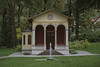
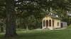
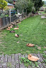
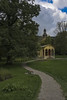
The above images may not be of the site on this page, but were taken nearby. They are loaded from Flickr so please click on them for image credits.
Click here to see more info for this site
Nearby sites
Click here to view sites on an interactive map of the areaKey: Red: member's photo, Blue: 3rd party photo, Yellow: other image, Green: no photo - please go there and take one, Grey: site destroyed
Download sites to:
KML (Google Earth)
GPX (GPS waypoints)
CSV (Garmin/Navman)
CSV (Excel)
To unlock full downloads you need to sign up as a Contributory Member. Otherwise downloads are limited to 50 sites.
Turn off the page maps and other distractions
Nearby sites listing. In the following links * = Image available
3.5km WNW 286° Johannisberg Wöllnitz* Causewayed Enclosure
4.4km NW 326° Steinkreis am Fuchsturm* Modern Stone Circle etc
5.1km SSW 210° Sandberg Ölknitz Ancient Village or Settlement
5.8km NNW 337° Jenzig Causewayed Enclosure
7.6km NW 319° Otto Schott's Grave* Modern Stone Circle etc
8.0km NNE 22° Alter Gleisberg* Ancient Village or Settlement
8.1km NW 307° Menhir in Jena* Standing Stone (Menhir)
8.4km ENE 58° Buttermilchquelle* Holy Well or Sacred Spring
8.4km ENE 61° Menhir von Thalbürgel* Standing Stone (Menhir)
9.4km ENE 68° Menhir von Waldeck* Standing Stone (Menhir)
9.8km ENE 76° Menhir of Bobeck* Standing Stone (Menhir)
10.2km SSW 203° Dohlenstein Ancient Village or Settlement
12.8km ENE 67° Vogelherd (Hermsdorf) Artificial Mound
12.9km NW 314° Grabhügel Vierzehnheiligen* Artificial Mound
13.0km NNW 341° Hainichen Barrow Cemetery
14.1km SSW 208° Hiemberg Kleineutersdorf Causewayed Enclosure
15.0km WSW 255° Menhir an der Quelle der Leutra* Modern Stone Circle etc
16.5km NE 53° Rosenhain Ancient Village or Settlement
17.3km SSW 205° Schimmersburg Natural Stone / Erratic / Other Natural Feature
17.4km E 90° Oberndorf Round Barrow(s)
17.7km NNE 23° Ellrich* Barrow Cemetery
18.0km NNE 12° Matzburg* Causewayed Enclosure
18.2km NNE 24° Thierschneck Barrow Cemetery
18.9km S 174° Theure Cave or Rock Shelter
19.0km S 174° Nischenhöhle Cave or Rock Shelter
View more nearby sites and additional images


 We would like to know more about this location. Please feel free to add a brief description and any relevant information in your own language.
 Wir möchten mehr über diese Stätte erfahren. Bitte zögern Sie nicht, eine kurze Beschreibung und relevante Informationen in Deutsch hinzuzufügen.
 Nous aimerions en savoir encore un peu sur les lieux. S'il vous plaît n'hesitez pas à ajouter une courte description et tous les renseignements pertinents dans votre propre langue.
 Quisieramos informarnos un poco más de las lugares. No dude en añadir una breve descripción y otros datos relevantes en su propio idioma.