


<< Text Pages >> Der Lange Stein Spielberg - Standing Stone (Menhir) in Germany in Saxony-Anhalt
Submitted by Klingon on Tuesday, 19 December 2006 Page Views: 3962
Neolithic and Bronze AgeSite Name: Der Lange Stein SpielbergCountry: Germany
NOTE: This site is 2.116 km away from the location you searched for.
Land: Saxony-Anhalt Type: Standing Stone (Menhir)
Nearest Town: Bad Kösen Nearest Village: Spielberg
Latitude: 51.152000N Longitude: 11.636000E
Condition:
| 5 | Perfect |
| 4 | Almost Perfect |
| 3 | Reasonable but with some damage |
| 2 | Ruined but still recognisable as an ancient site |
| 1 | Pretty much destroyed, possibly visible as crop marks |
| 0 | No data. |
| -1 | Completely destroyed |
| 5 | Superb |
| 4 | Good |
| 3 | Ordinary |
| 2 | Not Good |
| 1 | Awful |
| 0 | No data. |
| 5 | Can be driven to, probably with disabled access |
| 4 | Short walk on a footpath |
| 3 | Requiring a bit more of a walk |
| 2 | A long walk |
| 1 | In the middle of nowhere, a nightmare to find |
| 0 | No data. |
| 5 | co-ordinates taken by GPS or official recorded co-ordinates |
| 4 | co-ordinates scaled from a detailed map |
| 3 | co-ordinates scaled from a bad map |
| 2 | co-ordinates of the nearest village |
| 1 | co-ordinates of the nearest town |
| 0 | no data |
Be the first person to rate this site - see the 'Contribute!' box in the right hand menu.
Internal Links:
External Links:
Standing Stone (Menhir) in Saxony-Anhalt
Position of the site unknown, co-ordinates estimated.
You may be viewing yesterday's version of this page. To see the most up to date information please register for a free account.
Do not use the above information on other web sites or publications without permission of the contributor.
Nearby Images from Flickr
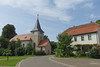
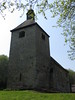
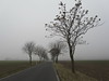
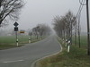
The above images may not be of the site on this page, but were taken nearby. They are loaded from Flickr so please click on them for image credits.
Click here to see more info for this site
Nearby sites
Click here to view sites on an interactive map of the areaKey: Red: member's photo, Blue: 3rd party photo, Yellow: other image, Green: no photo - please go there and take one, Grey: site destroyed
Download sites to:
KML (Google Earth)
GPX (GPS waypoints)
CSV (Garmin/Navman)
CSV (Excel)
To unlock full downloads you need to sign up as a Contributory Member. Otherwise downloads are limited to 50 sites.
Turn off the page maps and other distractions
Nearby sites listing. In the following links * = Image available
4.9km W 275° Menhir von Frankroda* Modern Stone Circle etc
5.8km SW 222° Napoleonslinden* Artificial Mound
8.9km WNW 299° Felsquelle Steinburg* Holy Well or Sacred Spring
10.6km NW 322° Langer Stein Altenroda* Standing Stone (Menhir)
10.6km NE 42° Magdstein* Standing Stone (Menhir)
10.7km SSE 157° St. Cyriakus* Ancient Village or Settlement
10.8km NE 42° Zscheiplitz Kreuz Ancient Cross
10.9km N 357° Tröbsdorf* Standing Stone (Menhir)
12.2km W 279° Hardisleben (1) Artificial Mound
12.2km W 275° Hardisleben (2)* Artificial Mound
12.5km SSE 155° Matzburg* Causewayed Enclosure
12.9km WSW 257° Hegegericht Emsen* Misc. Earthwork
14.5km E 94° Der Hohe Stein Wethau* Standing Stone (Menhir)
14.5km N 10° Karsdorf* Ancient Village or Settlement
14.7km E 84° Gräberfeld Eulau* Misc. Earthwork
15.0km NNW 338° Bock (XXVI)* Artificial Mound
15.0km NNW 338° Bock (XXVII)* Artificial Mound
15.2km NNW 331° Arche Nebra* Museum
15.3km NNW 337° Bock (XXIV)* Artificial Mound
15.3km NNW 338° Bock (XXIII)* Artificial Mound
15.3km NNW 337° Bock (XXV)* Artificial Mound
15.3km WNW 283° Streitholz (1)* Causewayed Enclosure
15.3km NNW 337° Bock (XX)* Artificial Mound
15.3km NNW 337° Bock (XIX)* Artificial Mound
15.3km SE 146° Ellrich* Barrow Cemetery
View more nearby sites and additional images


 We would like to know more about this location. Please feel free to add a brief description and any relevant information in your own language.
 Wir möchten mehr über diese Stätte erfahren. Bitte zögern Sie nicht, eine kurze Beschreibung und relevante Informationen in Deutsch hinzuzufügen.
 Nous aimerions en savoir encore un peu sur les lieux. S'il vous plaît n'hesitez pas à ajouter une courte description et tous les renseignements pertinents dans votre propre langue.
 Quisieramos informarnos un poco más de las lugares. No dude en añadir una breve descripción y otros datos relevantes en su propio idioma.