 with our Megalithic Portal iPhone app")


<< Our Photo Pages >> Manching Oppidum - Ancient Village or Settlement in Germany in Bavaria
Submitted by AlexHunger on Saturday, 18 February 2006 Page Views: 6099
Multi-periodSite Name: Manching OppidumCountry: Germany
NOTE: This site is 8.39 km away from the location you searched for.
Land: Bavaria Type: Ancient Village or Settlement
Nearest Town: Ingolstadt Nearest Village: Manching
Latitude: 48.706640N Longitude: 11.503070E
Condition:
| 5 | Perfect |
| 4 | Almost Perfect |
| 3 | Reasonable but with some damage |
| 2 | Ruined but still recognisable as an ancient site |
| 1 | Pretty much destroyed, possibly visible as crop marks |
| 0 | No data. |
| -1 | Completely destroyed |
| 5 | Superb |
| 4 | Good |
| 3 | Ordinary |
| 2 | Not Good |
| 1 | Awful |
| 0 | No data. |
| 5 | Can be driven to, probably with disabled access |
| 4 | Short walk on a footpath |
| 3 | Requiring a bit more of a walk |
| 2 | A long walk |
| 1 | In the middle of nowhere, a nightmare to find |
| 0 | No data. |
| 5 | co-ordinates taken by GPS or official recorded co-ordinates |
| 4 | co-ordinates scaled from a detailed map |
| 3 | co-ordinates scaled from a bad map |
| 2 | co-ordinates of the nearest village |
| 1 | co-ordinates of the nearest town |
| 0 | no data |
Internal Links:
External Links:
")
Positional co-ordinates scaled from a map source. Large 7 KM circumference fortified Iron age Settlement, half covered by airport. Was abondened just before arrival of Roman
You may be viewing yesterday's version of this page. To see the most up to date information please register for a free account.
")
")
Do not use the above information on other web sites or publications without permission of the contributor.
Nearby Images from Flickr
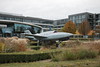
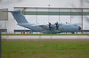
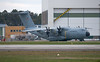
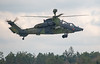


The above images may not be of the site on this page, but were taken nearby. They are loaded from Flickr so please click on them for image credits.
Click here to see more info for this site
Nearby sites
Click here to view sites on an interactive map of the areaKey: Red: member's photo, Blue: 3rd party photo, Yellow: other image, Green: no photo - please go there and take one, Grey: site destroyed
Download sites to:
KML (Google Earth)
GPX (GPS waypoints)
CSV (Garmin/Navman)
CSV (Excel)
To unlock full downloads you need to sign up as a Contributory Member. Otherwise downloads are limited to 50 sites.
Turn off the page maps and other distractions
Nearby sites listing. In the following links * = Image available
2.6km NE 36° Westenhausen Keltische Viereckschanze Ancient Village or Settlement
7.4km N 7° Kleinmehring Siedlung Ancient Village or Settlement
16.9km NE 42° Kelsbachquellen Holy Well or Sacred Spring
17.3km NE 45° Ettling Siedlung Ancient Village or Settlement
17.9km NE 49° Pförring Siedlung Ancient Village or Settlement
19.7km S 176° Summstein Pfaffenhofen an der Ilm Modern Stone Circle etc
20.4km NNW 337° Böhmfelder Keltenschanze C Ancient Village or Settlement
20.6km NNW 336° Böhmfelder Keltenschanze B Ancient Village or Settlement
21.0km NNW 336° Böhmfelder Keltenschanze A Ancient Village or Settlement
22.7km W 274° Neuburg Siedlung Ancient Village or Settlement
23.1km NW 305° Findling Adelschlag Natural Stone / Erratic / Other Natural Feature
24.0km WNW 296° Speckberg Ancient Village or Settlement
24.1km WNW 288° Grabgügelgruppe Attenfeld Barrow Cemetery
25.3km WNW 300° Nassenfels Keltenschanze Misc. Earthwork
25.3km WNW 300° Hoher Stein Möckenlohe Natural Stone / Erratic / Other Natural Feature
25.3km NNE 12° Pondorf Keltenschanze Misc. Earthwork
26.8km NW 315° Steinbruch Pfünz Ancient Mine, Quarry or other Industry
27.9km ENE 56° Sandharlanden Grabhügel Artificial Mound
30.9km W 269° Grabhügelgruppe Unterhauser Forst Barrow Cemetery
31.4km NE 49° Weltenburg Siedlung Ancient Village or Settlement
31.5km NNE 32° Wallanlage Einthal Ancient Village or Settlement
31.6km NNE 28° Opferplattform Emmerthal Artificial Mound
31.7km NNE 32° Klammhöhlen Cave or Rock Shelter
31.9km NE 36° Kastlhaenghoehle Cave or Rock Shelter
32.0km NNE 25° Summstein Harlanden Modern Stone Circle etc
View more nearby sites and additional images


 We would like to know more about this location. Please feel free to add a brief description and any relevant information in your own language.
 Wir möchten mehr über diese Stätte erfahren. Bitte zögern Sie nicht, eine kurze Beschreibung und relevante Informationen in Deutsch hinzuzufügen.
 Nous aimerions en savoir encore un peu sur les lieux. S'il vous plaît n'hesitez pas à ajouter une courte description et tous les renseignements pertinents dans votre propre langue.
 Quisieramos informarnos un poco más de las lugares. No dude en añadir una breve descripción y otros datos relevantes en su propio idioma.