 with our Megalithic Portal iPhone app")


<< Our Photo Pages >> Civic Archaeological Museum - Museum in Italy in Toscana
Submitted by Pressure on Wednesday, 09 November 2022 Page Views: 345
MuseumsSite Name: Civic Archaeological MuseumCountry: Italy
NOTE: This site is 9.006 km away from the location you searched for.
Region: Toscana Type: Museum
Nearest Town: Sarteano Nearest Village: Sarteano
Latitude: 42.990350N Longitude: 11.870410E
Condition:
| 5 | Perfect |
| 4 | Almost Perfect |
| 3 | Reasonable but with some damage |
| 2 | Ruined but still recognisable as an ancient site |
| 1 | Pretty much destroyed, possibly visible as crop marks |
| 0 | No data. |
| -1 | Completely destroyed |
| 5 | Superb |
| 4 | Good |
| 3 | Ordinary |
| 2 | Not Good |
| 1 | Awful |
| 0 | No data. |
| 5 | Can be driven to, probably with disabled access |
| 4 | Short walk on a footpath |
| 3 | Requiring a bit more of a walk |
| 2 | A long walk |
| 1 | In the middle of nowhere, a nightmare to find |
| 0 | No data. |
| 5 | co-ordinates taken by GPS or official recorded co-ordinates |
| 4 | co-ordinates scaled from a detailed map |
| 3 | co-ordinates scaled from a bad map |
| 2 | co-ordinates of the nearest village |
| 1 | co-ordinates of the nearest town |
| 0 | no data |
Internal Links:
External Links:
")
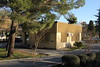
Excellent small archaeological museum with a range of Etruscan finds and a fabulous reconstruction of an elaborate tomb in the basement.
https://www.museisenesi.org/en/museo/civic-archaeological-museum-of-sarteano/
You may be viewing yesterday's version of this page. To see the most up to date information please register for a free account.
Do not use the above information on other web sites or publications without permission of the contributor.
Nearby Images from Flickr
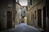


The above images may not be of the site on this page, but were taken nearby. They are loaded from Flickr so please click on them for image credits.
Click here to see more info for this site
Nearby sites
Click here to view sites on an interactive map of the areaKey: Red: member's photo, Blue: 3rd party photo, Yellow: other image, Green: no photo - please go there and take one, Grey: site destroyed
Download sites to:
KML (Google Earth)
GPX (GPS waypoints)
CSV (Garmin/Navman)
CSV (Excel)
To unlock full downloads you need to sign up as a Contributory Member. Otherwise downloads are limited to 50 sites.
Turn off the page maps and other distractions
Nearby sites listing. In the following links * = Image available
35.6km SSE 147° Necropoli del Crocifisso del Tufo Rock Cut Tomb
35.6km SSW 196° Vitozza* Cave or Rock Shelter
41.1km SSW 206° Sovana Necropolis* Rock Cut Tomb
41.6km SSW 208° Via Cava di Poggio Prisca* Ancient Trackway
41.7km SSW 208° Ildebranda Tomb* Rock Cut Tomb
41.8km SSW 207° Tomba della Sirena* Rock Cut Tomb
41.9km SSW 207° Via cava di S. Sebastiano* Ancient Trackway
43.5km WNW 296° Poggio Civitate Ancient Village or Settlement
44.2km ENE 72° The Hypogeum of the Volumni* Rock Cut Tomb
44.4km ENE 72° Perugia Arch* Stone Fort or Dun
60.3km WSW 253° Roselle* Hillfort
61.2km E 81° Assisi Ancient Village or Settlement
64.9km E 89° Hispellum* Ancient Village or Settlement
65.0km SSE 150° Bomarzo Etruscan 'Pyramid' Altar* Ancient Temple
65.1km S 187° San Giulano Rock Cut tombs Rock Cut Tomb
68.4km SE 125° Carsulae Ancient Village or Settlement
69.9km SSE 157° Mount Cimino Votive Site* Ancient Temple
72.5km W 260° Tomba del Diavolino 2* Chambered Cairn
72.8km S 175° Norchia Etruscan Necropolis* Rock Cut Tomb
74.5km W 259° Vetulonia Mura dell' Arce* Ancient Village or Settlement
79.3km S 172° Pian di Vescovo Rock Cut Tomb
80.0km SW 217° Cosa.* Hillfort
81.5km S 184° Tarquinia* Ancient Village or Settlement
82.7km SSE 168° Barbarano Romano Etruscan Necropolis Chambered Tomb
85.8km S 173° Casale Vignale Necropolis Chambered Cairn
View more nearby sites and additional images


 We would like to know more about this location. Please feel free to add a brief description and any relevant information in your own language.
 Wir möchten mehr über diese Stätte erfahren. Bitte zögern Sie nicht, eine kurze Beschreibung und relevante Informationen in Deutsch hinzuzufügen.
 Nous aimerions en savoir encore un peu sur les lieux. S'il vous plaît n'hesitez pas à ajouter une courte description et tous les renseignements pertinents dans votre propre langue.
 Quisieramos informarnos un poco más de las lugares. No dude en añadir una breve descripción y otros datos relevantes en su propio idioma.