


<< Our Photo Pages >> Speckstein - Standing Stone (Menhir) in Germany in Saxony-Anhalt
Submitted by AlexHunger on Tuesday, 27 September 2005 Page Views: 3919
Neolithic and Bronze AgeSite Name: SpecksteinCountry: Germany
NOTE: This site is 3.413 km away from the location you searched for.
Land: Saxony-Anhalt Type: Standing Stone (Menhir)
Nearest Town: Aschersleben Nearest Village: Groß Schierstedt
Latitude: 51.749970N Longitude: 11.479670E
Condition:
| 5 | Perfect |
| 4 | Almost Perfect |
| 3 | Reasonable but with some damage |
| 2 | Ruined but still recognisable as an ancient site |
| 1 | Pretty much destroyed, possibly visible as crop marks |
| 0 | No data. |
| -1 | Completely destroyed |
| 5 | Superb |
| 4 | Good |
| 3 | Ordinary |
| 2 | Not Good |
| 1 | Awful |
| 0 | No data. |
| 5 | Can be driven to, probably with disabled access |
| 4 | Short walk on a footpath |
| 3 | Requiring a bit more of a walk |
| 2 | A long walk |
| 1 | In the middle of nowhere, a nightmare to find |
| 0 | No data. |
| 5 | co-ordinates taken by GPS or official recorded co-ordinates |
| 4 | co-ordinates scaled from a detailed map |
| 3 | co-ordinates scaled from a bad map |
| 2 | co-ordinates of the nearest village |
| 1 | co-ordinates of the nearest town |
| 0 | no data |
Internal Links:
External Links:
")
1.8 Meter tall and 1.5 Meter wide thin Quarzite slab standing stone on top of Bronze Age tumulus. Across the road from large smoke stack. It has been pierced by inumerable nails as part of a local superstition. 117 Meters Altitude. At intersection of K2372 Road and railroad. Park in Layby before bridge.
You may be viewing yesterday's version of this page. To see the most up to date information please register for a free account.
")
Do not use the above information on other web sites or publications without permission of the contributor.
Nearby Images from Flickr
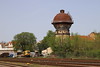
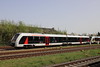
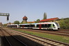
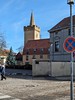
The above images may not be of the site on this page, but were taken nearby. They are loaded from Flickr so please click on them for image credits.
Click here to see more info for this site
Nearby sites
Click here to view sites on an interactive map of the areaKey: Red: member's photo, Blue: 3rd party photo, Yellow: other image, Green: no photo - please go there and take one, Grey: site destroyed
Download sites to:
KML (Google Earth)
GPX (GPS waypoints)
CSV (Garmin/Navman)
CSV (Excel)
To unlock full downloads you need to sign up as a Contributory Member. Otherwise downloads are limited to 50 sites.
Turn off the page maps and other distractions
Nearby sites listing. In the following links * = Image available
5.6km N 7° Menhir Blaue Gans* Standing Stone (Menhir)
7.2km SSW 201° Ringheiligtum Quenstedt* Timber Circle
9.5km WSW 258° Nagelstein Ermsleben* Standing Stone (Menhir)
9.7km W 262° Nagelstein Sinsleben* Natural Stone / Erratic / Other Natural Feature
10.6km ENE 60° Guddenstein* Standing Stone (Menhir)
12.1km SSE 157° Verwohrene Stein* Standing Stone (Menhir)
14.0km SSE 149° Pfaffenstein* Standing Stone (Menhir)
14.4km ENE 68° Sechs Steine* Early Christian Sculptured Stone
15.7km E 84° Stockhof Gröna* Artificial Mound
16.1km SSE 148° Hoyerstein Gerbstedt* Holed Stone
17.5km W 265° Gegensteine Rock Outcrop
20.5km SW 228° Der Heisse Stein* Standing Stone (Menhir)
21.9km ESE 121° Femegericht* Standing Stone (Menhir)
21.9km E 85° Schneiderberg Baalberge* Round Barrow(s)
22.1km ENE 74° Pfingstberg Latdorf* Standing Stone (Menhir)
22.9km E 100° Teufels Tintenfass Rock Art
23.0km ENE 68° Heringsberg* Chambered Tomb
23.1km E 95° Siebensteine Preußlitz* Standing Stones
23.5km ENE 75° Pohlsberg Latdorf* Artificial Mound
23.9km W 280° Rillenstein Westerhausen Standing Stone (Menhir)
24.8km ENE 69° Bierberg Gerbitz* Chambered Tomb
24.9km ENE 76° Spitzes Hoch* Round Barrow(s)
25.0km ENE 76° Steinerne Hütte* Chambered Tomb
25.3km E 95° Steinkisten Gräberfeld Cörmigk* Cist
25.4km NE 53° Trojaburg Calbe Turf Maze
View more nearby sites and additional images


 We would like to know more about this location. Please feel free to add a brief description and any relevant information in your own language.
 Wir möchten mehr über diese Stätte erfahren. Bitte zögern Sie nicht, eine kurze Beschreibung und relevante Informationen in Deutsch hinzuzufügen.
 Nous aimerions en savoir encore un peu sur les lieux. S'il vous plaît n'hesitez pas à ajouter une courte description et tous les renseignements pertinents dans votre propre langue.
 Quisieramos informarnos un poco más de las lugares. No dude en añadir una breve descripción y otros datos relevantes en su propio idioma.