


<< Our Photo Pages >> Stiftsmuseet Runesten - Carving in Denmark in Møn + Lolland-Falster
Submitted by Boeddel on Tuesday, 14 August 2018 Page Views: 1390
Multi-periodSite Name: Stiftsmuseet Runesten Alternative Name: StiftsmuseetCountry: Denmark County: Møn + Lolland-Falster Type: Carving
Nearest Town: Maribo
Latitude: 54.776287N Longitude: 11.501898E
Condition:
| 5 | Perfect |
| 4 | Almost Perfect |
| 3 | Reasonable but with some damage |
| 2 | Ruined but still recognisable as an ancient site |
| 1 | Pretty much destroyed, possibly visible as crop marks |
| 0 | No data. |
| -1 | Completely destroyed |
| 5 | Superb |
| 4 | Good |
| 3 | Ordinary |
| 2 | Not Good |
| 1 | Awful |
| 0 | No data. |
| 5 | Can be driven to, probably with disabled access |
| 4 | Short walk on a footpath |
| 3 | Requiring a bit more of a walk |
| 2 | A long walk |
| 1 | In the middle of nowhere, a nightmare to find |
| 0 | No data. |
| 5 | co-ordinates taken by GPS or official recorded co-ordinates |
| 4 | co-ordinates scaled from a detailed map |
| 3 | co-ordinates scaled from a bad map |
| 2 | co-ordinates of the nearest village |
| 1 | co-ordinates of the nearest town |
| 0 | no data |
Internal Links:
External Links:
I have visited· I would like to visit
Boeddel visited on 8th Aug 2018 - their rating: Amb: 3 Access: 5 the stones are in the entrance area and you can look at them without going to the museum. So to see the stones you do not have to pay entrance.
")
Stiftsmuseet Maribo
Banegårdspladsen 11
4930 Maribo
Denmark
Sædingestenen, Inscription:
Þyrvé got this stone made ... Krókr, her husband, and he was [then](?) the most resolute(?) of all Sunder-Swedes and South Danes. Torment ate(?) him/the hero, the best of Northmen. He was [there/ then](?) the Sunder-Swedes' end/yoke(?).
Skovlængestenen, Inscription:
Ástráðr raised this stone in memory of Júti, his father, a very good þegn.
You may be viewing yesterday's version of this page. To see the most up to date information please register for a free account.
")
")
")
")
Do not use the above information on other web sites or publications without permission of the contributor.
Nearby Images from Flickr
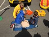
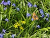
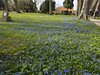
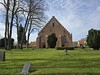
The above images may not be of the site on this page, but were taken nearby. They are loaded from Flickr so please click on them for image credits.
Click here to see more info for this site
Nearby sites
Click here to view sites on an interactive map of the areaKey: Red: member's photo, Blue: 3rd party photo, Yellow: other image, Green: no photo - please go there and take one, Grey: site destroyed
Download sites to:
KML (Google Earth)
GPX (GPS waypoints)
CSV (Garmin/Navman)
CSV (Excel)
To unlock full downloads you need to sign up as a Contributory Member. Otherwise downloads are limited to 50 sites.
Turn off the page maps and other distractions
Nearby sites listing. In the following links * = Image available
22m E 82° Stiftsmuseet i Maribo* Museum
5.3km NNW 345° Merretskov Sølvbjerghøiene Jættestue* Passage Grave
6.4km ESE 119° Bøgeskov Runddysse (Maribo) Burial Chamber or Dolmen
6.6km WNW 284° Daltoftegård Helleristningssten* Rock Art
7.1km SE 130° Lars Jensens Skov Jættestue Passage Grave
7.2km NNW 343° Lerbjerggård Rundhøj 4* Round Barrow(s)
7.2km NNW 342° Svanevig Rundhøj 3* Round Barrow(s)
7.3km NNW 342° Lerbjerggård Rundhøj 3* Round Barrow(s)
7.4km SW 226° Lolland Footprints and Fish Fence* Ancient Mine, Quarry or other Industry
7.4km NNW 341° Lerbjerggård Rundhøj 2* Round Barrow(s)
7.5km NNW 341° Lerbjerggård Rundhøj 1* Round Barrow(s)
8.0km SE 128° Kårupvænge Skov Runddysse* Burial Chamber or Dolmen
8.6km SE 128° Højene (Godsted)* Barrow Cemetery
9.1km E 83° Kulhøj Jættestue Passage Grave
9.2km NE 47° Orebygård Runddysse* Burial Chamber or Dolmen
9.7km NNW 328° Rørmark Jættestue 2* Passage Grave
9.8km NNW 328° Rørmark Jættestue 1* Passage Grave
10.2km E 83° Holmeskov Langdysse Long Barrow
10.7km SSE 160° Flårup Langdysse* Long Barrow
11.1km WSW 246° Runestenen - Tirsted Kirke* Carving
11.3km SSW 197° Tågerup Stenen* Carving
11.3km NW 325° Keldernæs Jættestue* Passage Grave
11.4km E 84° Radsted Langdysse* Long Barrow
12.0km SE 124° Musse Tjørnehøj Langdysse Long Barrow
12.0km E 83° Radsted Kirke Skåltegn* Rock Art
View more nearby sites and additional images


 We would like to know more about this location. Please feel free to add a brief description and any relevant information in your own language.
 Wir möchten mehr über diese Stätte erfahren. Bitte zögern Sie nicht, eine kurze Beschreibung und relevante Informationen in Deutsch hinzuzufügen.
 Nous aimerions en savoir encore un peu sur les lieux. S'il vous plaît n'hesitez pas à ajouter une courte description et tous les renseignements pertinents dans votre propre langue.
 Quisieramos informarnos un poco más de las lugares. No dude en añadir una breve descripción y otros datos relevantes en su propio idioma.