


<< Our Photo Pages >> Der Menhir von Wolfsgruben - Standing Stone (Menhir) in Italy in Trentino-Alto Adige
Submitted by MaRe on Friday, 02 December 2016 Page Views: 3910
Neolithic and Bronze AgeSite Name: Der Menhir von Wolfsgruben Alternative Name: Roarer Windspiel, Rohrer Windspiel, Großer MenhirCountry: Italy
NOTE: This site is 5.36 km away from the location you searched for.
Region: Trentino-Alto Adige Type: Standing Stone (Menhir)
Nearest Town: Oberbozen Nearest Village: Bozen
Latitude: 46.521900N Longitude: 11.429860E
Condition:
| 5 | Perfect |
| 4 | Almost Perfect |
| 3 | Reasonable but with some damage |
| 2 | Ruined but still recognisable as an ancient site |
| 1 | Pretty much destroyed, possibly visible as crop marks |
| 0 | No data. |
| -1 | Completely destroyed |
| 5 | Superb |
| 4 | Good |
| 3 | Ordinary |
| 2 | Not Good |
| 1 | Awful |
| 0 | No data. |
| 5 | Can be driven to, probably with disabled access |
| 4 | Short walk on a footpath |
| 3 | Requiring a bit more of a walk |
| 2 | A long walk |
| 1 | In the middle of nowhere, a nightmare to find |
| 0 | No data. |
| 5 | co-ordinates taken by GPS or official recorded co-ordinates |
| 4 | co-ordinates scaled from a detailed map |
| 3 | co-ordinates scaled from a bad map |
| 2 | co-ordinates of the nearest village |
| 1 | co-ordinates of the nearest town |
| 0 | no data |
Internal Links:
External Links:
")
The Menhir has a big cut out V in which the second stone with a triangular shape that lay on the ground until 1986 and has now been lifted on top. It is unclear if this was the original appearance of the menhir.
The Menhir from Wolfsgruben lies on a small hill near the lake of Wolfsgruben. Nearby, about 50 m away lies the remains of a "Wallburg", a prehistoric fort, dated from about late bronze age to iron age. There are many prehistoric sites at the surrounding, other menhirs, all aligned to sunrise at around equinox between the two peaks of the Schlern (ital: Sciliar).
Here you can read more about the solar calendar from Ritten in German:
Der Sonnenkalender von Wolfsgruben
You may be viewing yesterday's version of this page. To see the most up to date information please register for a free account.
")
")
")
Do not use the above information on other web sites or publications without permission of the contributor.
Nearby Images from Flickr
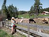
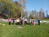
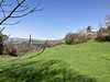

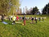

The above images may not be of the site on this page, but were taken nearby. They are loaded from Flickr so please click on them for image credits.
Click here to see more info for this site
Nearby sites
Click here to view sites on an interactive map of the areaKey: Red: member's photo, Blue: 3rd party photo, Yellow: other image, Green: no photo - please go there and take one, Grey: site destroyed
Download sites to:
KML (Google Earth)
GPX (GPS waypoints)
CSV (Garmin/Navman)
CSV (Excel)
To unlock full downloads you need to sign up as a Contributory Member. Otherwise downloads are limited to 50 sites.
Turn off the page maps and other distractions
Nearby sites listing. In the following links * = Image available
6.6km WSW 248° South Tyrol Museum of Archaeology* Museum
11.0km E 92° Schlern Natural Stone / Erratic / Other Natural Feature
29.0km NW 307° Stone Age 2001* Modern Stone Circle etc
29.2km NE 38° Bildstein (Elvas)* Rock Art
33.8km NW 313° Spronser Seen (Sprons Lakes)* Rock Art
43.7km WNW 286° Untere Grübelplatte (Schalenstein)* Rock Art
47.3km E 99° Museo Vittorino Cazzetta Museum
49.2km WNW 297° ArcheoPark and Museum Val Senales* Museum
52.3km NNW 334° Windachtal Schalenstein II Rock Art
52.5km NW 311° Kaser Menhir Standing Stone (Menhir)
53.3km NW 326° Lenzenalm Schalenstein Rock Art
53.3km WNW 303° Ötzi Memorial* Marker Stone
53.8km NW 315° Mutsbichl Schalensteine Rock Art
53.8km NW 313° Hohler Stein Kaser Natural Stone / Erratic / Other Natural Feature
55.3km NW 321° Heiligkreuz Teufelsfelsen Rock Art
57.6km NNW 329° Windachtal Schalenstein I Rock Art
58.7km NNW 327° Schlangenfelsen (Snake's rock) Rock Art
59.1km NNW 327° Sölden menhir* Standing Stone (Menhir)
67.2km N 350° Cupstone Lithagrub-Profegl Alm* Rock Art
67.4km N 352° Cupstone Menhir Viggar Valley Tyrol* Rock Art
69.2km NNW 330° Burgstein Schalenstein Rock Art
72.6km NNW 328° Innerbergalm Schalenstein Rock Art
73.9km N 1° Cupstone Slabs-Graveyard Tarzens* Rock Art
77.2km N 359° Goldbichl Natural Stone / Erratic / Other Natural Feature
77.6km NNW 331° Ötzi Village* Museum
View more nearby sites and additional images


 We would like to know more about this location. Please feel free to add a brief description and any relevant information in your own language.
 Wir möchten mehr über diese Stätte erfahren. Bitte zögern Sie nicht, eine kurze Beschreibung und relevante Informationen in Deutsch hinzuzufügen.
 Nous aimerions en savoir encore un peu sur les lieux. S'il vous plaît n'hesitez pas à ajouter une courte description et tous les renseignements pertinents dans votre propre langue.
 Quisieramos informarnos un poco más de las lugares. No dude en añadir una breve descripción y otros datos relevantes en su propio idioma.