 with our Megalithic Portal iPhone app")


<< Our Photo Pages >> Hankehøj - Round Barrow(s) in Denmark in Sjælland
Submitted by XIII on Friday, 22 June 2018 Page Views: 1123
Neolithic and Bronze AgeSite Name: HankehøjCountry: Denmark
NOTE: This site is 2.681 km away from the location you searched for.
County: Sjælland Type: Round Barrow(s)
Nearest Town: Holbaek Nearest Village: Vallekilde
Latitude: 55.746890N Longitude: 11.416250E
Condition:
| 5 | Perfect |
| 4 | Almost Perfect |
| 3 | Reasonable but with some damage |
| 2 | Ruined but still recognisable as an ancient site |
| 1 | Pretty much destroyed, possibly visible as crop marks |
| 0 | No data. |
| -1 | Completely destroyed |
| 5 | Superb |
| 4 | Good |
| 3 | Ordinary |
| 2 | Not Good |
| 1 | Awful |
| 0 | No data. |
| 5 | Can be driven to, probably with disabled access |
| 4 | Short walk on a footpath |
| 3 | Requiring a bit more of a walk |
| 2 | A long walk |
| 1 | In the middle of nowhere, a nightmare to find |
| 0 | No data. |
| 5 | co-ordinates taken by GPS or official recorded co-ordinates |
| 4 | co-ordinates scaled from a detailed map |
| 3 | co-ordinates scaled from a bad map |
| 2 | co-ordinates of the nearest village |
| 1 | co-ordinates of the nearest town |
| 0 | no data |
Internal Links:
External Links:
")
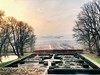
This round barrow was painted by Johan Thomas Lundbye in 1847.
The mound is in fact not as high as it looks in the painting by Lundbye.
Source and additional information: geoparkodsherred.dk (Danish)
You may be viewing yesterday's version of this page. To see the most up to date information please register for a free account.
")
")
Do not use the above information on other web sites or publications without permission of the contributor.
Nearby Images from Flickr
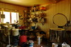
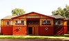
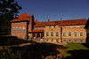
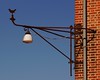
The above images may not be of the site on this page, but were taken nearby. They are loaded from Flickr so please click on them for image credits.
Click here to see more info for this site
Nearby sites
Click here to view sites on an interactive map of the areaKey: Red: member's photo, Blue: 3rd party photo, Yellow: other image, Green: no photo - please go there and take one, Grey: site destroyed
Download sites to:
KML (Google Earth)
GPX (GPS waypoints)
CSV (Garmin/Navman)
CSV (Excel)
To unlock full downloads you need to sign up as a Contributory Member. Otherwise downloads are limited to 50 sites.
Turn off the page maps and other distractions
Nearby sites listing. In the following links * = Image available
472m WNW 294° Bjergesø Langdysse* Long Barrow
3.2km WNW 294° Starreklinte Langdysse* Long Barrow
5.1km WSW 245° Føllenslev Runddysse* Burial Chamber or Dolmen
5.1km WSW 245° Føllenslev Langdysse 1* Long Barrow
5.2km WSW 245° Føllenslev Langdysse 2* Long Barrow
5.3km NNW 346° Fårevejle Vejrhøj* Round Barrow(s)
6.1km SSW 212° Favrbo Runddysse* Burial Chamber or Dolmen
6.5km SSW 213° Favrbo Langdysse* Long Barrow
7.4km SW 234° Hagendrup Runddysse* Burial Chamber or Dolmen
7.5km SSW 199° Hjembæk Frihed Runddysse Burial Chamber or Dolmen
7.6km NNE 14° Fårevejle Runddysse* Burial Chamber or Dolmen
7.6km N 9° Ris Stenkiste* Cist
7.7km NNE 19° Fårevejledyngen* Ancient Village or Settlement
8.1km W 259° Vesterlyng Langdysse* Long Barrow
8.2km WSW 255° Esgebjerg Langdysse* Long Barrow
8.2km NNW 344° Kårup Skov Langdysse* Long Barrow
8.6km N 5° Ris Megalitgrav* Burial Chamber or Dolmen
8.7km NE 36° Asnæs Kirke* Rock Art
8.8km SW 223° Bregninge Runddysse* Burial Chamber or Dolmen
9.0km S 190° Stokkebjerg Skov Langdysse* Long Barrow
9.4km NE 53° Tolsager Maglehøj Runddysse* Burial Chamber or Dolmen
9.5km SSW 198° Bjergstedskoven Runddysse 2* Burial Chamber or Dolmen
9.6km SSW 199° Bjergstedskoven Runddysse 1* Burial Chamber or Dolmen
9.7km SSW 199° Bjergstedskoven Runddysse 3* Burial Chamber or Dolmen
10.4km ENE 56° Grevinge Kirke* Carving
View more nearby sites and additional images


 We would like to know more about this location. Please feel free to add a brief description and any relevant information in your own language.
 Wir möchten mehr über diese Stätte erfahren. Bitte zögern Sie nicht, eine kurze Beschreibung und relevante Informationen in Deutsch hinzuzufügen.
 Nous aimerions en savoir encore un peu sur les lieux. S'il vous plaît n'hesitez pas à ajouter une courte description et tous les renseignements pertinents dans votre propre langue.
 Quisieramos informarnos un poco más de las lugares. No dude en añadir una breve descripción y otros datos relevantes en su propio idioma.