


<< Our Photo Pages >> Der Heisse Stein - Standing Stone (Menhir) in Germany in Saxony-Anhalt
Submitted by peterpf on Saturday, 08 July 2006 Page Views: 3240
Neolithic and Bronze AgeSite Name: Der Heisse SteinCountry: Germany
NOTE: This site is 4.645 km away from the location you searched for.
Land: Saxony-Anhalt Type: Standing Stone (Menhir)
Nearest Town: Molmerswende
Latitude: 51.627010N Longitude: 11.257370E
Condition:
| 5 | Perfect |
| 4 | Almost Perfect |
| 3 | Reasonable but with some damage |
| 2 | Ruined but still recognisable as an ancient site |
| 1 | Pretty much destroyed, possibly visible as crop marks |
| 0 | No data. |
| -1 | Completely destroyed |
| 5 | Superb |
| 4 | Good |
| 3 | Ordinary |
| 2 | Not Good |
| 1 | Awful |
| 0 | No data. |
| 5 | Can be driven to, probably with disabled access |
| 4 | Short walk on a footpath |
| 3 | Requiring a bit more of a walk |
| 2 | A long walk |
| 1 | In the middle of nowhere, a nightmare to find |
| 0 | No data. |
| 5 | co-ordinates taken by GPS or official recorded co-ordinates |
| 4 | co-ordinates scaled from a detailed map |
| 3 | co-ordinates scaled from a bad map |
| 2 | co-ordinates of the nearest village |
| 1 | co-ordinates of the nearest town |
| 0 | no data |
Internal Links:
External Links:
")
Der Heisse Stein = The hot stone
A small Menhir on top of the eastern part of the Harz mountains in the west of Molmerswende.
You may be viewing yesterday's version of this page. To see the most up to date information please register for a free account.
")
Do not use the above information on other web sites or publications without permission of the contributor.
Nearby Images from Flickr

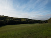
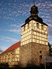
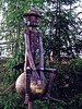
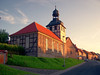
The above images may not be of the site on this page, but were taken nearby. They are loaded from Flickr so please click on them for image credits.
Click here to see more info for this site
Nearby sites
Click here to view sites on an interactive map of the areaKey: Red: member's photo, Blue: 3rd party photo, Yellow: other image, Green: no photo - please go there and take one, Grey: site destroyed
Download sites to:
KML (Google Earth)
GPX (GPS waypoints)
CSV (Garmin/Navman)
CSV (Excel)
To unlock full downloads you need to sign up as a Contributory Member. Otherwise downloads are limited to 50 sites.
Turn off the page maps and other distractions
Nearby sites listing. In the following links * = Image available
12.4km N 350° Gegensteine Rock Outcrop
13.1km NNE 27° Nagelstein Ermsleben* Standing Stone (Menhir)
13.5km NNE 25° Nagelstein Sinsleben* Natural Stone / Erratic / Other Natural Feature
14.5km ENE 61° Ringheiligtum Quenstedt* Timber Circle
16.4km S 173° Sangershausen Menhir* Standing Stone (Menhir)
17.7km S 175° Rogenstein Sangershausen* Early Christian Sculptured Stone
18.1km NW 310° Glockenstein Thale Natural Stone / Erratic / Other Natural Feature
18.9km NW 321° Teufelsmauer* Natural Stone / Erratic / Other Natural Feature
19.5km NNW 335° Rillenstein Westerhausen Standing Stone (Menhir)
19.8km NW 307° Hexentanzplatz (Thale)* Modern Stone Circle etc
20.3km NW 315° Moenchstein Thale Early Christian Sculptured Stone
20.3km E 83° Verwohrene Stein* Standing Stone (Menhir)
20.4km NW 306° Rosstrappe* Rock Art
20.5km NE 48° Speckstein* Standing Stone (Menhir)
21.4km SSE 160° Nagelstein Einzingen* Natural Stone / Erratic / Other Natural Feature
21.5km NNW 330° Eselstall* Stone Circle
22.5km E 86° Pfaffenstein* Standing Stone (Menhir)
22.9km SSE 169° Oberröblingen Ancient Village or Settlement
23.3km S 189° Menhir Hackpfüffel* Standing Stone (Menhir)
23.8km E 90° Hoyerstein Gerbstedt* Holed Stone
24.3km NW 314° Hamburger Wappen Rock Outcrop
24.8km SSW 200° Pfalz Tilleda* Ancient Palace
24.9km NW 326° Königsstein bei Westerhausen* Ancient Temple
25.0km NE 40° Menhir Blaue Gans* Standing Stone (Menhir)
25.3km SW 225° Hoher Stein Berga* Standing Stone (Menhir)
View more nearby sites and additional images


 We would like to know more about this location. Please feel free to add a brief description and any relevant information in your own language.
 Wir möchten mehr über diese Stätte erfahren. Bitte zögern Sie nicht, eine kurze Beschreibung und relevante Informationen in Deutsch hinzuzufügen.
 Nous aimerions en savoir encore un peu sur les lieux. S'il vous plaît n'hesitez pas à ajouter une courte description et tous les renseignements pertinents dans votre propre langue.
 Quisieramos informarnos un poco más de las lugares. No dude en añadir una breve descripción y otros datos relevantes en su propio idioma.