


<< Our Photo Pages >> Ulmekärr Labyrinth - Turf Maze in Sweden in Bohuslän
Submitted by LeGuMa on Tuesday, 26 September 2017 Page Views: 2922
Neolithic and Bronze AgeSite Name: Ulmekärr LabyrinthCountry: Sweden
NOTE: This site is 4.627 km away from the location you searched for.
Landskap: Bohuslän Type: Turf Maze
Nearest Town: Tanum Nearest Village: Grebbestad
Latitude: 58.704973N Longitude: 11.243556E
Condition:
| 5 | Perfect |
| 4 | Almost Perfect |
| 3 | Reasonable but with some damage |
| 2 | Ruined but still recognisable as an ancient site |
| 1 | Pretty much destroyed, possibly visible as crop marks |
| 0 | No data. |
| -1 | Completely destroyed |
| 5 | Superb |
| 4 | Good |
| 3 | Ordinary |
| 2 | Not Good |
| 1 | Awful |
| 0 | No data. |
| 5 | Can be driven to, probably with disabled access |
| 4 | Short walk on a footpath |
| 3 | Requiring a bit more of a walk |
| 2 | A long walk |
| 1 | In the middle of nowhere, a nightmare to find |
| 0 | No data. |
| 5 | co-ordinates taken by GPS or official recorded co-ordinates |
| 4 | co-ordinates scaled from a detailed map |
| 3 | co-ordinates scaled from a bad map |
| 2 | co-ordinates of the nearest village |
| 1 | co-ordinates of the nearest town |
| 0 | no data |
Internal Links:
External Links:
I have visited· I would like to visit
CharcoalBurner89 visited on 20th Aug 2023 - their rating: Cond: 3 Amb: 4 Access: 4 Beautiful (possibly prehistoric) maze.
")
It's situated along the road between Grebbestad and Havstenssund in Tanum, Bohuslän.
A small parking space is close by and a pair of stairs goes up to the labyrinth.
You may be viewing yesterday's version of this page. To see the most up to date information please register for a free account.
")
")
Do not use the above information on other web sites or publications without permission of the contributor.
Nearby Images from Flickr
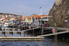
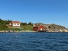
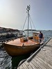
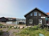
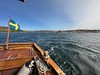
The above images may not be of the site on this page, but were taken nearby. They are loaded from Flickr so please click on them for image credits.
Click here to see more info for this site
Nearby sites
Click here to view sites on an interactive map of the areaKey: Red: member's photo, Blue: 3rd party photo, Yellow: other image, Green: no photo - please go there and take one, Grey: site destroyed
Download sites to:
KML (Google Earth)
GPX (GPS waypoints)
CSV (Garmin/Navman)
CSV (Excel)
To unlock full downloads you need to sign up as a Contributory Member. Otherwise downloads are limited to 50 sites.
Turn off the page maps and other distractions
Nearby sites listing. In the following links * = Image available
1.1km ESE 118° Greby* Barrow Cemetery
3.7km E 89° Björnemyren Hällkista* Cist
3.8km ENE 63° Säm Gånggrift* Passage Grave
4.1km ENE 60° Tanumshede Gravröse (1)* Cairn
5.0km ESE 111° Litsleby* Carving
5.1km ESE 110° Tanum 72:1 Tegneby* Rock Art
5.2km E 93° Vitlycke Rösen* Round Cairn
5.3km ENE 76° Kallebystenen* Carving
5.4km E 96° Tanum 9:1 Vitlycke* Rock Art
5.4km E 94° Vitlycke Carvings* Rock Art
5.4km E 94° Tanums Hällristningar* Carving
5.4km E 97° Tanum 6:1 Vitlycke* Rock Art
5.5km ESE 121° Emelieborg* Rock Art
5.6km E 93° Vitlycke Museum* Museum
5.6km E 93° Vitlycke gravfelt* Barrow Cemetery
5.6km E 101° Aspeberget* Carving
5.7km ESE 103° Aspeberget RAÄ nr 26:1* Rock Art
5.7km ESE 103° Tanum 28:1 Aspeberget* Rock Art
5.7km ESE 103° Tanum 25:1 Aspeberget* Rock Art
5.7km ESE 102° Tanum 18:1 Aspeberget* Rock Art
5.8km ESE 118° Tanum 192:1 Bro Utmark* Rock Art
6.8km ESE 111° Lövåsen Hällristningar* Rock Art
7.0km ESE 106° Gerum Rune Rock* Rock Art
8.2km ESE 111° Tanum 357:1 Sotetorp* Rock Art
8.4km ENE 75° Fossum (Tanum)* Carving
View more nearby sites and additional images


 We would like to know more about this location. Please feel free to add a brief description and any relevant information in your own language.
 Wir möchten mehr über diese Stätte erfahren. Bitte zögern Sie nicht, eine kurze Beschreibung und relevante Informationen in Deutsch hinzuzufügen.
 Nous aimerions en savoir encore un peu sur les lieux. S'il vous plaît n'hesitez pas à ajouter une courte description et tous les renseignements pertinents dans votre propre langue.
 Quisieramos informarnos un poco más de las lugares. No dude en añadir una breve descripción y otros datos relevantes en su propio idioma.