

<< Our Photo Pages >> Monte San Martino, Campi, Riva Dell Garda - Ancient Temple in Italy in Lombardia
Submitted by Faesten on Sunday, 16 June 2013 Page Views: 3420
Roman, Greek and ClassicalSite Name: Monte San Martino, Campi, Riva Dell GardaCountry: Italy
NOTE: This site is 14.699 km away from the location you searched for.
Region: Lombardia Type: Ancient Temple
Nearest Town: Tenno Nearest Village: Campi
Latitude: 45.917500N Longitude: 10.818100E
Condition:
| 5 | Perfect |
| 4 | Almost Perfect |
| 3 | Reasonable but with some damage |
| 2 | Ruined but still recognisable as an ancient site |
| 1 | Pretty much destroyed, possibly visible as crop marks |
| 0 | No data. |
| -1 | Completely destroyed |
| 5 | Superb |
| 4 | Good |
| 3 | Ordinary |
| 2 | Not Good |
| 1 | Awful |
| 0 | No data. |
| 5 | Can be driven to, probably with disabled access |
| 4 | Short walk on a footpath |
| 3 | Requiring a bit more of a walk |
| 2 | A long walk |
| 1 | In the middle of nowhere, a nightmare to find |
| 0 | No data. |
| 5 | co-ordinates taken by GPS or official recorded co-ordinates |
| 4 | co-ordinates scaled from a detailed map |
| 3 | co-ordinates scaled from a bad map |
| 2 | co-ordinates of the nearest village |
| 1 | co-ordinates of the nearest town |
| 0 | no data |
Internal Links:
External Links:
")
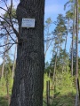
Iron age sanctuary associated with the Rhaetian culture subsequently rebuilt by the Romans as a temple to Minerva after their conquest of the area, several building phases between the iron Age and the 3/4th century CE nearby is a subsequent settlement which may have been built by the Byzantines as a military fort after their re-conquest of Italy in the 6th Century, near to this is the foundation ruins of a church dating from the 8th century.
Extensive archaeology on the site over the last 15 years or so and is still in process, site is well maintained.
You may be viewing yesterday's version of this page. To see the most up to date information please register for a free account.
Do not use the above information on other web sites or publications without permission of the contributor.
Nearby Images from Flickr
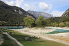


The above images may not be of the site on this page, but were taken nearby. They are loaded from Flickr so please click on them for image credits.
Click here to see more info for this site
Nearby sites
Click here to view sites on an interactive map of the areaKey: Red: member's photo, Blue: 3rd party photo, Yellow: other image, Green: no photo - please go there and take one, Grey: site destroyed
Download sites to:
KML (Google Earth)
GPX (GPS waypoints)
CSV (Garmin/Navman)
CSV (Excel)
To unlock full downloads you need to sign up as a Contributory Member. Otherwise downloads are limited to 50 sites.
Turn off the page maps and other distractions
Nearby sites listing. In the following links * = Image available
4.1km SSE 153° MAG Museo Alta Garda Museum
23.6km S 190° Castelletto* Carving
32.4km SSW 195° Crero* Carving
37.0km WNW 290° In Vall Rock Engravings Rock Art
37.2km WNW 290° Castagneto Rock Art
37.4km WNW 290° Dos Sottolaiolo* Rock Art
37.4km WNW 286° Nadro Cup-Marked-Stone* Rock Art
37.5km WNW 291° Plas - Capitello Rock Art
37.5km WNW 286° Foppe-Nadro Museum* Museum
37.5km WNW 290° ´Al de Plaha* Rock Art
37.7km WNW 287° Nadro Ancient Road* Ancient Trackway
37.8km WNW 287° Foppe-Nadro Stone* Standing Stone (Menhir)
37.8km WNW 288° Sotto Roccia shelter II* Cave or Rock Shelter
37.8km WNW 288° Foppe-Nadro Villaggio Prehistorico* Museum
37.9km WNW 288° Foppe-Nadro Rock 29* Rock Art
37.9km WNW 288° Foppe-Nadro Rock 26* Rock Art
37.9km WNW 288° Foppe-Nadro Rock 23* Rock Art
37.9km WNW 288° Foppe-Nadro Rock 1* Rock Art
37.9km WNW 289° Campanine Alta* Rock Art
37.9km WNW 288° Foppe-Nadro Rock 21* Rock Art
38.0km WNW 288° Foppe-Nadro Rock 24* Rock Art
38.0km WNW 288° Foppe-Nadro Rock 25* Rock Art
38.0km WNW 288° Foppe-Nadro Rock 4* Rock Art
38.0km WNW 288° Foppe-Nadro Rock 22* Rock Art
38.0km WNW 288° Foppe-Nadro Rock 34* Rock Art
View more nearby sites and additional images


 We would like to know more about this location. Please feel free to add a brief description and any relevant information in your own language.
 Wir möchten mehr über diese Stätte erfahren. Bitte zögern Sie nicht, eine kurze Beschreibung und relevante Informationen in Deutsch hinzuzufügen.
 Nous aimerions en savoir encore un peu sur les lieux. S'il vous plaît n'hesitez pas à ajouter une courte description et tous les renseignements pertinents dans votre propre langue.
 Quisieramos informarnos un poco más de las lugares. No dude en añadir una breve descripción y otros datos relevantes en su propio idioma.