


<< Text Pages >> Wei Ling Pyramid - Pyramid / Mastaba in China
Submitted by Klingon on Monday, 12 September 2005 Page Views: 7540
Multi-periodSite Name: Wei Ling Pyramid Alternative Name: 汉元帝渭陵Country: China Type: Pyramid / Mastaba
Latitude: 34.397827N Longitude: 108.712782E
Condition:
| 5 | Perfect |
| 4 | Almost Perfect |
| 3 | Reasonable but with some damage |
| 2 | Ruined but still recognisable as an ancient site |
| 1 | Pretty much destroyed, possibly visible as crop marks |
| 0 | No data. |
| -1 | Completely destroyed |
| 5 | Superb |
| 4 | Good |
| 3 | Ordinary |
| 2 | Not Good |
| 1 | Awful |
| 0 | No data. |
| 5 | Can be driven to, probably with disabled access |
| 4 | Short walk on a footpath |
| 3 | Requiring a bit more of a walk |
| 2 | A long walk |
| 1 | In the middle of nowhere, a nightmare to find |
| 0 | No data. |
| 5 | co-ordinates taken by GPS or official recorded co-ordinates |
| 4 | co-ordinates scaled from a detailed map |
| 3 | co-ordinates scaled from a bad map |
| 2 | co-ordinates of the nearest village |
| 1 | co-ordinates of the nearest town |
| 0 | no data |
Be the first person to rate this site - see the 'Contribute!' box in the right hand menu.
Internal Links:
External Links:
Pyramid in China
You may be viewing yesterday's version of this page. To see the most up to date information please register for a free account.
Do not use the above information on other web sites or publications without permission of the contributor.
Nearby Images from Flickr
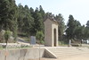
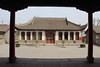
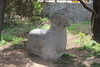
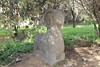
The above images may not be of the site on this page, but were taken nearby. They are loaded from Flickr so please click on them for image credits.
Click here to see more info for this site
Nearby sites
Click here to view sites on an interactive map of the areaKey: Red: member's photo, Blue: 3rd party photo, Yellow: other image, Green: no photo - please go there and take one, Grey: site destroyed
Download sites to:
KML (Google Earth)
GPX (GPS waypoints)
CSV (Garmin/Navman)
CSV (Excel)
To unlock full downloads you need to sign up as a Contributory Member. Otherwise downloads are limited to 50 sites.
Turn off the page maps and other distractions
Nearby sites listing. In the following links * = Image available
655m ESE 105° Chengwan Pyramid Pyramid / Mastaba
1.7km NE 42° Wenwang Pyramid Pyramid / Mastaba
1.9km NE 37° Wuwang Pyramid Pyramid / Mastaba
2.0km ESE 105° Kangwang Pyramid Pyramid / Mastaba
2.2km SSW 201° Chinese Pyramid (41) Pyramid / Mastaba
2.2km ENE 77° Chinese Pyramid (7) Pyramid / Mastaba
2.2km ENE 64° Chinese Pyramid (54) Pyramid / Mastaba
2.4km SSW 198° Chinese Pyramid (42) Pyramid / Mastaba
2.4km S 170° Chinese Pyramid (23) Pyramid / Mastaba
2.4km S 169° Chinese Pyramid (24) Pyramid / Mastaba
2.5km S 169° Chinese Pyramid (25) Pyramid / Mastaba
2.6km ESE 108° Yi Ling Pyramid Pyramid / Mastaba
2.7km S 171° Chinese Pyramid (26) Pyramid / Mastaba
2.7km S 172° Chinese Pyramid (27) Pyramid / Mastaba
2.9km SSW 207° Yan Ling Pyramid Pyramid / Mastaba
3.0km E 89° Chinese Pyramid (18) Pyramid / Mastaba
3.0km E 88° Chinese Pyramid (19) Pyramid / Mastaba
3.0km E 94° Chinese Pyramid (9) Pyramid / Mastaba
3.1km E 94° Chinese Pyramid (10) Pyramid / Mastaba
3.1km SW 230° Chinese Pyramid (63) Pyramid / Mastaba
3.2km E 92° Chinese Pyramid (14) Pyramid / Mastaba
3.2km SE 136° Chinese Pyramid (32) Pyramid / Mastaba
3.2km SE 137° Chinese Pyramid (33) Pyramid / Mastaba
3.2km SW 232° Chinese Pyramid (62) Pyramid / Mastaba
3.2km E 94° Chinese Pyramid (11) Pyramid / Mastaba
View more nearby sites and additional images


 We would like to know more about this location. Please feel free to add a brief description and any relevant information in your own language.
 Wir möchten mehr über diese Stätte erfahren. Bitte zögern Sie nicht, eine kurze Beschreibung und relevante Informationen in Deutsch hinzuzufügen.
 Nous aimerions en savoir encore un peu sur les lieux. S'il vous plaît n'hesitez pas à ajouter une courte description et tous les renseignements pertinents dans votre propre langue.
 Quisieramos informarnos un poco más de las lugares. No dude en añadir una breve descripción y otros datos relevantes en su propio idioma.