


<< Text Pages >> Sagan-Zaba Cape - Rock Art in Russia
Submitted by KaiHofmann on Saturday, 18 April 2015 Page Views: 1386
Rock ArtSite Name: Sagan-Zaba CapeCountry: Russia
NOTE: This site is 90.712 km away from the location you searched for.
Type: Rock Art
Nearest Village: Elantsy
Latitude: 52.681384N Longitude: 106.475066E
Condition:
| 5 | Perfect |
| 4 | Almost Perfect |
| 3 | Reasonable but with some damage |
| 2 | Ruined but still recognisable as an ancient site |
| 1 | Pretty much destroyed, possibly visible as crop marks |
| 0 | No data. |
| -1 | Completely destroyed |
| 5 | Superb |
| 4 | Good |
| 3 | Ordinary |
| 2 | Not Good |
| 1 | Awful |
| 0 | No data. |
| 5 | Can be driven to, probably with disabled access |
| 4 | Short walk on a footpath |
| 3 | Requiring a bit more of a walk |
| 2 | A long walk |
| 1 | In the middle of nowhere, a nightmare to find |
| 0 | No data. |
| 5 | co-ordinates taken by GPS or official recorded co-ordinates |
| 4 | co-ordinates scaled from a detailed map |
| 3 | co-ordinates scaled from a bad map |
| 2 | co-ordinates of the nearest village |
| 1 | co-ordinates of the nearest town |
| 0 | no data |
Internal Links:
External Links:
Rock Art in Russia
Sixty engraved dancing human-like figurines and animals direct at the Baikal lakeside. The petroglyphs are between 1-50 cm tall. The oldest engravings are dated back to 2.000 BCE.
You may be viewing yesterday's version of this page. To see the most up to date information please register for a free account.
Do not use the above information on other web sites or publications without permission of the contributor.
Nearby Images from Flickr
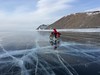
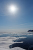

The above images may not be of the site on this page, but were taken nearby. They are loaded from Flickr so please click on them for image credits.
Click here to see more info for this site
Nearby sites
Click here to view sites on an interactive map of the areaKey: Red: member's photo, Blue: 3rd party photo, Yellow: other image, Green: no photo - please go there and take one, Grey: site destroyed
Download sites to:
KML (Google Earth)
GPX (GPS waypoints)
CSV (Garmin/Navman)
CSV (Excel)
To unlock full downloads you need to sign up as a Contributory Member. Otherwise downloads are limited to 50 sites.
Turn off the page maps and other distractions
Nearby sites listing. In the following links * = Image available
12.5km NNE 15° Sacred mountain Yord* Artificial Mound
116.6km SE 139° Ethnographic Museum of Buryatia* Museum
121.1km SE 141° Museum of Buryatia History* Museum
122.7km SE 146° Big Ivolginskoe settlement* Ancient Village or Settlement
155.5km WSW 254° Irkutsk Museum Of Regional Studies* Museum
156.0km NNW 341° Shishkino* Rock Art
201.2km W 278° Malta Paleolithic Settlement* Ancient Village or Settlement
235.2km S 185° Orgoyton-1 Burial Ground* Chambered Tomb
235.3km S 185° Orgoyton-2 Burial Ground* Chambered Tomb
566.7km SW 236° Moron Deer Stones* Standing Stones
655.3km SE 144° Duurlig Nars Burial Chamber or Dolmen
659.8km E 94° Ust-Chorninsk settlement* Ancient Village or Settlement
709.0km SW 227° Tariat Deer Stone* Standing Stones
796.8km ESE 103° Konduy settlement* Ancient Village or Settlement
817.1km WSW 246° Lake Oygon Round Barrows Round Barrow(s)
826.9km W 267° Republican Museum of Kyzyl* Museum
867.5km W 271° Arzhan Scythian royal necropolis* Barrow Cemetery
954.1km WNW 298° Krasnoyarsk Regional Museum of Local Lore* Museum
957.7km WNW 298° Settlement Afontova Mountain* Ancient Village or Settlement
964.2km W 269° Ancient sanctuary Chaa-Holl* Rock Cut Tomb
1006.3km WNW 283° Museum Kyzlasov L.R.* Museum
1050.2km WNW 284° Great Salbyk Kurgan* Pyramid / Mastaba
1106.8km WNW 287° Tuim Cromlech* Stone Circle
1121.3km WNW 288° Complex Sunduki* Natural Stone / Erratic / Other Natural Feature
1139.2km WNW 286° Paleolithic settlement Small Syya* Ancient Village or Settlement
View more nearby sites and additional images


 We would like to know more about this location. Please feel free to add a brief description and any relevant information in your own language.
 Wir möchten mehr über diese Stätte erfahren. Bitte zögern Sie nicht, eine kurze Beschreibung und relevante Informationen in Deutsch hinzuzufügen.
 Nous aimerions en savoir encore un peu sur les lieux. S'il vous plaît n'hesitez pas à ajouter une courte description et tous les renseignements pertinents dans votre propre langue.
 Quisieramos informarnos un poco más de las lugares. No dude en añadir una breve descripción y otros datos relevantes en su propio idioma.