

<< Our Photo Pages >> Irkutsk Museum Of Regional Studies - Museum in Russia
Submitted by DrewParsons on Friday, 21 December 2018 Page Views: 1656
MuseumsSite Name: Irkutsk Museum Of Regional StudiesCountry: Russia
NOTE: This site is 58.894 km away from the location you searched for.
Type: Museum
Nearest Town: Irkutsk
Latitude: 52.275770N Longitude: 104.277900E
Condition:
| 5 | Perfect |
| 4 | Almost Perfect |
| 3 | Reasonable but with some damage |
| 2 | Ruined but still recognisable as an ancient site |
| 1 | Pretty much destroyed, possibly visible as crop marks |
| 0 | No data. |
| -1 | Completely destroyed |
| 5 | Superb |
| 4 | Good |
| 3 | Ordinary |
| 2 | Not Good |
| 1 | Awful |
| 0 | No data. |
| 5 | Can be driven to, probably with disabled access |
| 4 | Short walk on a footpath |
| 3 | Requiring a bit more of a walk |
| 2 | A long walk |
| 1 | In the middle of nowhere, a nightmare to find |
| 0 | No data. |
| 5 | co-ordinates taken by GPS or official recorded co-ordinates |
| 4 | co-ordinates scaled from a detailed map |
| 3 | co-ordinates scaled from a bad map |
| 2 | co-ordinates of the nearest village |
| 1 | co-ordinates of the nearest town |
| 0 | no data |
Internal Links:
External Links:
I have visited· I would like to visit
DrewParsons has visited here
")
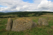
Whilst I thought that I understood the order of the displays in the museum, when I returned home and checked my photographs I could not be sure which captions belonged to which era exhibits and so I have posted the photos without descriptions but added photos of the four detailed epoc signs which describe the eras generally.
You may be viewing yesterday's version of this page. To see the most up to date information please register for a free account.
")
")
")
")
")
")
")
")
")
")
")
")
")
")
")
")
")
")
")
")
")
")
")
")
These are just the first 25 photos of Irkutsk Museum Of Regional Studies. If you log in with a free user account you will be able to see our entire collection.
Do not use the above information on other web sites or publications without permission of the contributor.
Click here to see more info for this site
Nearby sites
Click here to view sites on an interactive map of the areaKey: Red: member's photo, Blue: 3rd party photo, Yellow: other image, Green: no photo - please go there and take one, Grey: site destroyed
Download sites to:
KML (Google Earth)
GPX (GPS waypoints)
CSV (Garmin/Navman)
CSV (Excel)
To unlock full downloads you need to sign up as a Contributory Member. Otherwise downloads are limited to 50 sites.
Turn off the page maps and other distractions
Nearby sites listing. In the following links * = Image available
86.8km NW 323° Malta Paleolithic Settlement* Ancient Village or Settlement
155.5km ENE 72° Sagan-Zaba Cape Rock Art
162.2km ENE 68° Sacred mountain Yord* Artificial Mound
214.7km NNE 26° Shishkino* Rock Art
226.0km ESE 103° Big Ivolginskoe settlement* Ancient Village or Settlement
230.4km E 100° Ethnographic Museum of Buryatia* Museum
231.1km SE 144° Orgoyton-2 Burial Ground* Chambered Tomb
231.3km SE 144° Orgoyton-1 Burial Ground* Chambered Tomb
231.7km E 101° Museum of Buryatia History* Museum
421.4km SW 228° Moron Deer Stones* Standing Stones
574.7km SW 218° Tariat Deer Stone* Standing Stones
663.3km WSW 243° Lake Oygon Round Barrows Round Barrow(s)
676.6km W 269° Republican Museum of Kyzyl* Museum
720.0km W 273° Arzhan Scythian royal necropolis* Barrow Cemetery
723.6km SE 131° Duurlig Nars Burial Chamber or Dolmen
807.4km E 89° Ust-Chorninsk settlement* Ancient Village or Settlement
814.6km W 270° Ancient sanctuary Chaa-Holl* Rock Cut Tomb
849.5km WNW 304° Krasnoyarsk Regional Museum of Local Lore* Museum
852.7km WNW 304° Settlement Afontova Mountain* Ancient Village or Settlement
872.8km WNW 286° Museum Kyzlasov L.R.* Museum
918.2km WNW 287° Great Salbyk Kurgan* Pyramid / Mastaba
935.4km E 97° Konduy settlement* Ancient Village or Settlement
979.3km WNW 290° Tuim Cromlech* Stone Circle
996.5km WNW 291° Complex Sunduki* Natural Stone / Erratic / Other Natural Feature
1011.4km WNW 289° Paleolithic settlement Small Syya* Ancient Village or Settlement
View more nearby sites and additional images


 We would like to know more about this location. Please feel free to add a brief description and any relevant information in your own language.
 Wir möchten mehr über diese Stätte erfahren. Bitte zögern Sie nicht, eine kurze Beschreibung und relevante Informationen in Deutsch hinzuzufügen.
 Nous aimerions en savoir encore un peu sur les lieux. S'il vous plaît n'hesitez pas à ajouter une courte description et tous les renseignements pertinents dans votre propre langue.
 Quisieramos informarnos un poco más de las lugares. No dude en añadir una breve descripción y otros datos relevantes en su propio idioma.