 with our Megalithic Portal iPhone app")


<< Text Pages >> Phu Pha Yol Rock Engravings - Rock Art in Thailand
Submitted by KaiHofmann on Thursday, 02 March 2017 Page Views: 1200
Rock ArtSite Name: Phu Pha Yol Rock EngravingsCountry: Thailand
NOTE: This site is 138.187 km away from the location you searched for.
Type: Rock Art
Nearest Town: Mukdahan
Latitude: 16.745322N Longitude: 104.352314E
Condition:
| 5 | Perfect |
| 4 | Almost Perfect |
| 3 | Reasonable but with some damage |
| 2 | Ruined but still recognisable as an ancient site |
| 1 | Pretty much destroyed, possibly visible as crop marks |
| 0 | No data. |
| -1 | Completely destroyed |
| 5 | Superb |
| 4 | Good |
| 3 | Ordinary |
| 2 | Not Good |
| 1 | Awful |
| 0 | No data. |
| 5 | Can be driven to, probably with disabled access |
| 4 | Short walk on a footpath |
| 3 | Requiring a bit more of a walk |
| 2 | A long walk |
| 1 | In the middle of nowhere, a nightmare to find |
| 0 | No data. |
| 5 | co-ordinates taken by GPS or official recorded co-ordinates |
| 4 | co-ordinates scaled from a detailed map |
| 3 | co-ordinates scaled from a bad map |
| 2 | co-ordinates of the nearest village |
| 1 | co-ordinates of the nearest town |
| 0 | no data |
Internal Links:
External Links:
Rock Art in Thailand
Many rock engravings (around 1000 BCE) on a cliff of the Phu Pha Yol mountain range in the Phu Pha Yon National Park.
You may be viewing yesterday's version of this page. To see the most up to date information please register for a free account.
Do not use the above information on other web sites or publications without permission of the contributor.
Nearby Images from Flickr
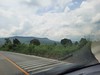
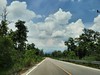


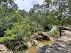

The above images may not be of the site on this page, but were taken nearby. They are loaded from Flickr so please click on them for image credits.
Click here to see more info for this site
Nearby sites
Click here to view sites on an interactive map of the areaKey: Red: member's photo, Blue: 3rd party photo, Yellow: other image, Green: no photo - please go there and take one, Grey: site destroyed
Download sites to:
KML (Google Earth)
GPX (GPS waypoints)
CSV (Garmin/Navman)
CSV (Excel)
To unlock full downloads you need to sign up as a Contributory Member. Otherwise downloads are limited to 50 sites.
Turn off the page maps and other distractions
Nearby sites listing. In the following links * = Image available
194.3km SE 140° Pha Taem Rock Art Rock Art
238.5km WNW 298° Phu Phra Bat Historical Park Rock Art
263.6km S 172° Prasat Preah Vihear* Ancient Temple
276.3km SW 234° Ban Non Wat Ancient Village or Settlement
289.6km SE 143° Wat Phou* Ancient Village or Settlement
306.1km NNW 340° The Plain of Jars* Ancient Mine, Quarry or other Industry
326.2km SSW 204° Banteay Chhmar Ancient Temple
330.0km S 177° Koh Ker* Ancient Village or Settlement
342.1km S 186° Kbal Spean* Carving
352.4km S 187° Banteay Srei* Ancient Temple
363.8km S 182° Beng Mealea Ancient Temple
366.8km S 186° Phnom Bok* Ancient Temple
367.7km S 188° Krol Ko* Ancient Temple
367.9km S 188° Banteay Prei* Ancient Temple
367.9km S 187° Ta Som* Ancient Temple
367.9km S 189° Prasat Banteay Thom* Ancient Temple
368.0km S 188° Prasat Prei* Ancient Temple
368.3km S 188° Neak Pean* Ancient Temple
368.7km S 188° Preah Khan* Ancient Temple
369.4km S 189° Prasat Prei Ancient Temple
369.6km S 188° Ta Nei* Ancient Temple
369.7km S 188° Angkor Thom North Gate* Ancient Temple
369.7km S 187° Banteay Samré* Ancient Temple
369.7km S 187° East Mebon* Ancient Temple
370.3km S 188° Preah Pithu* Ancient Temple
View more nearby sites and additional images


 We would like to know more about this location. Please feel free to add a brief description and any relevant information in your own language.
 Wir möchten mehr über diese Stätte erfahren. Bitte zögern Sie nicht, eine kurze Beschreibung und relevante Informationen in Deutsch hinzuzufügen.
 Nous aimerions en savoir encore un peu sur les lieux. S'il vous plaît n'hesitez pas à ajouter une courte description et tous les renseignements pertinents dans votre propre langue.
 Quisieramos informarnos un poco más de las lugares. No dude en añadir una breve descripción y otros datos relevantes en su propio idioma.