


<< Our Photo Pages >> Dienstedter Karsthöhle - Cave or Rock Shelter in Germany in Thuringia
Submitted by Klingon on Wednesday, 09 September 2009 Page Views: 2024
Natural PlacesSite Name: Dienstedter KarsthöhleCountry: Germany
NOTE: This site is 11.634 km away from the location you searched for.
Land: Thuringia Type: Cave or Rock Shelter
Latitude: 50.814150N Longitude: 11.175090E
Condition:
| 5 | Perfect |
| 4 | Almost Perfect |
| 3 | Reasonable but with some damage |
| 2 | Ruined but still recognisable as an ancient site |
| 1 | Pretty much destroyed, possibly visible as crop marks |
| 0 | No data. |
| -1 | Completely destroyed |
| 5 | Superb |
| 4 | Good |
| 3 | Ordinary |
| 2 | Not Good |
| 1 | Awful |
| 0 | No data. |
| 5 | Can be driven to, probably with disabled access |
| 4 | Short walk on a footpath |
| 3 | Requiring a bit more of a walk |
| 2 | A long walk |
| 1 | In the middle of nowhere, a nightmare to find |
| 0 | No data. |
| 5 | co-ordinates taken by GPS or official recorded co-ordinates |
| 4 | co-ordinates scaled from a detailed map |
| 3 | co-ordinates scaled from a bad map |
| 2 | co-ordinates of the nearest village |
| 1 | co-ordinates of the nearest town |
| 0 | no data |
Internal Links:
External Links:
I have visited· I would like to visit
Klingon visited on 10th Sep 2017 - their rating: Cond: 3 Amb: 5 Access: 3
")
People of the Linear Pottery culture inhabited the cave 4000 years ago.
You may be viewing yesterday's version of this page. To see the most up to date information please register for a free account.
")
Do not use the above information on other web sites or publications without permission of the contributor.
Nearby Images from Flickr
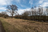
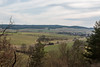
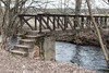
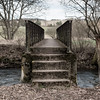
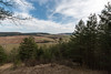
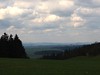
The above images may not be of the site on this page, but were taken nearby. They are loaded from Flickr so please click on them for image credits.
Click here to see more info for this site
Nearby sites
Click here to view sites on an interactive map of the areaKey: Red: member's photo, Blue: 3rd party photo, Yellow: other image, Green: no photo - please go there and take one, Grey: site destroyed
Download sites to:
KML (Google Earth)
GPX (GPS waypoints)
CSV (Garmin/Navman)
CSV (Excel)
To unlock full downloads you need to sign up as a Contributory Member. Otherwise downloads are limited to 50 sites.
Turn off the page maps and other distractions
Nearby sites listing. In the following links * = Image available
16.2km NE 41° Höhlenburg Buchfart* Cave or Rock Shelter
16.4km NW 320° Walterslebener Holz* Round Barrow(s)
16.9km NW 323° Grabhügel Martinsbusch* Round Barrow(s)
16.9km NW 325° Grabhügel Teufelssumpf* Round Barrow(s)
17.4km NW 323° Grabhügel Grenzweg* Artificial Mound
17.4km SE 139° Weinberg Oberpreilipp Ancient Village or Settlement
17.9km NW 314° Kirchberg (Möbisburg)* Hillfort
18.2km NNW 326° Grabhügel Am Tannenwäldchen* Artificial Mound
18.6km NW 325° Grabhügel Schuckelteich* Artificial Mound
18.9km NW 321° Hochheimer Holz* Causewayed Enclosure
19.1km NNW 326° Grabhügel Waldkasino* Artificial Mound
19.8km SSW 202° Bärenkeller Garsitz Cave or Rock Shelter
20.0km ENE 76° Menhir an der Quelle der Leutra* Modern Stone Circle etc
20.8km NNE 31° Museum of Prehistory Thuringia* Museum
21.1km NNW 339° Ringelberg Hügelgräber* Artificial Mound
22.6km NW 316° Gräberfelder Bindersleben* Round Barrow(s)
23.8km NNE 32° Auf dem Steinberge* Ancient Village or Settlement
24.5km NNE 16° Brunfthof* Causewayed Enclosure
25.3km NNE 16° Ettersburg* Standing Stone (Menhir)
25.4km NNE 26° Prinzenschneise (1)* Round Barrow(s)
25.5km NNE 26° Prinzenschneise (2)* Round Barrow(s)
25.5km NNE 26° Prinzenschneise (3)* Round Barrow(s)
25.6km NNE 26° Prinzenschneise (4)* Round Barrow(s)
26.0km SE 145° Teufelsbruecke Obernitz Cave or Rock Shelter
27.4km N 359° Am Krummbache* Artificial Mound
View more nearby sites and additional images


 We would like to know more about this location. Please feel free to add a brief description and any relevant information in your own language.
 Wir möchten mehr über diese Stätte erfahren. Bitte zögern Sie nicht, eine kurze Beschreibung und relevante Informationen in Deutsch hinzuzufügen.
 Nous aimerions en savoir encore un peu sur les lieux. S'il vous plaît n'hesitez pas à ajouter une courte description et tous les renseignements pertinents dans votre propre langue.
 Quisieramos informarnos un poco más de las lugares. No dude en añadir una breve descripción y otros datos relevantes en su propio idioma.