

<< Text Pages >> Hügelgräber Erlach - Round Barrow(s) in Germany in Bavaria
Submitted by Harald_Platta on Sunday, 12 April 2015 Page Views: 1128
Neolithic and Bronze AgeSite Name: Hügelgräber ErlachCountry: Germany
NOTE: This site is 8.711 km away from the location you searched for.
Land: Bavaria Type: Round Barrow(s)
Nearest Town: Zirndorf
Latitude: 49.416952N Longitude: 10.887724E
Condition:
| 5 | Perfect |
| 4 | Almost Perfect |
| 3 | Reasonable but with some damage |
| 2 | Ruined but still recognisable as an ancient site |
| 1 | Pretty much destroyed, possibly visible as crop marks |
| 0 | No data. |
| -1 | Completely destroyed |
| 5 | Superb |
| 4 | Good |
| 3 | Ordinary |
| 2 | Not Good |
| 1 | Awful |
| 0 | No data. |
| 5 | Can be driven to, probably with disabled access |
| 4 | Short walk on a footpath |
| 3 | Requiring a bit more of a walk |
| 2 | A long walk |
| 1 | In the middle of nowhere, a nightmare to find |
| 0 | No data. |
| 5 | co-ordinates taken by GPS or official recorded co-ordinates |
| 4 | co-ordinates scaled from a detailed map |
| 3 | co-ordinates scaled from a bad map |
| 2 | co-ordinates of the nearest village |
| 1 | co-ordinates of the nearest town |
| 0 | no data |
Internal Links:
External Links:
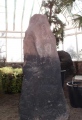
Erlach forest in Zirndorf (Bavaria, Germany) contains several round barrows. A few are still visible as small mounds, like e.g. the one, that is called “Hünengrab“ by the people of the city district Weinzierlein.
The round barrows are not well examined. Based on the discoveries of several artefacts in the wider surrounding, it has been speculated, that the round barrows my have been built ca. 1000 BC.
Text References:
[01] Übler, K. (Geschichtswerkstatt Zirndorf e. V.): personal communication (2015).
[02] Stadt Zirndorf: 75 Jahre Stadt Zirndorf (1987).
[03] Wikipedia articles „Zirndorf“ and „Weinzierlein“ (basic information about the round barrows, but without original text reference)
You may be viewing yesterday's version of this page. To see the most up to date information please register for a free account.
Do not use the above information on other web sites or publications without permission of the contributor.
Nearby Images from Flickr
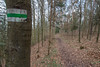
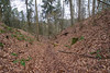
The above images may not be of the site on this page, but were taken nearby. They are loaded from Flickr so please click on them for image credits.
Click here to see more info for this site
Nearby sites
Click here to view sites on an interactive map of the areaKey: Red: member's photo, Blue: 3rd party photo, Yellow: other image, Green: no photo - please go there and take one, Grey: site destroyed
Download sites to:
KML (Google Earth)
GPX (GPS waypoints)
CSV (Garmin/Navman)
CSV (Excel)
To unlock full downloads you need to sign up as a Contributory Member. Otherwise downloads are limited to 50 sites.
Turn off the page maps and other distractions
Nearby sites listing. In the following links * = Image available
7.9km WNW 303° Druidenstein Stinzendorf Natural Stone / Erratic / Other Natural Feature
14.7km ENE 75° Naturhistorisches Museum Nürnberg* Museum
21.5km NE 54° Kraftshofer Forst* Round Barrow(s)
21.8km N 9° Kosbacher Altar* Round Barrow(s)
23.5km SSE 161° Druidenstein Mäbenberg Natural Stone / Erratic / Other Natural Feature
23.6km ENE 71° Behringersdorf* Chambered Tomb
24.6km WSW 253° Kleiner Markmann Standing Stone (Menhir)
25.1km WSW 254° Grosser Markmann Standing Stone (Menhir)
29.4km NNE 23° Mark-forst Grabhügel Artificial Mound
34.0km NW 321° Oasen der Sinne* Museum
34.9km SSW 196° Archäologisches Museum Gunzenhausen Museum
36.7km W 274° Summstein am Petersberg Modern Stone Circle etc
38.8km NNE 29° Walberla* Hillfort
39.2km S 188° Dittenheim Grabhügelfeld Barrow Cemetery
43.1km SSW 192° Die Gelbe Bürg Hillfort
43.7km ENE 79° Houbirg* Causewayed Enclosure
43.8km SSE 146° Thalmässing Vor-und Frühgeschichtliches Museum Museum
44.0km ESE 116° Buchberg Hillfort
44.3km E 80° Hohler Fels Houbirg* Cave or Rock Shelter
44.5km SE 146° Thalmässing Grabhügelfeld Artificial Mound
44.6km W 275° Statue Menhir Replica Gallmersgarten* Standing Stone (Menhir)
45.8km ENE 75° Wallanlage Windburg Hillfort
45.8km ESE 107° Krähentisch Natural Stone / Erratic / Other Natural Feature
46.9km SE 145° Gräberfeld Thalmässing Barrow Cemetery
47.1km E 81° Akropolis der Kelten* Ancient Village or Settlement
View more nearby sites and additional images


 We would like to know more about this location. Please feel free to add a brief description and any relevant information in your own language.
 Wir möchten mehr über diese Stätte erfahren. Bitte zögern Sie nicht, eine kurze Beschreibung und relevante Informationen in Deutsch hinzuzufügen.
 Nous aimerions en savoir encore un peu sur les lieux. S'il vous plaît n'hesitez pas à ajouter une courte description et tous les renseignements pertinents dans votre propre langue.
 Quisieramos informarnos un poco más de las lugares. No dude en añadir una breve descripción y otros datos relevantes en su propio idioma.