

<< Text Pages >> Am Geiersberg - Artificial Mound in Germany in Thuringia
Submitted by Klingon on Saturday, 06 August 2005 Page Views: 2348
Multi-periodSite Name: Am GeiersbergCountry: Germany
NOTE: This site is 7.262 km away from the location you searched for.
Land: Thuringia Type: Artificial Mound
Nearest Village: Heidersbach
Latitude: 50.640658N Longitude: 10.738854E
Condition:
| 5 | Perfect |
| 4 | Almost Perfect |
| 3 | Reasonable but with some damage |
| 2 | Ruined but still recognisable as an ancient site |
| 1 | Pretty much destroyed, possibly visible as crop marks |
| 0 | No data. |
| -1 | Completely destroyed |
| 5 | Superb |
| 4 | Good |
| 3 | Ordinary |
| 2 | Not Good |
| 1 | Awful |
| 0 | No data. |
| 5 | Can be driven to, probably with disabled access |
| 4 | Short walk on a footpath |
| 3 | Requiring a bit more of a walk |
| 2 | A long walk |
| 1 | In the middle of nowhere, a nightmare to find |
| 0 | No data. |
| 5 | co-ordinates taken by GPS or official recorded co-ordinates |
| 4 | co-ordinates scaled from a detailed map |
| 3 | co-ordinates scaled from a bad map |
| 2 | co-ordinates of the nearest village |
| 1 | co-ordinates of the nearest town |
| 0 | no data |
Be the first person to rate this site - see the 'Contribute!' box in the right hand menu.
Internal Links:
External Links:
I have visited· I would like to visit
Klingon couldn't find on 28th May 2017
Geiersberg = vulture's mountain
You may be viewing yesterday's version of this page. To see the most up to date information please register for a free account.
Do not use the above information on other web sites or publications without permission of the contributor.
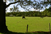
Nearby Images from Flickr
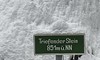
The above images may not be of the site on this page, but were taken nearby. They are loaded from Flickr so please click on them for image credits.
Click here to see more info for this site
Nearby sites
Click here to view sites on an interactive map of the areaKey: Red: member's photo, Blue: 3rd party photo, Yellow: other image, Green: no photo - please go there and take one, Grey: site destroyed
Download sites to:
KML (Google Earth)
GPX (GPS waypoints)
CSV (Garmin/Navman)
CSV (Excel)
To unlock full downloads you need to sign up as a Contributory Member. Otherwise downloads are limited to 50 sites.
Turn off the page maps and other distractions
Nearby sites listing. In the following links * = Image available
2.3km NNW 332° Wilder Kopf* Artificial Mound
2.3km W 262° Suhler Leube* Ancient Trackway
11.2km WSW 244° Dietzhausen (2) Artificial Mound
11.5km WSW 242° Dietzhausen (1) Artificial Mound
11.5km WSW 239° Dietzhausen (3) Artificial Mound
11.7km WSW 239° Schmeheimer Berg (2) Barrow Cemetery
12.1km WSW 240° Schmeheimer Berg (1) Barrow Cemetery
12.6km WSW 246° Buchberg Artificial Mound
12.9km WSW 243° Silbachshöhe (2) Causewayed Enclosure
13.0km WSW 244° Silbachshöhe (1) Artificial Mound
13.1km WSW 253° Schulzenkopf (2)* Artificial Mound
13.2km WSW 254° Streitschlag (2)* Artificial Mound
13.3km WSW 245° Herrnausleite Artificial Mound
13.4km WSW 252° Schulzenkopf (1)* Artificial Mound
13.5km WSW 254° Streitschlag (1) Artificial Mound
13.5km WSW 251° Rodeland* Barrow Cemetery
23.4km E 88° Bärenkeller Garsitz Cave or Rock Shelter
26.1km SSW 203° Steinsburg Grabhügel (3) Round Barrow(s)
26.5km SSW 203° Grabhügel am Schwarzen Stock (1)* Round Barrow(s)
26.7km SSW 203° Grabhügel am Schwarzen Stock (2)* Round Barrow(s)
26.8km SSW 202° Steinsburg Grabhügel (4) Round Barrow(s)
27.4km NNW 334° Summstein Am Klosterberg Modern Stone Circle etc
27.6km SSW 202° Steinsburg* Hillfort
28.5km SSW 202° Steinsburg Grabhügel (2) Round Barrow(s)
28.5km SE 139° Bleß Wallanlage* Causewayed Enclosure
View more nearby sites and additional images


 We would like to know more about this location. Please feel free to add a brief description and any relevant information in your own language.
 Wir möchten mehr über diese Stätte erfahren. Bitte zögern Sie nicht, eine kurze Beschreibung und relevante Informationen in Deutsch hinzuzufügen.
 Nous aimerions en savoir encore un peu sur les lieux. S'il vous plaît n'hesitez pas à ajouter une courte description et tous les renseignements pertinents dans votre propre langue.
 Quisieramos informarnos un poco más de las lugares. No dude en añadir una breve descripción y otros datos relevantes en su propio idioma.