


<< Our Photo Pages >> Haakenstadlinna-Kongshaug - Round Barrow(s) in Norway in Oppland
Submitted by kenntha88 on Thursday, 28 September 2023 Page Views: 105
Neolithic and Bronze AgeSite Name: Haakenstadlinna-KongshaugCountry: Norway
NOTE: This site is 4.226 km away from the location you searched for.
Fylke: Oppland Type: Round Barrow(s)
Nearest Town: Hønefoss Nearest Village: Roa
Latitude: 60.290677N Longitude: 10.661643E
Condition:
| 5 | Perfect |
| 4 | Almost Perfect |
| 3 | Reasonable but with some damage |
| 2 | Ruined but still recognisable as an ancient site |
| 1 | Pretty much destroyed, possibly visible as crop marks |
| 0 | No data. |
| -1 | Completely destroyed |
| 5 | Superb |
| 4 | Good |
| 3 | Ordinary |
| 2 | Not Good |
| 1 | Awful |
| 0 | No data. |
| 5 | Can be driven to, probably with disabled access |
| 4 | Short walk on a footpath |
| 3 | Requiring a bit more of a walk |
| 2 | A long walk |
| 1 | In the middle of nowhere, a nightmare to find |
| 0 | No data. |
| 5 | co-ordinates taken by GPS or official recorded co-ordinates |
| 4 | co-ordinates scaled from a detailed map |
| 3 | co-ordinates scaled from a bad map |
| 2 | co-ordinates of the nearest village |
| 1 | co-ordinates of the nearest town |
| 0 | no data |
Internal Links:
External Links:
")
The site consists of two barrows, one very large and one smaller. The smaller barrow is 15 metres in diameter and 1,5 metres in height. It is covered with thick forest and trees and can be hard to make out. The other barrow is huge, it is oval shaped with a size of 40X30 metres and around 3 metres in height. This barrow is not covered in trees but only in short grass and it is visible from a far distance even though its been plowed over several times previously.
You may be viewing yesterday's version of this page. To see the most up to date information please register for a free account.
")
")
")
Do not use the above information on other web sites or publications without permission of the contributor.
Nearby Images from Flickr
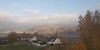
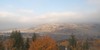
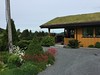
The above images may not be of the site on this page, but were taken nearby. They are loaded from Flickr so please click on them for image credits.
Click here to see more info for this site
Nearby sites
Click here to view sites on an interactive map of the areaKey: Red: member's photo, Blue: 3rd party photo, Yellow: other image, Green: no photo - please go there and take one, Grey: site destroyed
Download sites to:
KML (Google Earth)
GPX (GPS waypoints)
CSV (Garmin/Navman)
CSV (Excel)
To unlock full downloads you need to sign up as a Contributory Member. Otherwise downloads are limited to 50 sites.
Turn off the page maps and other distractions
Nearby sites listing. In the following links * = Image available
5.7km W 277° Lunner-Barneskole* Barrow Cemetery
5.9km NW 317° Dynna Barrow* Round Barrow(s)
8.0km W 278° Ballangrud Østre* Round Barrow(s)
9.8km WSW 257° Olimb* Barrow Cemetery
10.2km NNW 339° Framstad-Kongshaugen* Round Barrow(s)
10.5km WSW 259° Greftegrev* Barrow Cemetery
10.7km NNW 339° Hvaleby* Barrow Cemetery
11.1km NW 308° Gamme* Barrow Cemetery
11.2km NW 319° Granavollen Runestone* Carving
11.8km NW 319° Jostad* Barrow Cemetery
13.2km NW 325° Majors-Alm* Barrow Cemetery
13.3km W 278° Sognstoppen* Barrow Cemetery
13.3km NW 312° Sølvsberget* Hillfort
13.6km NW 324° Kakkelhaugene* Barrow Cemetery
13.8km NW 321° Røysumslinna* Round Barrow(s)
14.2km NW 319° Drøvdal* Barrow Cemetery
14.3km NW 325° Dynna Runestone* Carving
14.3km NW 325° Halvdanshaugen* Round Barrow(s)
14.6km NW 326° Østgardshaugen* Round Barrow(s)
14.8km WSW 247° Hauger* Stone Circle
14.9km NNW 327° Kapelljordshaugen* Round Barrow(s)
15.9km NW 309° Klauvstadgutua* Round Barrow(s)
16.6km NW 322° Bilden Stone Circle* Stone Circle
17.1km E 94° Bårhaugkampen Hillfort* Hillfort
17.4km E 97° Vålaug* Round Barrow(s)
View more nearby sites and additional images


 We would like to know more about this location. Please feel free to add a brief description and any relevant information in your own language.
 Wir möchten mehr über diese Stätte erfahren. Bitte zögern Sie nicht, eine kurze Beschreibung und relevante Informationen in Deutsch hinzuzufügen.
 Nous aimerions en savoir encore un peu sur les lieux. S'il vous plaît n'hesitez pas à ajouter une courte description et tous les renseignements pertinents dans votre propre langue.
 Quisieramos informarnos un poco más de las lugares. No dude en añadir una breve descripción y otros datos relevantes en su propio idioma.