

<< Our Photo Pages >> Stone circle (Lyngbæk) - Stone Circle in Denmark in Midtjylland
Submitted by Vishap on Wednesday, 05 January 2022 Page Views: 378
Modern SitesSite Name: Stone circle (Lyngbæk)Country: Denmark
NOTE: This site is 1.304 km away from the location you searched for.
County: Midtjylland Type: Stone Circle
Nearest Town: Ebeltoft Nearest Village: Femmøller
Latitude: 56.242074N Longitude: 10.602610E
Condition:
| 5 | Perfect |
| 4 | Almost Perfect |
| 3 | Reasonable but with some damage |
| 2 | Ruined but still recognisable as an ancient site |
| 1 | Pretty much destroyed, possibly visible as crop marks |
| 0 | No data. |
| -1 | Completely destroyed |
| 5 | Superb |
| 4 | Good |
| 3 | Ordinary |
| 2 | Not Good |
| 1 | Awful |
| 0 | No data. |
| 5 | Can be driven to, probably with disabled access |
| 4 | Short walk on a footpath |
| 3 | Requiring a bit more of a walk |
| 2 | A long walk |
| 1 | In the middle of nowhere, a nightmare to find |
| 0 | No data. |
| 5 | co-ordinates taken by GPS or official recorded co-ordinates |
| 4 | co-ordinates scaled from a detailed map |
| 3 | co-ordinates scaled from a bad map |
| 2 | co-ordinates of the nearest village |
| 1 | co-ordinates of the nearest town |
| 0 | no data |
Internal Links:
External Links:
 (PID:236437)")
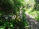
A lovely, small stone circle just off of Lyngsbækgårdvej between the villages of Lyngbæk and Femmøller in Mols Bjerge National Park. Spotted by chance on our way to Knebel and Agri to visit the well-known wonders there.
Looks suspiciously well-preserved for an ancient monument, but a gentleman we asked on the road confirmed that it's "old" and that locals use it as a gathering place in the summer.
You may be viewing yesterday's version of this page. To see the most up to date information please register for a free account.
Do not use the above information on other web sites or publications without permission of the contributor.
Nearby Images from Flickr
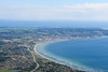
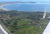
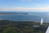
The above images may not be of the site on this page, but were taken nearby. They are loaded from Flickr so please click on them for image credits.
Click here to see more info for this site
Nearby sites
Click here to view sites on an interactive map of the areaKey: Red: member's photo, Blue: 3rd party photo, Yellow: other image, Green: no photo - please go there and take one, Grey: site destroyed
Download sites to:
KML (Google Earth)
GPX (GPS waypoints)
CSV (Garmin/Navman)
CSV (Excel)
To unlock full downloads you need to sign up as a Contributory Member. Otherwise downloads are limited to 50 sites.
Turn off the page maps and other distractions
Nearby sites listing. In the following links * = Image available
3.1km NW 313° Kejlstrup Runddysse Burial Chamber or Dolmen
3.3km W 265° Barsballe Runddysse Burial Chamber or Dolmen
3.3km WNW 303° Skårup Megalitgrav Burial Chamber or Dolmen
4.7km WNW 294° Grønfeld Megalitgrav Burial Chamber or Dolmen
5.0km W 263° Agri Stabelhøje* Round Barrow(s)
5.5km WSW 252° Agri Jættestue Passage Grave
5.5km SSW 208° Fuglsø Stenkiste Cist
5.5km W 260° Agri Grovlegård Runddysse* Burial Chamber or Dolmen
5.7km WSW 252° Agri Dysse* Burial Chamber or Dolmen
5.8km WNW 297° Egens Runddysse* Burial Chamber or Dolmen
5.8km W 268° Stenkirken Runddysse* Burial Chamber or Dolmen
6.1km SW 227° Viderup Trehøje* Barrow Cemetery
6.1km SW 233° Læggerholm Jættestue Passage Grave
6.2km SW 227° Viderup Stenkiste Cist
6.3km WSW 256° Andrup Runddysse* Burial Chamber or Dolmen
6.6km WNW 299° Egens Langdysse* Long Barrow
6.7km WSW 252° Knebel Langdysse Long Barrow
6.7km WSW 247° Knebel Poskær Stenhus* Burial Chamber or Dolmen
6.8km NNW 338° Tåstrup Kistehøj Langdysse Long Barrow
6.8km WNW 297° Egens Hundshoved Langdysse* Long Barrow
6.9km NW 323° Bjødstrup Runddysse 1 Burial Chamber or Dolmen
7.0km WSW 249° Knebel Runddysse* Burial Chamber or Dolmen
7.1km NNW 327° Korup Runddysse Burial Chamber or Dolmen
7.2km NW 305° Skovridergård Runddysse* Burial Chamber or Dolmen
7.3km WSW 237° Lynge Stenhus Runddysse Passage Grave
View more nearby sites and additional images


 We would like to know more about this location. Please feel free to add a brief description and any relevant information in your own language.
 Wir möchten mehr über diese Stätte erfahren. Bitte zögern Sie nicht, eine kurze Beschreibung und relevante Informationen in Deutsch hinzuzufügen.
 Nous aimerions en savoir encore un peu sur les lieux. S'il vous plaît n'hesitez pas à ajouter une courte description et tous les renseignements pertinents dans votre propre langue.
 Quisieramos informarnos un poco más de las lugares. No dude en añadir una breve descripción y otros datos relevantes en su propio idioma.