

<< Our Photo Pages >> Nohra Hünstein - Standing Stone (Menhir) in Germany in Thuringia
Submitted by kaihofmann on Wednesday, 04 September 2013 Page Views: 2000
Neolithic and Bronze AgeSite Name: Nohra HünsteinCountry: Germany Land: Thuringia Type: Standing Stone (Menhir)
Nearest Town: Nordhausen Nearest Village: Nohra
Latitude: 51.429912N Longitude: 10.714661E
Condition:
| 5 | Perfect |
| 4 | Almost Perfect |
| 3 | Reasonable but with some damage |
| 2 | Ruined but still recognisable as an ancient site |
| 1 | Pretty much destroyed, possibly visible as crop marks |
| 0 | No data. |
| -1 | Completely destroyed |
| 5 | Superb |
| 4 | Good |
| 3 | Ordinary |
| 2 | Not Good |
| 1 | Awful |
| 0 | No data. |
| 5 | Can be driven to, probably with disabled access |
| 4 | Short walk on a footpath |
| 3 | Requiring a bit more of a walk |
| 2 | A long walk |
| 1 | In the middle of nowhere, a nightmare to find |
| 0 | No data. |
| 5 | co-ordinates taken by GPS or official recorded co-ordinates |
| 4 | co-ordinates scaled from a detailed map |
| 3 | co-ordinates scaled from a bad map |
| 2 | co-ordinates of the nearest village |
| 1 | co-ordinates of the nearest town |
| 0 | no data |
Internal Links:
External Links:
I have visited· I would like to visit
Klingon visited on 28th Aug 2016 - their rating: Cond: 4 Amb: 3 Access: 5
")
You may be viewing yesterday's version of this page. To see the most up to date information please register for a free account.
")
")
Do not use the above information on other web sites or publications without permission of the contributor.
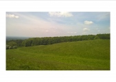
Nearby Images from Flickr
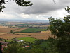
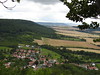
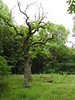
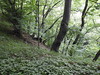
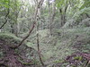
The above images may not be of the site on this page, but were taken nearby. They are loaded from Flickr so please click on them for image credits.
Click here to see more info for this site
Nearby sites
Click here to view sites on an interactive map of the areaKey: Red: member's photo, Blue: 3rd party photo, Yellow: other image, Green: no photo - please go there and take one, Grey: site destroyed
Download sites to:
KML (Google Earth)
GPX (GPS waypoints)
CSV (Garmin/Navman)
CSV (Excel)
To unlock full downloads you need to sign up as a Contributory Member. Otherwise downloads are limited to 50 sites.
Turn off the page maps and other distractions
Nearby sites listing. In the following links * = Image available
6.7km SE 136° Heiliger Berg Misc. Earthwork
7.0km ESE 113° Grasgarten Sechslinden Artificial Mound
9.6km SW 230° Helbeburg Causewayed Enclosure
9.9km SW 217° Mittelholz Artificial Mound
10.0km SE 126° Frauenberg Causewayed Enclosure
12.7km SE 139° Ölmüllersberg Causewayed Enclosure
13.7km ESE 104° Am wilden Mann Artificial Mound
15.1km S 189° Holzsußra Artificial Mound
20.2km ENE 79° Hoher Stein Berga* Standing Stone (Menhir)
20.4km SE 140° Der Hök* Artificial Mound
22.0km NW 324° Steina Monolith Natural Stone / Erratic / Other Natural Feature
22.3km SE 134° Der Höck* Artificial Mound
22.8km ESE 102° Ochsenburg Ancient Village or Settlement
23.0km SE 136° Feldengel* Standing Stone (Menhir)
23.5km ESE 109° Rottleben Artificial Mound
25.4km SSE 147° Funkenburg Westgreußen* Ancient Village or Settlement
25.7km ESE 120° Kohnstein Causewayed Enclosure
26.0km ESE 105° Kosackenberg* Cave or Rock Shelter
29.2km E 93° Pfalz Tilleda* Ancient Palace
29.6km SE 124° Sonnenkultstein Bilzingsleben* Sculptured Stone
29.6km SE 126° Rastplatz Bilzingsleben* Ancient Village or Settlement
31.3km NW 317° Einhornhoehle* Cave or Rock Shelter
31.8km ESE 111° Seehausen Menhir* Standing Stone (Menhir)
32.5km NW 314° Steinkirche* Cave or Rock Shelter
33.1km ESE 117° Sieben Hügel* Barrow Cemetery
View more nearby sites and additional images


 We would like to know more about this location. Please feel free to add a brief description and any relevant information in your own language.
 Wir möchten mehr über diese Stätte erfahren. Bitte zögern Sie nicht, eine kurze Beschreibung und relevante Informationen in Deutsch hinzuzufügen.
 Nous aimerions en savoir encore un peu sur les lieux. S'il vous plaît n'hesitez pas à ajouter une courte description et tous les renseignements pertinents dans votre propre langue.
 Quisieramos informarnos un poco más de las lugares. No dude en añadir una breve descripción y otros datos relevantes en su propio idioma.