


<< Other Photo Pages >> Summstein Hornburg - Modern Stone Circle etc in Germany in Lower Saxony, Bremen
Submitted by Harald_Platta on Saturday, 18 November 2017 Page Views: 717
Modern SitesSite Name: Summstein HornburgCountry: Germany
NOTE: This site is 5.232 km away from the location you searched for.
Land: Lower Saxony, Bremen Type: Modern Stone Circle etc
Nearest Town: Hornburg
Latitude: 52.028465N Longitude: 10.607353E
Condition:
| 5 | Perfect |
| 4 | Almost Perfect |
| 3 | Reasonable but with some damage |
| 2 | Ruined but still recognisable as an ancient site |
| 1 | Pretty much destroyed, possibly visible as crop marks |
| 0 | No data. |
| -1 | Completely destroyed |
| 5 | Superb |
| 4 | Good |
| 3 | Ordinary |
| 2 | Not Good |
| 1 | Awful |
| 0 | No data. |
| 5 | Can be driven to, probably with disabled access |
| 4 | Short walk on a footpath |
| 3 | Requiring a bit more of a walk |
| 2 | A long walk |
| 1 | In the middle of nowhere, a nightmare to find |
| 0 | No data. |
| 5 | co-ordinates taken by GPS or official recorded co-ordinates |
| 4 | co-ordinates scaled from a detailed map |
| 3 | co-ordinates scaled from a bad map |
| 2 | co-ordinates of the nearest village |
| 1 | co-ordinates of the nearest town |
| 0 | no data |
Be the first person to rate this site - see the 'Contribute!' box in the right hand menu.
Internal Links:
External Links:
")
Further information and literature on Summsteine in general: MP page Großer Summstein.
Reference:
[01] Stadt Hornburg (Hrsg.): Hornburg – Mit allen Sinnen erleben. In: Die gesunde Stadt [Webpage].
You may be viewing yesterday's version of this page. To see the most up to date information please register for a free account.
Do not use the above information on other web sites or publications without permission of the contributor.
Nearby Images from Flickr
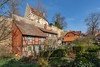
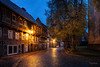
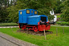
The above images may not be of the site on this page, but were taken nearby. They are loaded from Flickr so please click on them for image credits.
Click here to see more info for this site
Nearby sites
Click here to view sites on an interactive map of the areaKey: Red: member's photo, Blue: 3rd party photo, Yellow: other image, Green: no photo - please go there and take one, Grey: site destroyed
Download sites to:
KML (Google Earth)
GPX (GPS waypoints)
CSV (Garmin/Navman)
CSV (Excel)
To unlock full downloads you need to sign up as a Contributory Member. Otherwise downloads are limited to 50 sites.
Turn off the page maps and other distractions
Nearby sites listing. In the following links * = Image available
10.6km NNE 27° Remlingen Totenhütte* Chambered Tomb
12.5km NE 36° Meescheberg* Artificial Mound
12.6km W 266° Scheibenkreuzstein Liebenburg* Early Christian Sculptured Stone
13.0km NE 35° Klein Vahlberg Menhir* Standing Stone (Menhir)
13.4km NE 35° Galgenberg von Klein Vahlberg* Artificial Mound
16.0km NNW 342° Braunschweigisches Landesmuseum* Museum
16.0km SE 141° Brotstein* Standing Stone (Menhir)
17.0km ENE 67° Watenstedt Ringstein Sculptured Stone
17.1km SW 221° Klusfelsen (Goslar)* Rock Outcrop
19.0km WSW 249° Bredelem Menhir* Standing Stone (Menhir)
19.0km NNE 21° Evessen Tumulus* Round Barrow(s)
19.6km WSW 247° Bredelem Grosssteingrab* Passage Grave
19.7km SSW 206° Kästeklippen* Rock Outcrop
20.0km ENE 75° Watenstedt Hünenburg* Hillfort
21.0km NNE 26° Evessen Steingrab* Chambered Tomb
22.0km SSE 156° Altenrode* Stone Circle
22.4km NE 34° Tetzelstein* Standing Stone (Menhir)
23.1km W 270° Steinkreuz Sehlde Ancient Cross
23.1km NNE 19° Kleiner Tafelberg Hügelgrab* Artificial Mound
23.2km SSE 147° Knabenstein Early Christian Sculptured Stone
24.9km SSE 151° Summstein Sonnenstein Modern Stone Circle etc
26.9km W 271° Hubertuskapelle* Cave or Rock Shelter
27.8km SE 138° Menhir von Benzingerode* Standing Stone (Menhir)
27.9km NNE 31° Summstein Königslutter am Elm Modern Stone Circle etc
28.3km SE 138° Langhaus Benzingerode* Ancient Village or Settlement
View more nearby sites and additional images


 We would like to know more about this location. Please feel free to add a brief description and any relevant information in your own language.
 Wir möchten mehr über diese Stätte erfahren. Bitte zögern Sie nicht, eine kurze Beschreibung und relevante Informationen in Deutsch hinzuzufügen.
 Nous aimerions en savoir encore un peu sur les lieux. S'il vous plaît n'hesitez pas à ajouter une courte description et tous les renseignements pertinents dans votre propre langue.
 Quisieramos informarnos un poco más de las lugares. No dude en añadir una breve descripción y otros datos relevantes en su propio idioma.