


<< Text Pages >> Venushöhle, Tannhäuserhöhle - Cave or Rock Shelter in Germany in Thuringia
Submitted by Klingon on Friday, 26 November 2010 Page Views: 1752
Natural PlacesSite Name: Venushöhle, TannhäuserhöhleCountry: Germany
NOTE: This site is 5.143 km away from the location you searched for.
Land: Thuringia Type: Cave or Rock Shelter
Latitude: 50.956720N Longitude: 10.453920E
Condition:
| 5 | Perfect |
| 4 | Almost Perfect |
| 3 | Reasonable but with some damage |
| 2 | Ruined but still recognisable as an ancient site |
| 1 | Pretty much destroyed, possibly visible as crop marks |
| 0 | No data. |
| -1 | Completely destroyed |
| 5 | Superb |
| 4 | Good |
| 3 | Ordinary |
| 2 | Not Good |
| 1 | Awful |
| 0 | No data. |
| 5 | Can be driven to, probably with disabled access |
| 4 | Short walk on a footpath |
| 3 | Requiring a bit more of a walk |
| 2 | A long walk |
| 1 | In the middle of nowhere, a nightmare to find |
| 0 | No data. |
| 5 | co-ordinates taken by GPS or official recorded co-ordinates |
| 4 | co-ordinates scaled from a detailed map |
| 3 | co-ordinates scaled from a bad map |
| 2 | co-ordinates of the nearest village |
| 1 | co-ordinates of the nearest town |
| 0 | no data |
Be the first person to rate this site - see the 'Contribute!' box in the right hand menu.
Internal Links:
External Links:
Cave or Rock Shelter in Thuringia
These caves were inhabited during the last ice age.
You may be viewing yesterday's version of this page. To see the most up to date information please register for a free account.
Do not use the above information on other web sites or publications without permission of the contributor.
Nearby Images from Flickr
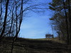
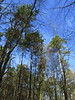
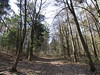
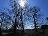
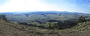
The above images may not be of the site on this page, but were taken nearby. They are loaded from Flickr so please click on them for image credits.
Click here to see more info for this site
Nearby sites
Click here to view sites on an interactive map of the areaKey: Red: member's photo, Blue: 3rd party photo, Yellow: other image, Green: no photo - please go there and take one, Grey: site destroyed
Download sites to:
KML (Google Earth)
GPX (GPS waypoints)
CSV (Garmin/Navman)
CSV (Excel)
To unlock full downloads you need to sign up as a Contributory Member. Otherwise downloads are limited to 50 sites.
Turn off the page maps and other distractions
Nearby sites listing. In the following links * = Image available
5.4km SW 230° Flußbetthöhle Farnroda Cave or Rock Shelter
10.2km W 273° Eisenacher Burg Ancient Village or Settlement
11.7km NNW 345° Alte Burg Berka vor dem Hainich Hillfort
13.2km SE 143° Summstein Am Klosterberg Modern Stone Circle etc
14.4km NE 38° Harth-Haus Grabhügel* Round Barrow(s)
15.8km SW 216° Schweina Barrow Cemetery
17.6km NW 321° Über dem Bocksgraben Barrow Cemetery
20.0km NW 312° Scherbdaer Struth Barrow Cemetery
20.1km WNW 282° Brandenburg Lauchröden Ancient Village or Settlement
22.0km SW 225° Celts' spa Museum
22.9km N 359° Ausstellung Opfermoor Vogtei* Museum
23.2km N 358° Seeheiligtum Niederdorla* Ancient Temple
24.8km NW 313° Hüneburg Schnellmannshausen Causewayed Enclosure
27.4km W 263° Becks Grab Artificial Mound
29.1km SW 218° Langenfeld Artificial Mound
30.1km SW 215° Bernshausen Artificial Mound
30.7km WSW 237° Dietlas Barrow Cemetery
32.6km SW 229° Bornkopf Barrow Cemetery
32.7km SW 227° Dorniges Gehege Barrow Cemetery
32.9km SW 227° An der Kuhhalle Artificial Mound
33.2km SW 226° Bayershof Artificial Mound
33.5km WSW 241° Mönchsholz Barrow Cemetery
33.9km SW 233° Martinroda Barrow Cemetery
33.9km SW 227° Baier Hillfort
34.1km WSW 237° Völkershausen (1)* Artificial Mound
View more nearby sites and additional images


 We would like to know more about this location. Please feel free to add a brief description and any relevant information in your own language.
 Wir möchten mehr über diese Stätte erfahren. Bitte zögern Sie nicht, eine kurze Beschreibung und relevante Informationen in Deutsch hinzuzufügen.
 Nous aimerions en savoir encore un peu sur les lieux. S'il vous plaît n'hesitez pas à ajouter une courte description et tous les renseignements pertinents dans votre propre langue.
 Quisieramos informarnos un poco más de las lugares. No dude en añadir una breve descripción y otros datos relevantes en su propio idioma.