


<< Our Photo Pages >> Ötzi Memorial - Marker Stone in Italy in Lombardia
Submitted by TheCaptain on Thursday, 08 December 2011 Page Views: 19566
Multi-periodSite Name: Ötzi Memorial Alternative Name: OetziCountry: Italy
NOTE: This site is 25.643 km away from the location you searched for.
Region: Lombardia Type: Marker Stone
Nearest Town: Solden
Latitude: 46.778900N Longitude: 10.839700E
Condition:
| 5 | Perfect |
| 4 | Almost Perfect |
| 3 | Reasonable but with some damage |
| 2 | Ruined but still recognisable as an ancient site |
| 1 | Pretty much destroyed, possibly visible as crop marks |
| 0 | No data. |
| -1 | Completely destroyed |
| 5 | Superb |
| 4 | Good |
| 3 | Ordinary |
| 2 | Not Good |
| 1 | Awful |
| 0 | No data. |
| 5 | Can be driven to, probably with disabled access |
| 4 | Short walk on a footpath |
| 3 | Requiring a bit more of a walk |
| 2 | A long walk |
| 1 | In the middle of nowhere, a nightmare to find |
| 0 | No data. |
| 5 | co-ordinates taken by GPS or official recorded co-ordinates |
| 4 | co-ordinates scaled from a detailed map |
| 3 | co-ordinates scaled from a bad map |
| 2 | co-ordinates of the nearest village |
| 1 | co-ordinates of the nearest town |
| 0 | no data |
Internal Links:
External Links:
I have visited· I would like to visit
TheCaptain has visited here
")
"Otzi" died from a shoulder wound inflicted by an arrow, according to research into his perfectly preserved 5,000-year old body.
Otzi, the oldest mummy unearthed, was found in the Italian Alps in 1991 wearing clothing made from leather and grasses and carrying a copper axe, a bow and arrows.
Though Otzi's body underwent several scientific tests to study life in the prehistoric age, it had so far been unclear whether he died from an arrow wound, a bad fall or severe freezing while climbing the high mountains.
Using modern X-ray technology, however, an Italian-Swiss research team said on Wednesday it had proved the cause of death as a lesion on an artery close to the shoulder, caused by an arrowhead that remains in the iceman's back.
A large haematoma -- or a collection of blood due to internal bleeding -- could also be seen in the surrounding tissue, and the iceman probably died shortly after the lesion was caused, researchers concluded.
Researchers had previously suggested he was killed by a rival hunter after putting up a fight, and concluded that his final meals consisted of venison and ibex meat.
Note: Ice mummy may have smashed eye in a fall, see also link to the comprehensive Iceman Photoscan site
You may be viewing yesterday's version of this page. To see the most up to date information please register for a free account.
")
Do not use the above information on other web sites or publications without permission of the contributor.
Nearby Images from Flickr
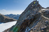
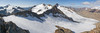
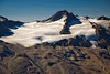
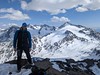
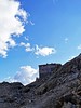
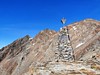
The above images may not be of the site on this page, but were taken nearby. They are loaded from Flickr so please click on them for image credits.
Click here to see more info for this site
Nearby sites
Click here to view sites on an interactive map of the areaKey: Red: member's photo, Blue: 3rd party photo, Yellow: other image, Green: no photo - please go there and take one, Grey: site destroyed
Download sites to:
KML (Google Earth)
GPX (GPS waypoints)
CSV (Garmin/Navman)
CSV (Excel)
To unlock full downloads you need to sign up as a Contributory Member. Otherwise downloads are limited to 50 sites.
Turn off the page maps and other distractions
Nearby sites listing. In the following links * = Image available
6.2km SSE 168° ArcheoPark and Museum Val Senales* Museum
7.9km NE 42° Kaser Menhir Standing Stone (Menhir)
9.8km NE 35° Hohler Stein Kaser Natural Stone / Erratic / Other Natural Feature
11.4km NE 36° Mutsbichl Schalensteine Rock Art
17.2km S 170° Untere Grübelplatte (Schalenstein)* Rock Art
17.8km NE 35° Heiligkreuz Teufelsfelsen Rock Art
20.9km ESE 106° Spronser Seen (Sprons Lakes)* Rock Art
21.5km NE 44° Lenzenalm Schalenstein Rock Art
24.6km NNE 32° Schlangenfelsen (Snake's rock) Rock Art
24.6km ESE 117° Stone Age 2001* Modern Stone Circle etc
24.8km NNE 31° Sölden menhir* Standing Stone (Menhir)
25.8km NE 36° Windachtal Schalenstein I Rock Art
28.6km NE 50° Windachtal Schalenstein II Rock Art
32.8km NNE 18° Burgstein Schalenstein Rock Art
33.6km N 11° Innerbergalm Schalenstein Rock Art
35.7km NNW 338° Schalenstein Prutz Rock Art
39.9km N 10° Ötzi Village* Museum
43.5km WNW 286° Heidelberg Hut Ancient Village or Settlement
46.3km N 2° Sautens Opferstein Natural Stone / Erratic / Other Natural Feature
49.8km SE 128° South Tyrol Museum of Archaeology* Museum
50.0km NE 41° Cupstone Lithagrub-Profegl Alm* Rock Art
51.9km NE 42° Cupstone Menhir Viggar Valley Tyrol* Rock Art
53.3km ESE 122° Der Menhir von Wolfsgruben* Standing Stone (Menhir)
63.1km ESE 117° Schlern Natural Stone / Erratic / Other Natural Feature
63.3km E 95° Bildstein (Elvas)* Rock Art
View more nearby sites and additional images


 We would like to know more about this location. Please feel free to add a brief description and any relevant information in your own language.
 Wir möchten mehr über diese Stätte erfahren. Bitte zögern Sie nicht, eine kurze Beschreibung und relevante Informationen in Deutsch hinzuzufügen.
 Nous aimerions en savoir encore un peu sur les lieux. S'il vous plaît n'hesitez pas à ajouter une courte description et tous les renseignements pertinents dans votre propre langue.
 Quisieramos informarnos un poco más de las lugares. No dude en añadir una breve descripción y otros datos relevantes en su propio idioma.