


<< Our Photo Pages >> Østgaarden-Egge - Round Barrow(s) in Norway in Oppland
Submitted by kenntha88 on Thursday, 05 October 2023 Page Views: 168
Neolithic and Bronze AgeSite Name: Østgaarden-EggeCountry: Norway
NOTE: This site is 1.683 km away from the location you searched for.
Fylke: Oppland Type: Round Barrow(s)
Nearest Town: Hønefoss Nearest Village: Brandbu
Latitude: 60.435265N Longitude: 10.496555E
Condition:
| 5 | Perfect |
| 4 | Almost Perfect |
| 3 | Reasonable but with some damage |
| 2 | Ruined but still recognisable as an ancient site |
| 1 | Pretty much destroyed, possibly visible as crop marks |
| 0 | No data. |
| -1 | Completely destroyed |
| 5 | Superb |
| 4 | Good |
| 3 | Ordinary |
| 2 | Not Good |
| 1 | Awful |
| 0 | No data. |
| 5 | Can be driven to, probably with disabled access |
| 4 | Short walk on a footpath |
| 3 | Requiring a bit more of a walk |
| 2 | A long walk |
| 1 | In the middle of nowhere, a nightmare to find |
| 0 | No data. |
| 5 | co-ordinates taken by GPS or official recorded co-ordinates |
| 4 | co-ordinates scaled from a detailed map |
| 3 | co-ordinates scaled from a bad map |
| 2 | co-ordinates of the nearest village |
| 1 | co-ordinates of the nearest town |
| 0 | no data |
Internal Links:
External Links:
")
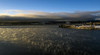
The barrow is 12 metres in diameter and 2,2 metres in height and very pretty. It doesnt seem to have any damage or crater on top at all and have a beautiful round profile with steep sides. Only two birch trees is growing on top of it and it is easy to see.
You may be viewing yesterday's version of this page. To see the most up to date information please register for a free account.
")
")
")
Do not use the above information on other web sites or publications without permission of the contributor.
Nearby Images from Flickr
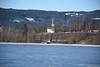
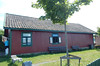
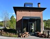

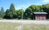
The above images may not be of the site on this page, but were taken nearby. They are loaded from Flickr so please click on them for image credits.
Click here to see more info for this site
Nearby sites
Click here to view sites on an interactive map of the areaKey: Red: member's photo, Blue: 3rd party photo, Yellow: other image, Green: no photo - please go there and take one, Grey: site destroyed
Download sites to:
KML (Google Earth)
GPX (GPS waypoints)
CSV (Garmin/Navman)
CSV (Excel)
To unlock full downloads you need to sign up as a Contributory Member. Otherwise downloads are limited to 50 sites.
Turn off the page maps and other distractions
Nearby sites listing. In the following links * = Image available
1.2km NW 305° Kirsebærhaugen* Round Barrow(s)
1.4km NW 313° Nordjordet* Round Barrow(s)
1.5km W 281° Rundshaugen hillfort* Hillfort
2.2km WSW 255° Nesstrand-Nes* Round Barrow(s)
3.3km SSW 202° Bilden Stone Circle* Stone Circle
3.7km SSE 166° Kapelljordshaugen* Round Barrow(s)
4.0km SSE 167° Østgardshaugen* Round Barrow(s)
4.4km SSE 168° Halvdanshaugen* Round Barrow(s)
4.5km S 170° Dynna Runestone* Carving
5.1km SSE 167° Kakkelhaugene* Barrow Cemetery
5.3km S 176° Røysumslinna* Round Barrow(s)
5.4km S 182° Drøvdal* Barrow Cemetery
5.5km SSE 164° Majors-Alm* Barrow Cemetery
6.8km SSW 209° Klauvstadgutua* Round Barrow(s)
7.2km S 169° Jostad* Barrow Cemetery
7.3km S 187° Sølvsberget* Hillfort
7.8km SSE 167° Granavollen Runestone* Carving
8.1km SE 139° Hvaleby* Barrow Cemetery
8.5km SE 141° Framstad-Kongshaugen* Round Barrow(s)
9.3km S 178° Gamme* Barrow Cemetery
12.8km SSE 157° Dynna Barrow* Round Barrow(s)
14.7km SSW 196° Sognstoppen* Barrow Cemetery
15.0km S 175° Ballangrud Østre* Round Barrow(s)
15.7km SSE 167° Lunner-Barneskole* Barrow Cemetery
18.2km S 184° Greftegrev* Barrow Cemetery
View more nearby sites and additional images


 We would like to know more about this location. Please feel free to add a brief description and any relevant information in your own language.
 Wir möchten mehr über diese Stätte erfahren. Bitte zögern Sie nicht, eine kurze Beschreibung und relevante Informationen in Deutsch hinzuzufügen.
 Nous aimerions en savoir encore un peu sur les lieux. S'il vous plaît n'hesitez pas à ajouter une courte description et tous les renseignements pertinents dans votre propre langue.
 Quisieramos informarnos un poco más de las lugares. No dude en añadir una breve descripción y otros datos relevantes en su propio idioma.