


<< Our Photo Pages >> Altare neolitico di Santa Maria Navarrese - Rock Art in Italy in Sardinia (Sardegna)
Submitted by francescomanconi on Monday, 25 February 2013 Page Views: 2208
Rock ArtSite Name: Altare neolitico di Santa Maria NavarreseCountry: Italy
NOTE: This site is 56.396 km away from the location you searched for.
Region: Sardinia (Sardegna) Type: Rock Art
Nearest Town: Tortolì Nearest Village: Santa Maria Navarrese
Latitude: 39.988350N Longitude: 9.689512E
Condition:
| 5 | Perfect |
| 4 | Almost Perfect |
| 3 | Reasonable but with some damage |
| 2 | Ruined but still recognisable as an ancient site |
| 1 | Pretty much destroyed, possibly visible as crop marks |
| 0 | No data. |
| -1 | Completely destroyed |
| 5 | Superb |
| 4 | Good |
| 3 | Ordinary |
| 2 | Not Good |
| 1 | Awful |
| 0 | No data. |
| 5 | Can be driven to, probably with disabled access |
| 4 | Short walk on a footpath |
| 3 | Requiring a bit more of a walk |
| 2 | A long walk |
| 1 | In the middle of nowhere, a nightmare to find |
| 0 | No data. |
| 5 | co-ordinates taken by GPS or official recorded co-ordinates |
| 4 | co-ordinates scaled from a detailed map |
| 3 | co-ordinates scaled from a bad map |
| 2 | co-ordinates of the nearest village |
| 1 | co-ordinates of the nearest town |
| 0 | no data |
Internal Links:
External Links:
")
A Neolithic altar with bowls. A big granite stone. We find some of them in Ogliastra, east-central Sardinia.
You may be viewing yesterday's version of this page. To see the most up to date information please register for a free account.
Do not use the above information on other web sites or publications without permission of the contributor.
Nearby Images from Flickr

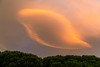
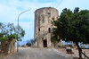
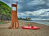
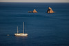
The above images may not be of the site on this page, but were taken nearby. They are loaded from Flickr so please click on them for image credits.
Click here to see more info for this site
Nearby sites
Click here to view sites on an interactive map of the areaKey: Red: member's photo, Blue: 3rd party photo, Yellow: other image, Green: no photo - please go there and take one, Grey: site destroyed
Download sites to:
KML (Google Earth)
GPX (GPS waypoints)
CSV (Garmin/Navman)
CSV (Excel)
To unlock full downloads you need to sign up as a Contributory Member. Otherwise downloads are limited to 50 sites.
Turn off the page maps and other distractions
Nearby sites listing. In the following links * = Image available
4.3km NNW 344° Punnacci Nuraghe* Broch or Nuraghe
4.5km WNW 298° Genna Olidone Nuraghe Broch or Nuraghe
4.5km SSW 202° Cerinas Nuraghe Broch or Nuraghe
5.0km WSW 256° Fund'e Monti Nuraghe* Broch or Nuraghe
5.0km WSW 256° Tracucu Domus de Janas* Rock Cut Tomb
5.5km WSW 241° Santu Tomau Nuraghe Broch or Nuraghe
5.7km WNW 291° Cugumacci Nuraghe Broch or Nuraghe
6.4km WNW 293° Mullò* Rock Art
6.8km SW 227° Sconk'e Porcu Nuraghe Broch or Nuraghe
6.8km WSW 253° Perd'e Scarlattu Nuraghe Broch or Nuraghe
6.8km WNW 304° Figu Nuraghe (Trieri) Broch or Nuraghe
7.4km NW 318° Nunucoli Nuraghe Broch or Nuraghe
8.1km NW 310° Osono Tomba di Giganti* Chambered Tomb
8.1km NW 325° Loppelie Nuraghe Broch or Nuraghe
8.3km SSW 194° S'Ortali 'e su Monti Standing stones* Standing Stones
8.6km SSW 192° S'Ortali 'e Su Monte Nuraghe and settlement* Ancient Village or Settlement
8.8km SSW 192° S'Ortali 'e su Monte Tomba di Giganti* Chambered Tomb
8.8km SSW 198° Santa Giusta Nuraghe Broch or Nuraghe
9.5km N 357° Coa 'e Serra Nuraghe* Broch or Nuraghe
11.2km NNW 347° Alvo Nuraghe* Broch or Nuraghe
11.2km NNW 345° Doladorgiu Fortezza Nuragica* Stone Fort or Dun
11.5km N 351° San Pietro in Golgo Baethyles* Sculptured Stone
11.7km SSW 195° Perdalonga Area Sacra* Stone Row / Alignment
11.8km SSW 196° Perdalonga Menhir* Standing Stone (Menhir)
11.9km N 350° Orgoduri Complesso Nuragico* Broch or Nuraghe
View more nearby sites and additional images


 We would like to know more about this location. Please feel free to add a brief description and any relevant information in your own language.
 Wir möchten mehr über diese Stätte erfahren. Bitte zögern Sie nicht, eine kurze Beschreibung und relevante Informationen in Deutsch hinzuzufügen.
 Nous aimerions en savoir encore un peu sur les lieux. S'il vous plaît n'hesitez pas à ajouter une courte description et tous les renseignements pertinents dans votre propre langue.
 Quisieramos informarnos un poco más de las lugares. No dude en añadir una breve descripción y otros datos relevantes en su propio idioma.