 with our Megalithic Portal iPhone app")


<< Our Photo Pages >> Borno Stelae (4) - Rock Art in Italy in Lombardia
Submitted by Martin_L on Wednesday, 25 March 2009 Page Views: 6219
Rock ArtSite Name: Borno Stelae (4) Alternative Name: Borno 4Country: Italy Region: Lombardia Type: Rock Art
Nearest Town: Bergamo Nearest Village: Capo di Ponte
Latitude: 46.025623N Longitude: 10.348778E
Condition:
| 5 | Perfect |
| 4 | Almost Perfect |
| 3 | Reasonable but with some damage |
| 2 | Ruined but still recognisable as an ancient site |
| 1 | Pretty much destroyed, possibly visible as crop marks |
| 0 | No data. |
| -1 | Completely destroyed |
| 5 | Superb |
| 4 | Good |
| 3 | Ordinary |
| 2 | Not Good |
| 1 | Awful |
| 0 | No data. |
| 5 | Can be driven to, probably with disabled access |
| 4 | Short walk on a footpath |
| 3 | Requiring a bit more of a walk |
| 2 | A long walk |
| 1 | In the middle of nowhere, a nightmare to find |
| 0 | No data. |
| 5 | co-ordinates taken by GPS or official recorded co-ordinates |
| 4 | co-ordinates scaled from a detailed map |
| 3 | co-ordinates scaled from a bad map |
| 2 | co-ordinates of the nearest village |
| 1 | co-ordinates of the nearest town |
| 0 | no data |
Internal Links:
External Links:
I have visited· I would like to visit
Martin_L has visited here
 (PID:46132)")
Part of the UNESCO-World heritage. Currently exhibited at the Naquane National Park of Rock Engravings (Parco nazionale delle incisioni rupestri di Naquane).
Borno 4 - Carvings: arrangements of 7 animals (some probably deer) and 3 daggers (bottom right). Above the animals a large oval-shaped symbol, and a large axe-like object in front of the animals.
As in many other cases it is hardly possible to give a reliable interpretation.
The Val Camonica is named after the “Camunni” the first people settling in this area approximately 8000 BP. The first rock carvings are dating back to 6000 BP, while the major part of the over 350.000 carvings in Val Camonica is from Pre-Roman Iron Age (2800-2100 BP)
You may be viewing yesterday's version of this page. To see the most up to date information please register for a free account.
Do not use the above information on other web sites or publications without permission of the contributor.
Nearby Images from Flickr
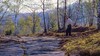


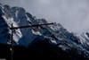
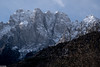
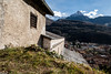
The above images may not be of the site on this page, but were taken nearby. They are loaded from Flickr so please click on them for image credits.
Click here to see more info for this site
Nearby sites
Click here to view sites on an interactive map of the areaKey: Red: member's photo, Blue: 3rd party photo, Yellow: other image, Green: no photo - please go there and take one, Grey: site destroyed
Download sites to:
KML (Google Earth)
GPX (GPS waypoints)
CSV (Garmin/Navman)
CSV (Excel)
To unlock full downloads you need to sign up as a Contributory Member. Otherwise downloads are limited to 50 sites.
Turn off the page maps and other distractions
Nearby sites listing. In the following links * = Image available
42m N 2° Cemmo 3* Rock Art
194m E 81° Campanine Bosc del Vicare Rock Art
268m NNE 26° Naquane* Rock Art
334m SSE 151° Foppe-Nadro Rock 34* Rock Art
372m ENE 68° Campanine Alta* Rock Art
391m SSE 157° Foppe-Nadro Rock 25* Rock Art
418m SSE 159° Foppe-Nadro Rock 24* Rock Art
430m SSE 152° Foppe-Nadro Rock 26* Rock Art
436m SSE 152° Foppe-Nadro Rock 29* Rock Art
462m SSE 165° Foppe-Nadro Rock 22* Rock Art
471m SSE 160° Foppe-Nadro Rock 23* Rock Art
483m SSE 163° Foppe-Nadro Rock 21* Rock Art
494m S 171° Foppe-Nadro Rock 6* Rock Art
495m SSE 167° Foppe-Nadro Rock 4* Rock Art
575m SSE 168° Foppe-Nadro Rock 1* Rock Art
584m SSE 155° Sotto Roccia shelter II* Cave or Rock Shelter
596m NNW 328° Museo Nazionale Della Preistoria Della Valle Camonica Museum
730m SSE 167° Foppe-Nadro Villaggio Prehistorico* Museum
845m SSE 166° Foppe-Nadro Stone* Standing Stone (Menhir)
1.0km NNW 332° Seradina - Bedolina* Rock Art
1.0km NW 309° Cemmo Stones* Rock Art
1.1km S 169° Nadro Ancient Road* Ancient Trackway
1.2km NE 54° ´Al de Plaha* Rock Art
1.4km ENE 77° In Vall Rock Engravings Rock Art
1.5km NE 53° Dos Sottolaiolo* Rock Art
View more nearby sites and additional images


 We would like to know more about this location. Please feel free to add a brief description and any relevant information in your own language.
 Wir möchten mehr über diese Stätte erfahren. Bitte zögern Sie nicht, eine kurze Beschreibung und relevante Informationen in Deutsch hinzuzufügen.
 Nous aimerions en savoir encore un peu sur les lieux. S'il vous plaît n'hesitez pas à ajouter une courte description et tous les renseignements pertinents dans votre propre langue.
 Quisieramos informarnos un poco más de las lugares. No dude en añadir una breve descripción y otros datos relevantes en su propio idioma.