


<< Our Photo Pages >> Nehmten Steingrab 7 - Long Barrow in Germany in Schleswig-Holstein, Hamburg
Submitted by stollentroll on Thursday, 12 June 2008 Page Views: 2443
Neolithic and Bronze AgeSite Name: Nehmten Steingrab 7 Alternative Name: Sprockhoff 227Country: Germany
NOTE: This site is 2.768 km away from the location you searched for.
Land: Schleswig-Holstein, Hamburg Type: Long Barrow
Nearest Town: Plön Nearest Village: Nehmten
Latitude: 54.100230N Longitude: 10.365220E
Condition:
| 5 | Perfect |
| 4 | Almost Perfect |
| 3 | Reasonable but with some damage |
| 2 | Ruined but still recognisable as an ancient site |
| 1 | Pretty much destroyed, possibly visible as crop marks |
| 0 | No data. |
| -1 | Completely destroyed |
| 5 | Superb |
| 4 | Good |
| 3 | Ordinary |
| 2 | Not Good |
| 1 | Awful |
| 0 | No data. |
| 5 | Can be driven to, probably with disabled access |
| 4 | Short walk on a footpath |
| 3 | Requiring a bit more of a walk |
| 2 | A long walk |
| 1 | In the middle of nowhere, a nightmare to find |
| 0 | No data. |
| 5 | co-ordinates taken by GPS or official recorded co-ordinates |
| 4 | co-ordinates scaled from a detailed map |
| 3 | co-ordinates scaled from a bad map |
| 2 | co-ordinates of the nearest village |
| 1 | co-ordinates of the nearest town |
| 0 | no data |
Internal Links:
External Links:
")
A long barrow in East-West direction, 54 m in length.
You may be viewing yesterday's version of this page. To see the most up to date information please register for a free account.
")
Do not use the above information on other web sites or publications without permission of the contributor.
Nearby Images from Flickr
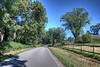
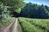
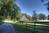
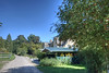
The above images may not be of the site on this page, but were taken nearby. They are loaded from Flickr so please click on them for image credits.
Click here to see more info for this site
Nearby sites
Click here to view sites on an interactive map of the areaKey: Red: member's photo, Blue: 3rd party photo, Yellow: other image, Green: no photo - please go there and take one, Grey: site destroyed
Download sites to:
KML (Google Earth)
GPX (GPS waypoints)
CSV (Garmin/Navman)
CSV (Excel)
To unlock full downloads you need to sign up as a Contributory Member. Otherwise downloads are limited to 50 sites.
Turn off the page maps and other distractions
Nearby sites listing. In the following links * = Image available
196m SSW 198° Nehmten Grabhügelgruppe* Round Barrow(s)
207m SE 133° Nehmten Steingrab 6* Chambered Tomb
538m SE 126° Nehmten Steingrab 4 (Schalenstein)* Rock Art
554m ESE 119° Nehmten Steingrab 5 Long Barrow
1.2km SE 137° Nehmten Huegelgrab 2* Round Barrow(s)
1.3km SSE 147° Nehmten Steingrab 3 Long Barrow
1.3km SSE 153° Nehmten Steingrab 1* Long Barrow
1.4km SSE 152° Nehmten Steingrab 2* Long Barrow
1.4km ESE 118° Nehmten Huegelgrab 1* Round Barrow(s)
5.2km SSW 207° Tensfeld Langbett* Long Barrow
6.0km WSW 255° Schmalensee Huegelgrab* Round Barrow(s)
6.1km WSW 242° Schmalensee Langbett* Long Barrow
6.2km W 266° Belau Huegelgrab* Round Barrow(s)
6.5km SW 227° Damsdorf 3* Long Barrow
6.6km SW 228° Damsdorf 2* Chambered Tomb
6.6km SW 226° Damsdorf 4* Long Barrow
6.7km SW 229° Damsdorf Langbett* Long Barrow
6.9km WSW 244° Schmalensee Huegelgrab 2* Round Barrow(s)
7.1km NNE 26° Museum des Kreises Ploen* Museum
7.4km SW 232° Tarbek Langbett 2* Long Barrow
7.5km SW 233° Tarbek Langbett 1* Long Barrow
7.6km SW 231° Tarbek Huegelgrab* Round Barrow(s)
8.1km SSW 195° Muggesfelde Huegelgrab* Round Barrow(s)
8.5km WNW 290° Perdoel Grabhuegelgruppe* Round Barrow(s)
10.6km SSW 199° Blunk Schalenstein* Rock Art
View more nearby sites and additional images


 We would like to know more about this location. Please feel free to add a brief description and any relevant information in your own language.
 Wir möchten mehr über diese Stätte erfahren. Bitte zögern Sie nicht, eine kurze Beschreibung und relevante Informationen in Deutsch hinzuzufügen.
 Nous aimerions en savoir encore un peu sur les lieux. S'il vous plaît n'hesitez pas à ajouter une courte description et tous les renseignements pertinents dans votre propre langue.
 Quisieramos informarnos un poco más de las lugares. No dude en añadir una breve descripción y otros datos relevantes en su propio idioma.