


<< Text Pages >> Frühkeltische Grabhügelgruppe Bückleshau - Barrow Cemetery in Germany in Baden-Wuerttemberg
Submitted by stop on Friday, 07 February 2020 Page Views: 496
Neolithic and Bronze AgeSite Name: Frühkeltische Grabhügelgruppe BückleshauCountry: Germany
NOTE: This site is 20.65 km away from the location you searched for.
Land: Baden-Wuerttemberg Type: Barrow Cemetery
Nearest Town: Bopfingen Nearest Village: Bopfingen
Latitude: 48.885749N Longitude: 10.342566E
Condition:
| 5 | Perfect |
| 4 | Almost Perfect |
| 3 | Reasonable but with some damage |
| 2 | Ruined but still recognisable as an ancient site |
| 1 | Pretty much destroyed, possibly visible as crop marks |
| 0 | No data. |
| -1 | Completely destroyed |
| 5 | Superb |
| 4 | Good |
| 3 | Ordinary |
| 2 | Not Good |
| 1 | Awful |
| 0 | No data. |
| 5 | Can be driven to, probably with disabled access |
| 4 | Short walk on a footpath |
| 3 | Requiring a bit more of a walk |
| 2 | A long walk |
| 1 | In the middle of nowhere, a nightmare to find |
| 0 | No data. |
| 5 | co-ordinates taken by GPS or official recorded co-ordinates |
| 4 | co-ordinates scaled from a detailed map |
| 3 | co-ordinates scaled from a bad map |
| 2 | co-ordinates of the nearest village |
| 1 | co-ordinates of the nearest town |
| 0 | no data |
Internal Links:
External Links:
Barrow Cemetery in Baden-Wuerttemberg
Barrow cemetary of about 40 barrows (almost 60 in the last century) dated to Hallstatt C, 8./7. Century BC.
Size up to 25m diameter and 2m height.
Located in viewing distance to the "Ipf" mountain (about 2km to the east).
Main site is surrounded by a fence (with some goats in it). So it is not accessible directly but can be viewed quite well.
Information taken from a tableau onsite by "Landesdenkmalamt Baden Württemberg. Archäologische Denkmalpflege"
You may be viewing yesterday's version of this page. To see the most up to date information please register for a free account.
Do not use the above information on other web sites or publications without permission of the contributor.
Nearby Images from Flickr
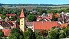
The above images may not be of the site on this page, but were taken nearby. They are loaded from Flickr so please click on them for image credits.
Click here to see more info for this site
Nearby sites
Click here to view sites on an interactive map of the areaKey: Red: member's photo, Blue: 3rd party photo, Yellow: other image, Green: no photo - please go there and take one, Grey: site destroyed
Download sites to:
KML (Google Earth)
GPX (GPS waypoints)
CSV (Garmin/Navman)
CSV (Excel)
To unlock full downloads you need to sign up as a Contributory Member. Otherwise downloads are limited to 50 sites.
Turn off the page maps and other distractions
Nearby sites listing. In the following links * = Image available
2.0km SSE 149° Ipf Höhensiedlung* Hillfort
6.2km ESE 119° Fürschwell Ancient Village or Settlement
7.0km ESE 109° Goldberg Höhensiedlung Hillfort
10.8km SE 135° Ofnethöhlen* Cave or Rock Shelter
16.1km SSW 212° Grosskuchen Grabhügelfeld Barrow Cemetery
16.6km SW 222° Grosskuchen Eisenbrunnen Holy Well or Sacred Spring
19.1km SSW 198° Nattheim Keltische Viereckschanze Ancient Village or Settlement
19.3km SSW 192° Burg Keltische Viereckschanze Ancient Village or Settlement
19.6km SSW 202° Buchen Grabhügelfeld Barrow Cemetery
21.2km ESE 114° Hahnenberg Hillfort
22.8km SSE 158° Eichenwald Keltische Viereckschanze Ancient Village or Settlement
24.6km ESE 110° Ringwall Burgberg Hoppingen Hillfort
27.4km SSW 211° Hellenstein Schlossmuseum Museum
28.1km ENE 60° Grabhügelgruppe Westheim Barrow Cemetery
28.9km W 260° Grubenholz Grabhügelgruppe Barrow Cemetery
29.5km WSW 251° Grosse Scheuer* Cave or Rock Shelter
29.5km WSW 251° Höhle Haus am Rosenstein Cave or Rock Shelter
29.6km WSW 250° Finsteres Loch* Cave or Rock Shelter
29.9km ENE 74° Blutrinne Hechlingen Ancient Temple
30.2km SSW 211° Mergelstetten Grabhügelfeld Barrow Cemetery
30.6km WSW 250° Rosenstein Wallanlage C Hillfort
30.8km WSW 250° Dreieingangshöhle Rosenstein Cave or Rock Shelter
31.1km WSW 250° Kleine Scheuer* Cave or Rock Shelter
31.6km SW 224° Grothau Grabhügelfeld Barrow Cemetery
33.7km SSW 202° Buigen Hillfort
View more nearby sites and additional images


 We would like to know more about this location. Please feel free to add a brief description and any relevant information in your own language.
 Wir möchten mehr über diese Stätte erfahren. Bitte zögern Sie nicht, eine kurze Beschreibung und relevante Informationen in Deutsch hinzuzufügen.
 Nous aimerions en savoir encore un peu sur les lieux. S'il vous plaît n'hesitez pas à ajouter une courte description et tous les renseignements pertinents dans votre propre langue.
 Quisieramos informarnos un poco más de las lugares. No dude en añadir una breve descripción y otros datos relevantes en su propio idioma.