

<< Our Photo Pages >> Statue Menhir Replica Gallmersgarten - Standing Stone (Menhir) in Germany in Bavaria
Submitted by KaiHofmann on Tuesday, 23 October 2018 Page Views: 1265
Neolithic and Bronze AgeSite Name: Statue Menhir Replica GallmersgartenCountry: Germany
NOTE: This site is 7.996 km away from the location you searched for.
Land: Bavaria Type: Standing Stone (Menhir)
Nearest Town: Rothenburg ob der Tauber Nearest Village: Gallmersgarten
Latitude: 49.453245N Longitude: 10.274147E
Condition:
| 5 | Perfect |
| 4 | Almost Perfect |
| 3 | Reasonable but with some damage |
| 2 | Ruined but still recognisable as an ancient site |
| 1 | Pretty much destroyed, possibly visible as crop marks |
| 0 | No data. |
| -1 | Completely destroyed |
| 5 | Superb |
| 4 | Good |
| 3 | Ordinary |
| 2 | Not Good |
| 1 | Awful |
| 0 | No data. |
| 5 | Can be driven to, probably with disabled access |
| 4 | Short walk on a footpath |
| 3 | Requiring a bit more of a walk |
| 2 | A long walk |
| 1 | In the middle of nowhere, a nightmare to find |
| 0 | No data. |
| 5 | co-ordinates taken by GPS or official recorded co-ordinates |
| 4 | co-ordinates scaled from a detailed map |
| 3 | co-ordinates scaled from a bad map |
| 2 | co-ordinates of the nearest village |
| 1 | co-ordinates of the nearest town |
| 0 | no data |
Internal Links:
External Links:
")
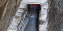
Replica of an neolithic statue menhir with an archaic head with face and shoulders. It was found in 2015 during earthworks. The original standing stone could be visited in the Gollachgau museum in Uffenheim.
You may be viewing yesterday's version of this page. To see the most up to date information please register for a free account.
Do not use the above information on other web sites or publications without permission of the contributor.
Nearby Images from Flickr

The above images may not be of the site on this page, but were taken nearby. They are loaded from Flickr so please click on them for image credits.
Click here to see more info for this site
Nearby sites
Click here to view sites on an interactive map of the areaKey: Red: member's photo, Blue: 3rd party photo, Yellow: other image, Green: no photo - please go there and take one, Grey: site destroyed
Download sites to:
KML (Google Earth)
GPX (GPS waypoints)
CSV (Garmin/Navman)
CSV (Excel)
To unlock full downloads you need to sign up as a Contributory Member. Otherwise downloads are limited to 50 sites.
Turn off the page maps and other distractions
Nearby sites listing. In the following links * = Image available
7.9km ESE 102° Summstein am Petersberg Modern Stone Circle etc
10.5km NNW 342° Gollachgau Museum Museum
11.5km SW 223° Engelsburg Keltenwall* Hillfort
11.6km W 260° Burgstall Oppidum* Hillfort
23.1km WSW 256° Niederstetten Keltische Viereckschanze Ancient Village or Settlement
23.2km ESE 119° Grosser Markmann Standing Stone (Menhir)
23.7km ESE 118° Kleiner Markmann Standing Stone (Menhir)
25.7km WNW 297° Fuchsenbühl Grabhügel Artificial Mound
26.5km NNW 329° Hopferstadt Ringheiligtum Henge
30.6km N 1° Schwanberg Hillfort Hillfort
32.0km NE 45° Oasen der Sinne* Museum
32.2km NW 306° Allersheim Grabhügelfeld Barrow Cemetery
35.2km NNW 343° Buchbrunn Settlement Ancient Village or Settlement
36.4km SW 215° Triensbach Grabhügelgruppe Barrow Cemetery
36.8km SW 232° Langenburg Keltische Viereckschanze Ancient Village or Settlement
37.7km E 89° Druidenstein Stinzendorf Natural Stone / Erratic / Other Natural Feature
41.4km WSW 257° Hoehle St.Wendel zum Stein Cave or Rock Shelter
44.6km E 95° Hügelgräber Erlach Round Barrow(s)
45.7km N 358° Grabstele Volkach Standing Stone (Menhir)
46.5km NNE 20° Ebracher Bildstein* Sculptured Stone
46.5km NNE 24° Hünerstein Ebrach Standing Stone (Menhir)
46.5km N 352° Vogelburg Hillfort
48.0km WNW 293° Tauberfraenkischen Landschaftmuseum Museum
49.5km SW 216° Stöckenburg Ancient Village or Settlement
49.8km SW 215° Vellberg Natur und Heimatmuseum Museum
View more nearby sites and additional images


 We would like to know more about this location. Please feel free to add a brief description and any relevant information in your own language.
 Wir möchten mehr über diese Stätte erfahren. Bitte zögern Sie nicht, eine kurze Beschreibung und relevante Informationen in Deutsch hinzuzufügen.
 Nous aimerions en savoir encore un peu sur les lieux. S'il vous plaît n'hesitez pas à ajouter une courte description et tous les renseignements pertinents dans votre propre langue.
 Quisieramos informarnos un poco más de las lugares. No dude en añadir una breve descripción y otros datos relevantes en su propio idioma.