


<< Text Pages >> Eiersberg - Hillfort in Germany in Bavaria
Submitted by KaiHofmann on Wednesday, 04 October 2017 Page Views: 744
Iron Age and Later PrehistorySite Name: EiersbergCountry: Germany
NOTE: This site is 7.842 km away from the location you searched for.
Land: Bavaria Type: Hillfort
Nearest Town: Bad Neustadt an der Saale Nearest Village: Oberstreu
Latitude: 50.400270N Longitude: 10.259419E
Condition:
| 5 | Perfect |
| 4 | Almost Perfect |
| 3 | Reasonable but with some damage |
| 2 | Ruined but still recognisable as an ancient site |
| 1 | Pretty much destroyed, possibly visible as crop marks |
| 0 | No data. |
| -1 | Completely destroyed |
| 5 | Superb |
| 4 | Good |
| 3 | Ordinary |
| 2 | Not Good |
| 1 | Awful |
| 0 | No data. |
| 5 | Can be driven to, probably with disabled access |
| 4 | Short walk on a footpath |
| 3 | Requiring a bit more of a walk |
| 2 | A long walk |
| 1 | In the middle of nowhere, a nightmare to find |
| 0 | No data. |
| 5 | co-ordinates taken by GPS or official recorded co-ordinates |
| 4 | co-ordinates scaled from a detailed map |
| 3 | co-ordinates scaled from a bad map |
| 2 | co-ordinates of the nearest village |
| 1 | co-ordinates of the nearest town |
| 0 | no data |
Internal Links:
External Links:
Hillfort in Bavaria
Iron-age hillfort on the Eiersberg with some still visible ramparts in the south-east of the hill.
You may be viewing yesterday's version of this page. To see the most up to date information please register for a free account.
Do not use the above information on other web sites or publications without permission of the contributor.
Nearby Images from Flickr
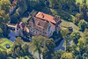
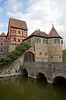
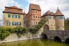
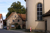
The above images may not be of the site on this page, but were taken nearby. They are loaded from Flickr so please click on them for image credits.
Click here to see more info for this site
Nearby sites
Click here to view sites on an interactive map of the areaKey: Red: member's photo, Blue: 3rd party photo, Yellow: other image, Green: no photo - please go there and take one, Grey: site destroyed
Download sites to:
KML (Google Earth)
GPX (GPS waypoints)
CSV (Garmin/Navman)
CSV (Excel)
To unlock full downloads you need to sign up as a Contributory Member. Otherwise downloads are limited to 50 sites.
Turn off the page maps and other distractions
Nearby sites listing. In the following links * = Image available
5.9km NNW 336° Hügelgräberfeld Kleiner Lindenberg* Barrow Cemetery
10.6km W 276° Wiesenthal Barrow Cemetery
21.2km E 94° Gräberfeld Merzelbachwald (2)* Round Barrow(s)
21.3km E 94° Gräberfeld Merzelbachwald (1)* Round Barrow(s)
22.5km E 89° Steinsburg Grabhügel (1) Round Barrow(s)
23.2km E 89° Steinsburg Grabhügel (2) Round Barrow(s)
23.5km E 90° Steinsburgmuseum* Museum
23.6km E 84° Grabhügel am Schwarzen Stock (1)* Round Barrow(s)
23.6km E 87° Steinsburg* Hillfort
23.7km E 85° Grabhügel am Schwarzen Stock (2)* Round Barrow(s)
23.8km E 85° Steinsburg Grabhügel (4) Round Barrow(s)
23.9km E 84° Steinsburg Grabhügel (3) Round Barrow(s)
24.9km N 350° Riederholz Barrow Cemetery
25.2km N 351° Fuchshügel Artificial Mound
25.5km NNW 337° Weiber Wetzstein Marker Stone
25.9km SSW 211° Heidenopferstein* Rock Art
28.0km NNW 341° Kaltennordheim (2) Barrow Cemetery
28.3km NNW 346° Kaltennordheim (1) Causewayed Enclosure
29.4km NNW 348° Fischbach Artificial Mound
30.2km WNW 302° Milseburg Hillfort
30.3km NNW 341° Fischberg Causewayed Enclosure
30.4km NE 46° Herrnausleite Artificial Mound
30.5km NE 46° Silbachshöhe (1) Artificial Mound
30.6km NE 47° Silbachshöhe (2) Causewayed Enclosure
30.7km NE 43° Rodeland* Barrow Cemetery
View more nearby sites and additional images


 We would like to know more about this location. Please feel free to add a brief description and any relevant information in your own language.
 Wir möchten mehr über diese Stätte erfahren. Bitte zögern Sie nicht, eine kurze Beschreibung und relevante Informationen in Deutsch hinzuzufügen.
 Nous aimerions en savoir encore un peu sur les lieux. S'il vous plaît n'hesitez pas à ajouter une courte description et tous les renseignements pertinents dans votre propre langue.
 Quisieramos informarnos un poco más de las lugares. No dude en añadir una breve descripción y otros datos relevantes en su propio idioma.