

, Aubrey Burl")
<< Text Pages >> Hellenstein Schlossmuseum - Museum in Germany in Baden-Wuerttemberg
Submitted by AlexHunger on Tuesday, 13 September 2005 Page Views: 2077
MuseumsSite Name: Hellenstein SchlossmuseumCountry: Germany
NOTE: This site is 0.491 km away from the location you searched for.
Land: Baden-Wuerttemberg Type: Museum
Nearest Town: Stuttgart Nearest Village: Heidenheim an der Brenz
Latitude: 48.674880N Longitude: 10.148020E
Condition:
| 5 | Perfect |
| 4 | Almost Perfect |
| 3 | Reasonable but with some damage |
| 2 | Ruined but still recognisable as an ancient site |
| 1 | Pretty much destroyed, possibly visible as crop marks |
| 0 | No data. |
| -1 | Completely destroyed |
| 5 | Superb |
| 4 | Good |
| 3 | Ordinary |
| 2 | Not Good |
| 1 | Awful |
| 0 | No data. |
| 5 | Can be driven to, probably with disabled access |
| 4 | Short walk on a footpath |
| 3 | Requiring a bit more of a walk |
| 2 | A long walk |
| 1 | In the middle of nowhere, a nightmare to find |
| 0 | No data. |
| 5 | co-ordinates taken by GPS or official recorded co-ordinates |
| 4 | co-ordinates scaled from a detailed map |
| 3 | co-ordinates scaled from a bad map |
| 2 | co-ordinates of the nearest village |
| 1 | co-ordinates of the nearest town |
| 0 | no data |
Be the first person to rate this site - see the 'Contribute!' box in the right hand menu.
Internal Links:
External Links:
Museum in Baden-Württemberg
GPS Position. Artifacts from Buchen Grabhügelfeld
Address: Schlosshaustrasse,
Phone: 0049 7321 43 381
Opening Hours: Tüsdays to Sundays 10:00-12:00 and 14:00-17:00
You may be viewing yesterday's version of this page. To see the most up to date information please register for a free account.
Do not use the above information on other web sites or publications without permission of the contributor.
Nearby Images from Flickr

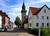

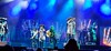

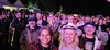
The above images may not be of the site on this page, but were taken nearby. They are loaded from Flickr so please click on them for image credits.
Click here to see more info for this site
Nearby sites
Click here to view sites on an interactive map of the areaKey: Red: member's photo, Blue: 3rd party photo, Yellow: other image, Green: no photo - please go there and take one, Grey: site destroyed
Download sites to:
KML (Google Earth)
GPX (GPS waypoints)
CSV (Garmin/Navman)
CSV (Excel)
To unlock full downloads you need to sign up as a Contributory Member. Otherwise downloads are limited to 50 sites.
Turn off the page maps and other distractions
Nearby sites listing. In the following links * = Image available
2.8km SSW 202° Mergelstetten Grabhügelfeld Barrow Cemetery
7.8km W 276° Grothau Grabhügelfeld Barrow Cemetery
7.9km SSE 168° Buigen Hillfort
8.7km NE 52° Buchen Grabhügelfeld Barrow Cemetery
9.9km ENE 58° Nattheim Keltische Viereckschanze Ancient Village or Settlement
11.4km ENE 66° Burg Keltische Viereckschanze Ancient Village or Settlement
11.4km NNE 30° Grosskuchen Grabhügelfeld Barrow Cemetery
11.4km SW 214° Hungerbrunnen* Holy Well or Sacred Spring
11.5km NNE 16° Grosskuchen Eisenbrunnen Holy Well or Sacred Spring
13.3km SSE 165° Vogelherd Höhle* Cave or Rock Shelter
13.4km S 178° Bocksteinhöhle* Cave or Rock Shelter
14.1km S 173° Hohlenstein Höhle Cave or Rock Shelter
14.3km SSE 156° Niederstotzingen Keltische Viereckschanze Ancient Village or Settlement
18.8km SSW 202° Fohlenhaus-Höhlen Cave or Rock Shelter
18.8km NW 314° Finsteres Loch* Cave or Rock Shelter
19.2km NW 315° Grosse Scheuer* Cave or Rock Shelter
19.2km NW 315° Höhle Haus am Rosenstein Cave or Rock Shelter
19.4km NW 312° Rosenstein Wallanlage C Hillfort
19.4km NW 311° Dreieingangshöhle Rosenstein Cave or Rock Shelter
19.6km NW 310° Kleine Scheuer* Cave or Rock Shelter
19.9km S 186° Museum für Vor-und Frühgeschichte des Lonetales Museum
22.9km E 84° Eichenwald Keltische Viereckschanze Ancient Village or Settlement
23.2km NW 322° Grubenholz Grabhügelgruppe Barrow Cemetery
26.6km NE 35° Ipf Höhensiedlung* Hillfort
27.0km NE 54° Ofnethöhlen* Cave or Rock Shelter
View more nearby sites and additional images


 We would like to know more about this location. Please feel free to add a brief description and any relevant information in your own language.
 Wir möchten mehr über diese Stätte erfahren. Bitte zögern Sie nicht, eine kurze Beschreibung und relevante Informationen in Deutsch hinzuzufügen.
 Nous aimerions en savoir encore un peu sur les lieux. S'il vous plaît n'hesitez pas à ajouter une courte description et tous les renseignements pertinents dans votre propre langue.
 Quisieramos informarnos un poco más de las lugares. No dude en añadir una breve descripción y otros datos relevantes en su propio idioma.