


<< Text Pages >> Poblat Ibèric del Cogulló - Ancient Village or Settlement in Spain in Cataluña
Submitted by holger_rix on Saturday, 05 December 2015 Page Views: 790
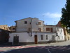
Multi-periodSite Name: Poblat Ibèric del CogullóCountry: Spain Region: Cataluña Type: Ancient Village or Settlement
Latitude: 41.808910N Longitude: 1.888980E
Condition:
| 5 | Perfect |
| 4 | Almost Perfect |
| 3 | Reasonable but with some damage |
| 2 | Ruined but still recognisable as an ancient site |
| 1 | Pretty much destroyed, possibly visible as crop marks |
| 0 | No data. |
| -1 | Completely destroyed |
| 5 | Superb |
| 4 | Good |
| 3 | Ordinary |
| 2 | Not Good |
| 1 | Awful |
| 0 | No data. |
| 5 | Can be driven to, probably with disabled access |
| 4 | Short walk on a footpath |
| 3 | Requiring a bit more of a walk |
| 2 | A long walk |
| 1 | In the middle of nowhere, a nightmare to find |
| 0 | No data. |
| 5 | co-ordinates taken by GPS or official recorded co-ordinates |
| 4 | co-ordinates scaled from a detailed map |
| 3 | co-ordinates scaled from a bad map |
| 2 | co-ordinates of the nearest village |
| 1 | co-ordinates of the nearest town |
| 0 | no data |
Be the first person to rate this site - see the 'Contribute!' box in the right hand menu.
Internal Links:
External Links:
Ancient Village or Settlement in Cataluña
You may be viewing yesterday's version of this page. To see the most up to date information please register for a free account.
Do not use the above information on other web sites or publications without permission of the contributor.
Nearby Images from Flickr
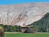
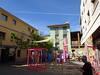
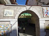
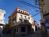

The above images may not be of the site on this page, but were taken nearby. They are loaded from Flickr so please click on them for image credits.
Click here to see more info for this site
Nearby sites
Click here to view sites on an interactive map of the areaKey: Red: member's photo, Blue: 3rd party photo, Yellow: other image, Green: no photo - please go there and take one, Grey: site destroyed
Download sites to:
KML (Google Earth)
GPX (GPS waypoints)
CSV (Garmin/Navman)
CSV (Excel)
To unlock full downloads you need to sign up as a Contributory Member. Otherwise downloads are limited to 50 sites.
Turn off the page maps and other distractions
Nearby sites listing. In the following links * = Image available
7.5km NNW 341° Dolmen Pla del Coll* Burial Chamber or Dolmen
8.7km W 259° Dolmen de La Tosa Burial Chamber or Dolmen
9.8km NNE 26° Dolmen de Cornet 2 Burial Chamber or Dolmen
10.3km WNW 301° Dolmen Els Barquets Burial Chamber or Dolmen
10.5km ESE 102° Dolmen de Sant Amanç Burial Chamber or Dolmen
12.2km WNW 299° Dolmen Cortès del Pi Burial Chamber or Dolmen
12.7km NNW 338° Navàs Tombes Antropomòrfiques Barrow Cemetery
12.7km SW 224° La Taula de Cal Cuques Natural Stone / Erratic / Other Natural Feature
12.9km NNE 16° Tomba del Moro de Cal Vidal Burial Chamber or Dolmen
13.0km WNW 295° Dolmen Llosa Dreta del Samuntà Burial Chamber or Dolmen
13.1km WNW 294° Balma Sepulcral del Samuntà Burial Chamber or Dolmen
13.7km WNW 289° Menhir Vinya Sala 2 Standing Stone (Menhir)
13.8km ESE 110° Dolmen del Trompo Burial Chamber or Dolmen
13.8km WNW 289° Menhir Vinya Sala 1 Standing Stone (Menhir)
13.8km WNW 289° Dolmen Vinya Sala Burial Chamber or Dolmen
14.0km WNW 298° Dolmen de les Comes Burial Chamber or Dolmen
14.0km ESE 120° Dolmen del Pla de Trullars* Burial Chamber or Dolmen
14.2km E 83° Cista de Vilaclara* Burial Chamber or Dolmen
14.3km E 96° Dolmen de Santa Magdalena* Burial Chamber or Dolmen
14.8km ESE 107° Dolmen de La Clusella Burial Chamber or Dolmen
15.0km WSW 258° Dolmen de Betlem Burial Chamber or Dolmen
15.7km WNW 282° Dolmen Feixes de Coaner Burial Chamber or Dolmen
16.0km WNW 281° Dolmen Creu d'Espelta Burial Chamber or Dolmen
16.1km NNW 338° Tomba Quadre Blanc Barrow Cemetery
16.7km ENE 57° Dolmen Pla de la Bassa de Can Garriga Burial Chamber or Dolmen
View more nearby sites and additional images


 We would like to know more about this location. Please feel free to add a brief description and any relevant information in your own language.
 Wir möchten mehr über diese Stätte erfahren. Bitte zögern Sie nicht, eine kurze Beschreibung und relevante Informationen in Deutsch hinzuzufügen.
 Nous aimerions en savoir encore un peu sur les lieux. S'il vous plaît n'hesitez pas à ajouter une courte description et tous les renseignements pertinents dans votre propre langue.
 Quisieramos informarnos un poco más de las lugares. No dude en añadir una breve descripción y otros datos relevantes en su propio idioma.