


<< Text Pages >> Bradstow School - Barrow Cemetery in England in Kent
Submitted by coldrum on Tuesday, 25 October 2011 Page Views: 3384
Neolithic and Bronze AgeSite Name: Bradstow SchoolCountry: England
NOTE: This site is 28.097 km away from the location you searched for.
County: Kent Type: Barrow Cemetery
Nearest Town: Broadstairs
Map Ref: TR39456709
Latitude: 51.352397N Longitude: 1.437524E
Condition:
| 5 | Perfect |
| 4 | Almost Perfect |
| 3 | Reasonable but with some damage |
| 2 | Ruined but still recognisable as an ancient site |
| 1 | Pretty much destroyed, possibly visible as crop marks |
| 0 | No data. |
| -1 | Completely destroyed |
| 5 | Superb |
| 4 | Good |
| 3 | Ordinary |
| 2 | Not Good |
| 1 | Awful |
| 0 | No data. |
| 5 | Can be driven to, probably with disabled access |
| 4 | Short walk on a footpath |
| 3 | Requiring a bit more of a walk |
| 2 | A long walk |
| 1 | In the middle of nowhere, a nightmare to find |
| 0 | No data. |
| 5 | co-ordinates taken by GPS or official recorded co-ordinates |
| 4 | co-ordinates scaled from a detailed map |
| 3 | co-ordinates scaled from a bad map |
| 2 | co-ordinates of the nearest village |
| 1 | co-ordinates of the nearest town |
| 0 | no data |
Internal Links:
External Links:
Barrow Cemetery in Kent
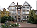
"An Anglo-Saxon inhumation cemetery found and excavated at Valetta House (now Bradstow School) in 1910-11. Some 15 inhumations with accompanying grave goods were discovered. Two ring-ditches with 9 associated crouched burials, probably of Bronze Age date were also discovered, although later intepretations have also postulated an Iron Age date. Further excavations between 1970-4 located another 98 Saxon inhumations, including a nucleated group of warrior graves. Some of the graves had associated structures, one possibly a canopy support, and at least one was surrounded by the ditch of a ploughed-out barrow. It was thought that the cemetery had still not been fully excavated when the excavations were terminated. The cemetery started in the late 5th century, but was most intensively used in the period 600-800. Most of the graves were aligned East-West, although those on or near the central mound are sometimes tangential to it. There were twice as many male as female inhumations. Many of the graves had structural features, including post-holes, sockets, ledges and small ring ditches. Several of the graves appear to have been robbed soon after interment. Excavations in 2003 revealed further graves of the 7th century and also a feature which was either possibly a section of the barrow ditch noted previously, or a later quarry pit."
http://www.archaeologyse.co.uk/04-projects/Kent/Broadstairs-School/index.htm
Source: Pastscape.
You may be viewing yesterday's version of this page. To see the most up to date information please register for a free account.
Do not use the above information on other web sites or publications without permission of the contributor.
Nearby Images from Geograph Britain and Ireland:
©2017(licence)
©2017(licence)
©2014(licence)
©2014(licence)
©2021(licence)
The above images may not be of the site on this page, they are loaded from Geograph.
Please Submit an Image of this site or go out and take one for us!
Click here to see more info for this site
Nearby sites
Key: Red: member's photo, Blue: 3rd party photo, Yellow: other image, Green: no photo - please go there and take one, Grey: site destroyed
Download sites to:
KML (Google Earth)
GPX (GPS waypoints)
CSV (Garmin/Navman)
CSV (Excel)
To unlock full downloads you need to sign up as a Contributory Member. Otherwise downloads are limited to 50 sites.
Turn off the page maps and other distractions
Nearby sites listing. In the following links * = Image available
3.0km NW 325° Broadley Road Barrow Round Barrow(s) (TR37576948)
3.1km NNW 341° Payton Heights Barrows Round Barrow(s) (TR383700)
3.5km NW 304° Ramsgate Barrows and Enclosures Round Barrow(s) (TR365689)
4.1km SW 235° Chalk Hill Causewayed Enclosure Causewayed Enclosure (TR36156457)
4.3km WSW 248° Ramsgate Barrow Cemetary Barrow Cemetery (TR355653)
4.7km WSW 249° Cliffs End Ring Ditch* Round Barrow(s) (TR351652)
5.1km WSW 239° Cliffsend* Museum (TR352643)
6.0km WSW 240° St. Augustine's Well (Minster)* Holy Well or Sacred Spring (TR344639)
12.2km W 269° St Nicholas At Wade Barrow Round Barrow(s) (TR272663)
14.2km SW 226° Ringlemere* Barrow Cemetery (TR297567)
16.8km W 281° Reculver Towers and Roman Fort* Promontory Fort / Cliff Castle (TR228694)
17.1km S 190° Walmer Barrow Round Barrow(s) (TR37405005)
17.5km SW 219° Shingleton Barrows* Round Barrow(s) (TR29185290)
17.9km SW 218° Eastry Barrow* Round Barrow(s) (TR28965259)
18.8km SW 233° Ermin Way Stone Sculptured Stone
19.1km SW 219° Nonington Barrow Cemetary Barrow Cemetery (TR28185160)
19.1km S 187° The Blue Well Holy Well or Sacred Spring (TR379480)
19.1km W 268° St. Ethelburga's Well* Holy Well or Sacred Spring (TR203656)
20.2km S 191° Ringwould Barrows* Round Barrow(s) (TR36474706)
20.5km S 190° Ringwould Barrow Round Barrow(s) (TR36834673)
20.9km WSW 250° Arrianes Well Holy Well or Sacred Spring (TR201589)
21.1km S 190° St Margaret's Bay Barrow Round Barrow(s) (TR36914609)
21.6km SSW 208° White Caps Barrow Round Barrow(s) (TR30034766)
21.7km SW 232° Adisham Timber Circle (TR22885294)
22.1km WSW 244° Bekesbourne* Holy Well or Sacred Spring (TR20005646)
View more nearby sites and additional images


 We would like to know more about this location. Please feel free to add a brief description and any relevant information in your own language.
 Wir möchten mehr über diese Stätte erfahren. Bitte zögern Sie nicht, eine kurze Beschreibung und relevante Informationen in Deutsch hinzuzufügen.
 Nous aimerions en savoir encore un peu sur les lieux. S'il vous plaît n'hesitez pas à ajouter une courte description et tous les renseignements pertinents dans votre propre langue.
 Quisieramos informarnos un poco más de las lugares. No dude en añadir una breve descripción y otros datos relevantes en su propio idioma.