

<< Text Pages >> Bell Hill - Round Barrow(s) in England
Submitted by Davidwk on Thursday, 25 March 2004 Page Views: 9199
Neolithic and Bronze AgeSite Name: Bell HillCountry: England
NOTE: This site is 0.9 km away from the location you searched for.
Type: Round Barrow(s)
Nearest Town: Belton Nearest Village: Fritton
Map Ref: TG480010 Landranger Map Number: 134
Latitude: 52.550300N Longitude: 1.656623E
Condition:
| 5 | Perfect |
| 4 | Almost Perfect |
| 3 | Reasonable but with some damage |
| 2 | Ruined but still recognisable as an ancient site |
| 1 | Pretty much destroyed, possibly visible as crop marks |
| 0 | No data. |
| -1 | Completely destroyed |
| 5 | Superb |
| 4 | Good |
| 3 | Ordinary |
| 2 | Not Good |
| 1 | Awful |
| 0 | No data. |
| 5 | Can be driven to, probably with disabled access |
| 4 | Short walk on a footpath |
| 3 | Requiring a bit more of a walk |
| 2 | A long walk |
| 1 | In the middle of nowhere, a nightmare to find |
| 0 | No data. |
| 5 | co-ordinates taken by GPS or official recorded co-ordinates |
| 4 | co-ordinates scaled from a detailed map |
| 3 | co-ordinates scaled from a bad map |
| 2 | co-ordinates of the nearest village |
| 1 | co-ordinates of the nearest town |
| 0 | no data |
Internal Links:
External Links:
Round barrow in Norfolk
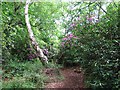
Bell Hill is a few hundred yards away from Mill Hill in Belton. It is situated at the top of the forest road that leaves the A143 Yarmouth-Beccles road at the side of the Decoy pub. If you park and walk into the tree plantation through the fire gate and keep walking in the same general direction of the road it soon becomes visible through the trees.
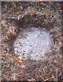
Its extremely overgrown and deep in bracken but nonetheless recognisably barrow-like. Not a great site but one worth recording as one of the very few remaining in this part of east Anglia. The site is actually marked as a battery and its easy to see how its position high over the waveney might have led to later use as a gun placement
You may be viewing yesterday's version of this page. To see the most up to date information please register for a free account.
Do not use the above information on other web sites or publications without permission of the contributor.
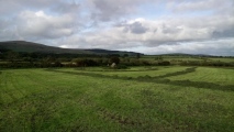
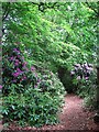
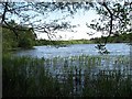
Nearby Images from Geograph Britain and Ireland:
©2008(licence)
©2019(licence)

©2008(licence)
©2008(licence)
©2008(licence)
The above images may not be of the site on this page, they are loaded from Geograph.
Please Submit an Image of this site or go out and take one for us!
Click here to see more info for this site
Nearby sites
Key: Red: member's photo, Blue: 3rd party photo, Yellow: other image, Green: no photo - please go there and take one, Grey: site destroyed
Download sites to:
KML (Google Earth)
GPX (GPS waypoints)
CSV (Garmin/Navman)
CSV (Excel)
To unlock full downloads you need to sign up as a Contributory Member. Otherwise downloads are limited to 50 sites.
Turn off the page maps and other distractions
Nearby sites listing. In the following links * = Image available
nankm 0° Mill Hill Round Barrow(s) (TG480010)
3.4km N 353° Burgh Castle Shore Fort Stone Fort or Dun (TG474044)
5.0km ENE 63° Gull Stones (Great Yarmouth) Sculptured Stone (TG524035)
9.7km SE 136° The Witches' Stones, Lowestoft Modern Stone Circle etc (TM5505294359)
11.3km WSW 239° Stockton Stone* Standing Stone (Menhir) (TM386946)
16.7km WSW 237° Broome Heath Long Barrow Long Barrow (TM344913)
18.2km SW 235° Druid's Stone (Bungay)* Natural Stone / Erratic / Other Natural Feature (TM3366689739)
22.9km SW 233° Flixton Park Quarry Timber Circle (TM303863)
24.4km WNW 285° Arminghall Henge* Henge (TG240060)
25.0km S 190° Ladywell (Blythborough)* Holy Well or Sacred Spring (TM450762)
25.0km W 278° Venta Icenorum* Ancient Village or Settlement (TG230034)
25.9km WNW 290° Norwich Castle Museum and Art Gallery* Museum (TG231085)
26.2km S 185° Walberswick Burial Mounds* Round Barrow(s) (TM4718274820)
27.1km WNW 284° Eaton Heath Barrow Cemetery (TG21280605)
27.6km NNW 334° Devil's Ditch Ancient Trackway (TG347252)
28.2km W 263° Tasburgh Fort* Hillfort (TM201960)
32.1km NNW 345° Happisburgh Ancient Village or Settlement (TG379315)
32.5km WNW 290° Roundwell* Holy Well or Sacred Spring (TG168104)
33.5km WNW 286° St Walstan's Well* Holy Well or Sacred Spring (TG15350878)
33.8km WNW 303° Horsford Woods Barrow Cemetary* Barrow Cemetery (TG18571780)
37.0km NNW 334° Knapton* Modern Stone Circle etc (TG3020433448)
37.0km SW 227° Kesgrave Bowl Barrow 2 Round Barrow(s) (TM220745)
37.3km W 274° St Thomas's Well (Wymondham)* Holy Well or Sacred Spring (TG10550146)
38.2km NW 311° Maiden's Head* Holy Well or Sacred Spring (TG178246)
38.3km SW 234° St. Edmund's Cross Ancient Cross (TM1877)
View more nearby sites and additional images


 We would like to know more about this location. Please feel free to add a brief description and any relevant information in your own language.
 Wir möchten mehr über diese Stätte erfahren. Bitte zögern Sie nicht, eine kurze Beschreibung und relevante Informationen in Deutsch hinzuzufügen.
 Nous aimerions en savoir encore un peu sur les lieux. S'il vous plaît n'hesitez pas à ajouter une courte description et tous les renseignements pertinents dans votre propre langue.
 Quisieramos informarnos un poco más de las lugares. No dude en añadir una breve descripción y otros datos relevantes en su propio idioma.