


<< Text Pages >> Musée de Tarascon - Museum in France in Midi:Ariège (09)
Submitted by TheCaptain on Thursday, 10 February 2005 Page Views: 5774
MuseumsSite Name: Musée de TarasconCountry: France
NOTE: This site is 3.351 km away from the location you searched for.
Département: Midi:Ariège (09) Type: Museum
Nearest Town: Tarascon-sur-Ariège Nearest Village: Tarascon-sur-Ariège
Latitude: 42.845000N Longitude: 1.608000E
Condition:
| 5 | Perfect |
| 4 | Almost Perfect |
| 3 | Reasonable but with some damage |
| 2 | Ruined but still recognisable as an ancient site |
| 1 | Pretty much destroyed, possibly visible as crop marks |
| 0 | No data. |
| -1 | Completely destroyed |
| 5 | Superb |
| 4 | Good |
| 3 | Ordinary |
| 2 | Not Good |
| 1 | Awful |
| 0 | No data. |
| 5 | Can be driven to, probably with disabled access |
| 4 | Short walk on a footpath |
| 3 | Requiring a bit more of a walk |
| 2 | A long walk |
| 1 | In the middle of nowhere, a nightmare to find |
| 0 | No data. |
| 5 | co-ordinates taken by GPS or official recorded co-ordinates |
| 4 | co-ordinates scaled from a detailed map |
| 3 | co-ordinates scaled from a bad map |
| 2 | co-ordinates of the nearest village |
| 1 | co-ordinates of the nearest town |
| 0 | no data |
Be the first person to rate this site - see the 'Contribute!' box in the right hand menu.
Internal Links:
External Links:
Museum in Ariège
Have you visited this site? Please add a comment below.
Phone: 35 61 05 81 57
You may be viewing yesterday's version of this page. To see the most up to date information please register for a free account.
Do not use the above information on other web sites or publications without permission of the contributor.
Nearby Images from Flickr
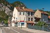
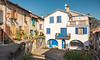
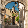

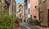
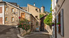
The above images may not be of the site on this page, but were taken nearby. They are loaded from Flickr so please click on them for image credits.
Click here to see more info for this site
Nearby sites
Click here to view sites on an interactive map of the areaKey: Red: member's photo, Blue: 3rd party photo, Yellow: other image, Green: no photo - please go there and take one, Grey: site destroyed
Download sites to:
KML (Google Earth)
GPX (GPS waypoints)
CSV (Garmin/Navman)
CSV (Excel)
To unlock full downloads you need to sign up as a Contributory Member. Otherwise downloads are limited to 50 sites.
Turn off the page maps and other distractions
Nearby sites listing. In the following links * = Image available
2.1km WSW 245° Dolmen de la Plagne Burial Chamber or Dolmen
2.2km SSE 152° Grotte des Eglises Cave or Rock Shelter
2.5km SSE 165° Grotte de Lombrives* Cave or Rock Shelter
3.0km WNW 293° Parc Pyrénéen de l'Art Préhistorique* Museum
3.0km SSW 203° Grotte de Niaux* Cave or Rock Shelter
3.2km SSW 211° Grotte de La Vache* Cave or Rock Shelter
3.3km SSW 199° Grotte de la Petite Caougno* Cave or Rock Shelter
4.3km NW 314° Grotte de Bédeilhac* Cave or Rock Shelter
4.4km N 11° Dolmen de Peyrogall* Burial Chamber or Dolmen
4.8km SE 141° Grotte de Fontanet Cave or Rock Shelter
5.1km SSW 206° Dolmen de Quiernès Natural Stone / Erratic / Other Natural Feature
11.4km SW 223° Palet de Sanson* Natural Stone / Erratic / Other Natural Feature
13.2km N 360° Grotte de Cheval Cave or Rock Shelter
13.4km N 359° Musée Départemental de l'Ariège* Museum
14.7km NNE 18° Grotte de l'Herm Cave or Rock Shelter
18.0km SE 125° La Cabane de Rolana* Burial Chamber or Dolmen
18.6km E 79° Montségur* Ancient Village or Settlement
18.6km E 81° Montségur museum* Museum
20.7km ENE 75° Roc de Fougasse Natural Stone / Erratic / Other Natural Feature
21.4km NNW 345° Grotte du Portel* Cave or Rock Shelter
21.5km SE 127° Menhir de Savignac-les-Ormeaux* Standing Stone (Menhir)
23.8km WNW 284° Grotte du Ker de Massat* Cave or Rock Shelter
24.7km NW 314° Hautech ancient copper mine Ancient Mine, Quarry or other Industry
25.5km NW 308° Rougé ancient copper mine Ancient Mine, Quarry or other Industry
25.9km E 79° Source de Fontestorbes* Holy Well or Sacred Spring
View more nearby sites and additional images


 We would like to know more about this location. Please feel free to add a brief description and any relevant information in your own language.
 Wir möchten mehr über diese Stätte erfahren. Bitte zögern Sie nicht, eine kurze Beschreibung und relevante Informationen in Deutsch hinzuzufügen.
 Nous aimerions en savoir encore un peu sur les lieux. S'il vous plaît n'hesitez pas à ajouter une courte description et tous les renseignements pertinents dans votre propre langue.
 Quisieramos informarnos un poco más de las lugares. No dude en añadir una breve descripción y otros datos relevantes en su propio idioma.