


<< Our Photo Pages >> Dolmen du Pech 10 - Burial Chamber or Dolmen in France in Midi:Tarn-et-Garonne (82)
Submitted by TheCaptain on Friday, 06 May 2011 Page Views: 1809
Neolithic and Bronze AgeSite Name: Dolmen du Pech 10 Alternative Name: Dolmen du Pech (J)Country: France Département: Midi:Tarn-et-Garonne (82) Type: Burial Chamber or Dolmen
Nearest Town: Montauban Nearest Village: Bruniquel
Latitude: 44.053190N Longitude: 1.652080E
Condition:
| 5 | Perfect |
| 4 | Almost Perfect |
| 3 | Reasonable but with some damage |
| 2 | Ruined but still recognisable as an ancient site |
| 1 | Pretty much destroyed, possibly visible as crop marks |
| 0 | No data. |
| -1 | Completely destroyed |
| 5 | Superb |
| 4 | Good |
| 3 | Ordinary |
| 2 | Not Good |
| 1 | Awful |
| 0 | No data. |
| 5 | Can be driven to, probably with disabled access |
| 4 | Short walk on a footpath |
| 3 | Requiring a bit more of a walk |
| 2 | A long walk |
| 1 | In the middle of nowhere, a nightmare to find |
| 0 | No data. |
| 5 | co-ordinates taken by GPS or official recorded co-ordinates |
| 4 | co-ordinates scaled from a detailed map |
| 3 | co-ordinates scaled from a bad map |
| 2 | co-ordinates of the nearest village |
| 1 | co-ordinates of the nearest town |
| 0 | no data |
Internal Links:
External Links:
I have visited· I would like to visit
johnstone visited on 7th Sep 2018 - their rating: Cond: 2 Amb: 3 Access: 4
")
Dolmen du Pech 10 is a burial chamber in the community of Bruniquel, Departement of Tarn-et-Garonne, Region of Midi-Pyrénées
You may be viewing yesterday's version of this page. To see the most up to date information please register for a free account.
")
")
")
")
Do not use the above information on other web sites or publications without permission of the contributor.
Nearby Images from Flickr
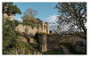

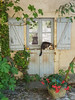


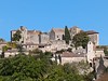
The above images may not be of the site on this page, but were taken nearby. They are loaded from Flickr so please click on them for image credits.
Click here to see more info for this site
Nearby sites
Click here to view sites on an interactive map of the areaKey: Red: member's photo, Blue: 3rd party photo, Yellow: other image, Green: no photo - please go there and take one, Grey: site destroyed
Download sites to:
KML (Google Earth)
GPX (GPS waypoints)
CSV (Garmin/Navman)
CSV (Excel)
To unlock full downloads you need to sign up as a Contributory Member. Otherwise downloads are limited to 50 sites.
Turn off the page maps and other distractions
Nearby sites listing. In the following links * = Image available
109m E 86° Dolmen du Pech 2* Burial Chamber or Dolmen
162m SSE 159° Dolmen du Pech 1.* Burial Chamber or Dolmen
165m E 101° Dolmen du Pech 3 Burial Chamber or Dolmen
1.3km ENE 70° Abris sous roche du château de Bruniquel* Cave or Rock Shelter
2.8km ESE 122° Grotte de Mayrière Supérieure Cave or Rock Shelter
2.9km ENE 59° Bruniquel Cave* Cave or Rock Shelter
5.0km NNE 27° Dolmen des Arrendies* Burial Chamber or Dolmen
5.7km E 90° Dolmen des Jasses * Burial Chamber or Dolmen
5.7km E 90° Ciste de la Jasse n°2* Cist
5.8km N 0° Dolmen de Brétou 1* Burial Chamber or Dolmen
6.0km NNE 20° Dolmen de La Barraque* Burial Chamber or Dolmen
6.2km N 11° Dolmen de la Forêt de la Garrigue du Loup* Burial Chamber or Dolmen
6.6km N 355° Dolmen de Brétou 2* Burial Chamber or Dolmen
6.7km NNE 30° Dolmen de Lautanel* Burial Chamber or Dolmen
6.7km ENE 56° Dolmen des Alberts* Burial Chamber or Dolmen
6.8km SE 142° Dolmen du Rouzet* Burial Chamber or Dolmen
6.9km N 5° Ciste du Loup* Cist
6.9km N 6° Dolmen de la Garrigue (Cazals)* Burial Chamber or Dolmen
7.1km NNE 24° Dolmen du Pech de Montgrès* Burial Chamber or Dolmen
7.1km NE 47° Ciste de Puech Moureau* Cist
7.3km NE 38° Dolmen de la Devèze de Barsalès* Burial Chamber or Dolmen
8.1km ENE 60° Dolmen de Suquets* Burial Chamber or Dolmen
8.4km N 357° Dolmen 2 de la Ferme du Frau* Burial Chamber or Dolmen
9.1km N 11° Dolmen du Pech (Cazals)* Burial Chamber or Dolmen
9.4km ENE 60° Dolmen de Martres de Bel-Air* Burial Chamber or Dolmen
View more nearby sites and additional images


 We would like to know more about this location. Please feel free to add a brief description and any relevant information in your own language.
 Wir möchten mehr über diese Stätte erfahren. Bitte zögern Sie nicht, eine kurze Beschreibung und relevante Informationen in Deutsch hinzuzufügen.
 Nous aimerions en savoir encore un peu sur les lieux. S'il vous plaît n'hesitez pas à ajouter une courte description et tous les renseignements pertinents dans votre propre langue.
 Quisieramos informarnos un poco más de las lugares. No dude en añadir una breve descripción y otros datos relevantes en su propio idioma.