


<< Text Pages >> La Feixa del Moro - Cist in Andorra
Submitted by KaiHofmann on Wednesday, 03 April 2013 Page Views: 3704
Neolithic and Bronze AgeSite Name: La Feixa del MoroCountry: Andorra
NOTE: This site is 14.224 km away from the location you searched for.
Type: Cist
Nearest Village: Juberri
Latitude: 42.440415N Longitude: 1.487967E
Condition:
| 5 | Perfect |
| 4 | Almost Perfect |
| 3 | Reasonable but with some damage |
| 2 | Ruined but still recognisable as an ancient site |
| 1 | Pretty much destroyed, possibly visible as crop marks |
| 0 | No data. |
| -1 | Completely destroyed |
| 5 | Superb |
| 4 | Good |
| 3 | Ordinary |
| 2 | Not Good |
| 1 | Awful |
| 0 | No data. |
| 5 | Can be driven to, probably with disabled access |
| 4 | Short walk on a footpath |
| 3 | Requiring a bit more of a walk |
| 2 | A long walk |
| 1 | In the middle of nowhere, a nightmare to find |
| 0 | No data. |
| 5 | co-ordinates taken by GPS or official recorded co-ordinates |
| 4 | co-ordinates scaled from a detailed map |
| 3 | co-ordinates scaled from a bad map |
| 2 | co-ordinates of the nearest village |
| 1 | co-ordinates of the nearest town |
| 0 | no data |
Internal Links:
External Links:
The only megalithic/neolithic tomb (cist) found so far in Andorra.
You may be viewing yesterday's version of this page. To see the most up to date information please register for a free account.
Do not use the above information on other web sites or publications without permission of the contributor.
Nearby Images from Flickr
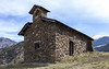
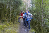
The above images may not be of the site on this page, but were taken nearby. They are loaded from Flickr so please click on them for image credits.
Click here to see more info for this site
Nearby sites
Click here to view sites on an interactive map of the areaKey: Red: member's photo, Blue: 3rd party photo, Yellow: other image, Green: no photo - please go there and take one, Grey: site destroyed
Download sites to:
KML (Google Earth)
GPX (GPS waypoints)
CSV (Garmin/Navman)
CSV (Excel)
To unlock full downloads you need to sign up as a Contributory Member. Otherwise downloads are limited to 50 sites.
Turn off the page maps and other distractions
Nearby sites listing. In the following links * = Image available
7.3km ESE 123° Dolmen de Coll Jovell Burial Chamber or Dolmen
7.4km SE 131° Dolmen de la Llosa Burial Chamber or Dolmen
8.8km SE 138° Dolmen Cabana del Moro de Bescaran Burial Chamber or Dolmen
13.7km SW 228° Dolmen Cabana de Moro de Sarcèdol Burial Chamber or Dolmen
14.7km WSW 245° Dolmen de Turbiàs Burial Chamber or Dolmen
15.4km SW 232° Dolmen de Coll de Jou Burial Chamber or Dolmen
15.8km SW 230° Dolmen de la Cabana del Moro d'Avellanet Burial Chamber or Dolmen
17.3km WSW 245° Dolmen de la Collada d'Orri Burial Chamber or Dolmen
19.7km WSW 243° Coll de Sant Magí Menhir Standing Stone (Menhir)
20.7km ESE 103° Dolmen Ca n'Orèn 2 Burial Chamber or Dolmen
21.1km ESE 103° Dolmen Ca n'Orèn 1 Burial Chamber or Dolmen
22.0km SSW 198° Dolmen del Coll d'Arnat Burial Chamber or Dolmen
22.3km SSW 203° Dolmen Tarter del Cap del Bosc Burial Chamber or Dolmen
22.7km SSW 203° Dolmen Tarter del Serrat dels Quadrats Burial Chamber or Dolmen
22.7km SSW 204° Cista Tarter del Serrat del Vent Burial Chamber or Dolmen
23.4km SSW 201° Dolmen Roca Foradada del Serrat de Trutxeu Burial Chamber or Dolmen
23.5km SSW 198° Dolmen El Cucut Burial Chamber or Dolmen
23.6km SSW 197° Dolmen Tarter del Cataplà Burial Chamber or Dolmen
24.1km WSW 244° Dolmen de Biscarbó* Burial Chamber or Dolmen
24.1km SSW 203° Dolmen Tarter del Passiró Burial Chamber or Dolmen
24.5km WSW 253° Santa Creu de Llagunes Ancient Village or Settlement
24.5km S 181° Dolmen de l'Espluga de la Bruixa* Burial Chamber or Dolmen
24.5km SSW 202° Dolmen Tarter del Clot de les Basses Burial Chamber or Dolmen
24.6km SSW 202° Cista Tarter del Clot de les Basses Burial Chamber or Dolmen
25.0km E 101° Coll de Fans Dolmen Burial Chamber or Dolmen
View more nearby sites and additional images


 We would like to know more about this location. Please feel free to add a brief description and any relevant information in your own language.
 Wir möchten mehr über diese Stätte erfahren. Bitte zögern Sie nicht, eine kurze Beschreibung und relevante Informationen in Deutsch hinzuzufügen.
 Nous aimerions en savoir encore un peu sur les lieux. S'il vous plaît n'hesitez pas à ajouter une courte description et tous les renseignements pertinents dans votre propre langue.
 Quisieramos informarnos un poco más de las lugares. No dude en añadir una breve descripción y otros datos relevantes en su propio idioma.