 with our Megalithic Portal iPhone app")


<< Our Photo Pages >> Dolmen de Sainte-Marie - Burial Chamber or Dolmen in France in Limousin:Haute-Vienne (87)
Submitted by TheCaptain on Saturday, 16 April 2005 Page Views: 4113
Neolithic and Bronze AgeSite Name: Dolmen de Sainte-MarieCountry: France
NOTE: This site is 6.335 km away from the location you searched for.
Département: Limousin:Haute-Vienne (87) Type: Burial Chamber or Dolmen
Nearest Town: Limoges Nearest Village: Châteauneuf-la-Forêt
Latitude: 45.705455N Longitude: 1.605750E
Condition:
| 5 | Perfect |
| 4 | Almost Perfect |
| 3 | Reasonable but with some damage |
| 2 | Ruined but still recognisable as an ancient site |
| 1 | Pretty much destroyed, possibly visible as crop marks |
| 0 | No data. |
| -1 | Completely destroyed |
| 5 | Superb |
| 4 | Good |
| 3 | Ordinary |
| 2 | Not Good |
| 1 | Awful |
| 0 | No data. |
| 5 | Can be driven to, probably with disabled access |
| 4 | Short walk on a footpath |
| 3 | Requiring a bit more of a walk |
| 2 | A long walk |
| 1 | In the middle of nowhere, a nightmare to find |
| 0 | No data. |
| 5 | co-ordinates taken by GPS or official recorded co-ordinates |
| 4 | co-ordinates scaled from a detailed map |
| 3 | co-ordinates scaled from a bad map |
| 2 | co-ordinates of the nearest village |
| 1 | co-ordinates of the nearest town |
| 0 | no data |
Be the first person to rate this site - see the 'Contribute!' box in the right hand menu.
Internal Links:
External Links:
")
Location Source: T4T35.fr
You may be viewing yesterday's version of this page. To see the most up to date information please register for a free account.
Do not use the above information on other web sites or publications without permission of the contributor.
Nearby Images from Flickr
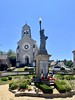
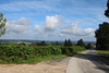
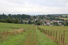
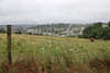
The above images may not be of the site on this page, but were taken nearby. They are loaded from Flickr so please click on them for image credits.
Click here to see more info for this site
Nearby sites
Click here to view sites on an interactive map of the areaKey: Red: member's photo, Blue: 3rd party photo, Yellow: other image, Green: no photo - please go there and take one, Grey: site destroyed
Download sites to:
KML (Google Earth)
GPX (GPS waypoints)
CSV (Garmin/Navman)
CSV (Excel)
To unlock full downloads you need to sign up as a Contributory Member. Otherwise downloads are limited to 50 sites.
Turn off the page maps and other distractions
Nearby sites listing. In the following links * = Image available
9.5km NNW 340° Camp de César de Villejoubert Ancient Village or Settlement
10.1km NNW 331° Dolmen de la Valade Burial Chamber or Dolmen
13.8km WNW 293° Métayer menhir 1* Standing Stone (Menhir)
13.9km S 185° Dolmen du Reineix* Burial Chamber or Dolmen
13.9km WNW 293° Métayer menhir 2* Standing Stone (Menhir)
13.9km NW 320° Dolmen du Pouyol* Burial Chamber or Dolmen
14.2km N 349° Pierre Borne Standing Stone (Menhir)
18.0km SW 224° Dolmen de la Villedieu Burial Chamber or Dolmen
19.8km WNW 304° Dolmen dit la Pierre Muret Burial Chamber or Dolmen
19.9km ENE 64° Tumulus de Puy de la Besse* Barrow Cemetery
21.8km N 11° Dolmen de la Gardelle Burial Chamber or Dolmen
23.2km WSW 239° Dolmen de Fayat Burial Chamber or Dolmen
24.3km N 8° Menhir des Clides Standing Stone (Menhir)
24.4km NW 316° Menhir de Fountalino Standing Stone (Menhir)
24.6km SW 230° Alignement du Pré d'Avant-Clédie Stone Row / Alignment
25.0km N 354° Dolmen dit la Table des Chasseurs Burial Chamber or Dolmen
25.8km SW 231° Menhir de Lugin Standing Stone (Menhir)
26.8km SSW 199° Dolmen de la Vernouille Burial Chamber or Dolmen
27.2km SE 145° Pierre des Druides (Affieux)* Burial Chamber or Dolmen
27.3km WNW 303° Dolmen de Forest Burial Chamber or Dolmen
28.7km WSW 245° Pierre Levée de La Roche-l'Abeille* Burial Chamber or Dolmen
31.4km WNW 291° Dolmen d'Envaud 1 Burial Chamber or Dolmen
31.5km WNW 291° Dolmen d'Envaud 2 Burial Chamber or Dolmen
31.5km ENE 74° Menhir de la Femme Morte Standing Stone (Menhir)
31.5km S 182° Dolmen dit La Maison du Loup* Burial Chamber or Dolmen
View more nearby sites and additional images


 We would like to know more about this location. Please feel free to add a brief description and any relevant information in your own language.
 Wir möchten mehr über diese Stätte erfahren. Bitte zögern Sie nicht, eine kurze Beschreibung und relevante Informationen in Deutsch hinzuzufügen.
 Nous aimerions en savoir encore un peu sur les lieux. S'il vous plaît n'hesitez pas à ajouter une courte description et tous les renseignements pertinents dans votre propre langue.
 Quisieramos informarnos un poco más de las lugares. No dude en añadir una breve descripción y otros datos relevantes en su propio idioma.