


<< Our Photo Pages >> Pou de Forada - Holy Well or Sacred Spring in Spain in Balearic Isles (Ibiza)
Submitted by HOLYWELL on Wednesday, 23 August 2006 Page Views: 3475
Springs and Holy WellsSite Name: Pou de ForadaCountry: Spain
NOTE: This site is 5.598 km away from the location you searched for.
Region: Balearic Isles (Ibiza) Type: Holy Well or Sacred Spring
Nearest Town: San Antonio Nearest Village: San Antonio
Latitude: 38.993430N Longitude: 1.365630E
Condition:
| 5 | Perfect |
| 4 | Almost Perfect |
| 3 | Reasonable but with some damage |
| 2 | Ruined but still recognisable as an ancient site |
| 1 | Pretty much destroyed, possibly visible as crop marks |
| 0 | No data. |
| -1 | Completely destroyed |
| 5 | Superb |
| 4 | Good |
| 3 | Ordinary |
| 2 | Not Good |
| 1 | Awful |
| 0 | No data. |
| 5 | Can be driven to, probably with disabled access |
| 4 | Short walk on a footpath |
| 3 | Requiring a bit more of a walk |
| 2 | A long walk |
| 1 | In the middle of nowhere, a nightmare to find |
| 0 | No data. |
| 5 | co-ordinates taken by GPS or official recorded co-ordinates |
| 4 | co-ordinates scaled from a detailed map |
| 3 | co-ordinates scaled from a bad map |
| 2 | co-ordinates of the nearest village |
| 1 | co-ordinates of the nearest town |
| 0 | no data |
Internal Links:
External Links:
")
This is a large chapel well which has a large opening and two basins beside it. A dance or Pegasa is held here on the second Sunday of October. It is sign posted off the road, and easy to find.
You may be viewing yesterday's version of this page. To see the most up to date information please register for a free account.
Do not use the above information on other web sites or publications without permission of the contributor.
Nearby Images from Flickr
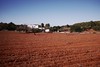
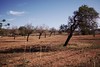
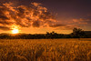
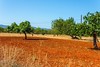
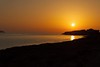
The above images may not be of the site on this page, but were taken nearby. They are loaded from Flickr so please click on them for image credits.
Click here to see more info for this site
Nearby sites
Click here to view sites on an interactive map of the areaKey: Red: member's photo, Blue: 3rd party photo, Yellow: other image, Green: no photo - please go there and take one, Grey: site destroyed
Download sites to:
KML (Google Earth)
GPX (GPS waypoints)
CSV (Garmin/Navman)
CSV (Excel)
To unlock full downloads you need to sign up as a Contributory Member. Otherwise downloads are limited to 50 sites.
Turn off the page maps and other distractions
Nearby sites listing. In the following links * = Image available
8.7km SSW 210° Font de Verger* Holy Well or Sacred Spring
9.5km NNE 32° Font des ses Torres Holy Well or Sacred Spring
9.6km ENE 62° Pou d’Albarqueta Holy Well or Sacred Spring
11.1km SSE 150° Puig Des Molins* Museum
11.2km ENE 67° Font de Balafi* Holy Well or Sacred Spring
11.7km SSE 167° Pou Roig* Holy Well or Sacred Spring
13.7km NE 53° Pou de Labritja* Holy Well or Sacred Spring
14.3km S 191° Sa Caleta Ancient Village or Settlement
14.8km SSW 213° Font den Xiquet* Holy Well or Sacred Spring
16.4km NE 52° Pou des Baladre* Holy Well or Sacred Spring
17.8km ENE 76° Font de Peralta* Holy Well or Sacred Spring
21.0km ENE 62° Cova d'Es Cuieram Cave or Rock Shelter
30.5km SSE 167° Ca Na Costa* Passage Grave
111.7km ENE 59° Poblat del Puig de sa Morisca* Ancient Village or Settlement
112.0km ENE 59° Talayot de Son Miralles* Broch or Nuraghe
112.0km ENE 59° Túmulo de Son Miralles* Artificial Mound
112.1km ENE 59° Santa Ponça 5* Ancient Village or Settlement
112.3km ENE 59° Santa Ponça 20* Ancient Village or Settlement
112.3km ENE 60° Túmulo de Son Ferrer* Round Barrow(s)
114.5km ENE 60° Naveta Alemany* Ancient Village or Settlement
127.7km ENE 60° Museu de Mallorca* Museum
130.9km ENE 62° Son Oms santuario* Ancient Temple
131.3km NE 53° Son Oleza Ancient Village or Settlement
132.9km NE 53° The Maze, Mallorca Ancient Village or Settlement
133.3km NE 53° Son Mas* Ancient Temple
View more nearby sites and additional images


 We would like to know more about this location. Please feel free to add a brief description and any relevant information in your own language.
 Wir möchten mehr über diese Stätte erfahren. Bitte zögern Sie nicht, eine kurze Beschreibung und relevante Informationen in Deutsch hinzuzufügen.
 Nous aimerions en savoir encore un peu sur les lieux. S'il vous plaît n'hesitez pas à ajouter une courte description et tous les renseignements pertinents dans votre propre langue.
 Quisieramos informarnos un poco más de las lugares. No dude en añadir una breve descripción y otros datos relevantes en su propio idioma.