


<< Other Photo Pages >> Ca Na Costa - Passage Grave in Spain in Balearic Isles (Formentera)
Submitted by davidmorgan on Thursday, 22 January 2015 Page Views: 2537
Neolithic and Bronze AgeSite Name: Ca Na CostaCountry: Spain
NOTE: This site is 2.598 km away from the location you searched for.
Region: Balearic Isles (Formentera) Type: Passage Grave
Nearest Town: Es Pujols
Latitude: 38.726535N Longitude: 1.445766E
Condition:
| 5 | Perfect |
| 4 | Almost Perfect |
| 3 | Reasonable but with some damage |
| 2 | Ruined but still recognisable as an ancient site |
| 1 | Pretty much destroyed, possibly visible as crop marks |
| 0 | No data. |
| -1 | Completely destroyed |
| 5 | Superb |
| 4 | Good |
| 3 | Ordinary |
| 2 | Not Good |
| 1 | Awful |
| 0 | No data. |
| 5 | Can be driven to, probably with disabled access |
| 4 | Short walk on a footpath |
| 3 | Requiring a bit more of a walk |
| 2 | A long walk |
| 1 | In the middle of nowhere, a nightmare to find |
| 0 | No data. |
| 5 | co-ordinates taken by GPS or official recorded co-ordinates |
| 4 | co-ordinates scaled from a detailed map |
| 3 | co-ordinates scaled from a bad map |
| 2 | co-ordinates of the nearest village |
| 1 | co-ordinates of the nearest town |
| 0 | no data |
Internal Links:
External Links:
")
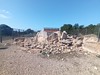
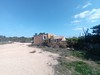
Dating from the Early Bronze Age (2000 - 1600 BCE), this is the oldest tomb in the Balearic Islands. It consists of a circular chamber with access passage and is surrounded by two concentric circles of paving stones.
Excavations discovered eight bodies, six men and two women, and also ceramics.
You may be viewing yesterday's version of this page. To see the most up to date information please register for a free account.
")
Do not use the above information on other web sites or publications without permission of the contributor.
Nearby Images from Flickr
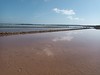
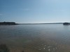
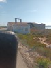
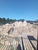
The above images may not be of the site on this page, but were taken nearby. They are loaded from Flickr so please click on them for image credits.
Click here to see more info for this site
Nearby sites
Click here to view sites on an interactive map of the areaKey: Red: member's photo, Blue: 3rd party photo, Yellow: other image, Green: no photo - please go there and take one, Grey: site destroyed
Download sites to:
KML (Google Earth)
GPX (GPS waypoints)
CSV (Garmin/Navman)
CSV (Excel)
To unlock full downloads you need to sign up as a Contributory Member. Otherwise downloads are limited to 50 sites.
Turn off the page maps and other distractions
Nearby sites listing. In the following links * = Image available
18.3km NNW 328° Sa Caleta Ancient Village or Settlement
18.8km NNW 347° Pou Roig* Holy Well or Sacred Spring
20.1km N 356° Puig Des Molins* Museum
22.8km NW 319° Font den Xiquet* Holy Well or Sacred Spring
24.9km NNW 333° Font de Verger* Holy Well or Sacred Spring
30.5km NNW 347° Pou de Forada* Holy Well or Sacred Spring
34.2km N 3° Pou d’Albarqueta Holy Well or Sacred Spring
34.2km N 6° Font de Balafi* Holy Well or Sacred Spring
35.6km NNE 17° Font de Peralta* Holy Well or Sacred Spring
37.7km N 357° Font des ses Torres Holy Well or Sacred Spring
38.1km N 6° Pou de Labritja* Holy Well or Sacred Spring
40.1km N 9° Pou des Baladre* Holy Well or Sacred Spring
41.3km NNE 16° Cova d'Es Cuieram Cave or Rock Shelter
124.6km NE 45° Poblat del Puig de sa Morisca* Ancient Village or Settlement
124.6km NE 46° Túmulo de Son Ferrer* Round Barrow(s)
124.7km NE 46° Talayot de Son Miralles* Broch or Nuraghe
124.7km NE 46° Túmulo de Son Miralles* Artificial Mound
124.9km NE 46° Santa Ponça 5* Ancient Village or Settlement
125.0km NE 46° Santa Ponça 20* Ancient Village or Settlement
126.6km NE 47° Naveta Alemany* Ancient Village or Settlement
139.8km NE 48° Museu de Mallorca* Museum
140.5km ENE 57° Capocorb Vell* Ancient Village or Settlement
140.7km ENE 59° Talaies de Cala Pi* Ancient Village or Settlement
141.9km NE 50° Son Oms santuario* Ancient Temple
143.1km WNW 281° Archaeological Museum of Gandia Museum
View more nearby sites and additional images

")
 We would like to know more about this location. Please feel free to add a brief description and any relevant information in your own language.
 Wir möchten mehr über diese Stätte erfahren. Bitte zögern Sie nicht, eine kurze Beschreibung und relevante Informationen in Deutsch hinzuzufügen.
 Nous aimerions en savoir encore un peu sur les lieux. S'il vous plaît n'hesitez pas à ajouter une courte description et tous les renseignements pertinents dans votre propre langue.
 Quisieramos informarnos un poco más de las lugares. No dude en añadir una breve descripción y otros datos relevantes en su propio idioma.