

, Aubrey Burl")
<< Other Photo Pages >> Musée Archéologique de Toulouse - Museum in France in Midi:Haute-Garonne (31)
Submitted by TheCaptain on Thursday, 10 February 2005 Page Views: 3694
MuseumsSite Name: Musée Archéologique de ToulouseCountry: France
NOTE: This site is 0.528 km away from the location you searched for.
Département: Midi:Haute-Garonne (31) Type: Museum
Nearest Town: Toulouse Nearest Village: Toulouse
Latitude: 43.595405N Longitude: 1.442898E
Condition:
| 5 | Perfect |
| 4 | Almost Perfect |
| 3 | Reasonable but with some damage |
| 2 | Ruined but still recognisable as an ancient site |
| 1 | Pretty much destroyed, possibly visible as crop marks |
| 0 | No data. |
| -1 | Completely destroyed |
| 5 | Superb |
| 4 | Good |
| 3 | Ordinary |
| 2 | Not Good |
| 1 | Awful |
| 0 | No data. |
| 5 | Can be driven to, probably with disabled access |
| 4 | Short walk on a footpath |
| 3 | Requiring a bit more of a walk |
| 2 | A long walk |
| 1 | In the middle of nowhere, a nightmare to find |
| 0 | No data. |
| 5 | co-ordinates taken by GPS or official recorded co-ordinates |
| 4 | co-ordinates scaled from a detailed map |
| 3 | co-ordinates scaled from a bad map |
| 2 | co-ordinates of the nearest village |
| 1 | co-ordinates of the nearest town |
| 0 | no data |
Be the first person to rate this site - see the 'Contribute!' box in the right hand menu.
Internal Links:
External Links:
Museum in Haute-Garonne
Address: L'Institut Catholique, 31 Rue de la Fonderie
Phone: 05 61 36 81 00
You may be viewing yesterday's version of this page. To see the most up to date information please register for a free account.
Do not use the above information on other web sites or publications without permission of the contributor.
davidmorgan has found this location on Google Street View:
Nearby Images from Flickr


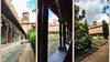
The above images may not be of the site on this page, but were taken nearby. They are loaded from Flickr so please click on them for image credits.
Click here to see more info for this site
Nearby sites
Click here to view sites on an interactive map of the areaKey: Red: member's photo, Blue: 3rd party photo, Yellow: other image, Green: no photo - please go there and take one, Grey: site destroyed
Download sites to:
KML (Google Earth)
GPX (GPS waypoints)
CSV (Garmin/Navman)
CSV (Excel)
To unlock full downloads you need to sign up as a Contributory Member. Otherwise downloads are limited to 50 sites.
Turn off the page maps and other distractions
Nearby sites listing. In the following links * = Image available
1.3km ESE 111° Musée Georges Labit* Museum
1.4km N 354° Musée Saint-Raymond* Museum
4.7km WNW 304° Saint Michel du Touch Ancient Mine, Quarry or other Industry
49.0km S 180° Abri de Buhuloup Cave or Rock Shelter
49.8km ESE 105° Menhirs des Lattes* Standing Stones
50.2km NNE 25° Dolmen du Rouzet* Burial Chamber or Dolmen
51.8km ESE 111° Menhir de Peyre Basal* Standing Stone (Menhir)
53.0km NNE 21° Grotte de Mayrière Supérieure Cave or Rock Shelter
53.2km E 100° Menhir des Rivals* Standing Stone (Menhir)
53.5km NNE 18° Dolmen du Pech 1.* Burial Chamber or Dolmen
53.5km NE 34° Saint-Paul Dolmen* Burial Chamber or Dolmen
53.6km NNE 18° Dolmen du Pech 10* Burial Chamber or Dolmen
53.6km NNE 18° Dolmen du Pech 3 Burial Chamber or Dolmen
53.6km NNE 18° Dolmen du Pech 2* Burial Chamber or Dolmen
53.7km ESE 108° Berniquaut Oppidum Ancient Village or Settlement
53.8km NNE 31° Dolmen de Peyre Longue* Burial Chamber or Dolmen
53.9km NE 38° Dolmen d'Istricou* Burial Chamber or Dolmen
54.3km ESE 109° Peyre-Ficade la Privade * Standing Stone (Menhir)
54.4km NNE 19° Abris sous roche du château de Bruniquel* Cave or Rock Shelter
54.6km ESE 108° Grotte du Calel* Cave or Rock Shelter
54.8km ESE 109° Menhir de Jacournassy* Standing Stone (Menhir)
55.3km NE 38° Menhir Ste Carissime* Standing Stone (Menhir)
55.5km S 188° Dolmen de Balignas Burial Chamber or Dolmen
55.7km NE 34° Dolmen dit la Peyra Levada* Burial Chamber or Dolmen
55.7km NNE 24° Dolmen des Jasses * Burial Chamber or Dolmen
View more nearby sites and additional images


 We would like to know more about this location. Please feel free to add a brief description and any relevant information in your own language.
 Wir möchten mehr über diese Stätte erfahren. Bitte zögern Sie nicht, eine kurze Beschreibung und relevante Informationen in Deutsch hinzuzufügen.
 Nous aimerions en savoir encore un peu sur les lieux. S'il vous plaît n'hesitez pas à ajouter une courte description et tous les renseignements pertinents dans votre propre langue.
 Quisieramos informarnos un poco más de las lugares. No dude en añadir una breve descripción y otros datos relevantes en su propio idioma.