

<< Other Photo Pages >> Venta Icenorum - Ancient Village or Settlement in England in Norfolk
Submitted by Andy B on Wednesday, 16 September 2020 Page Views: 14497
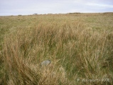
Multi-periodSite Name: Venta IcenorumCountry: England
NOTE: This site is 4.698 km away from the location you searched for.
County: Norfolk Type: Ancient Village or Settlement
Nearest Town: Caistor Roman Town Nearest Village: Caistor St. Edmund
Map Ref: TG230034
Latitude: 52.582647N Longitude: 1.290178E
Condition:
| 5 | Perfect |
| 4 | Almost Perfect |
| 3 | Reasonable but with some damage |
| 2 | Ruined but still recognisable as an ancient site |
| 1 | Pretty much destroyed, possibly visible as crop marks |
| 0 | No data. |
| -1 | Completely destroyed |
| 5 | Superb |
| 4 | Good |
| 3 | Ordinary |
| 2 | Not Good |
| 1 | Awful |
| 0 | No data. |
| 5 | Can be driven to, probably with disabled access |
| 4 | Short walk on a footpath |
| 3 | Requiring a bit more of a walk |
| 2 | A long walk |
| 1 | In the middle of nowhere, a nightmare to find |
| 0 | No data. |
| 5 | co-ordinates taken by GPS or official recorded co-ordinates |
| 4 | co-ordinates scaled from a detailed map |
| 3 | co-ordinates scaled from a bad map |
| 2 | co-ordinates of the nearest village |
| 1 | co-ordinates of the nearest town |
| 0 | no data |
Internal Links:
External Links:
I have visited· I would like to visit
seadog visited on 1st Jan 1957 - their rating: Cond: 3 Amb: 4 Access: 4 My grandfather farmed the site in the 50's and 60's. I remember finding spades from illegal diggers. I still have some coins from the site. I believe the Roman temple was not at Venta Icenorum itself but 800m to the NE.
myf have visited here
")
The Iceni had close ties with their neighbouring tribe the Trinovantes to the south and possibly also with the civilised Coritani to the north-west, and their former adversaries the Catuvellauni lay to the south-west. It is suggested there might have been an Iron Age settlement on the Roman grounds prior to the Roman settlement, which will hopefully be revealed by forthcoming excavations.
More: Roman Britain
Note: Dig post excavation confirms "one of the largest" temple buildings in Roman Britain, full details in the comments on our page, along with what there is to see now at Venta Icenorum
You may be viewing yesterday's version of this page. To see the most up to date information please register for a free account.
")
")
")
")
")
")
")
")
")
")
")
")
")
")
")
")
")
Do not use the above information on other web sites or publications without permission of the contributor.
Click here to see more info for this site
Nearby sites
Key: Red: member's photo, Blue: 3rd party photo, Yellow: other image, Green: no photo - please go there and take one, Grey: site destroyed
Download sites to:
KML (Google Earth)
GPX (GPS waypoints)
CSV (Garmin/Navman)
CSV (Excel)
To unlock full downloads you need to sign up as a Contributory Member. Otherwise downloads are limited to 50 sites.
Turn off the page maps and other distractions
Nearby sites listing. In the following links * = Image available
2.8km NNE 24° Arminghall Henge* Henge (TG240060)
3.2km NNW 330° Eaton Heath Barrow Cemetery (TG21280605)
5.1km N 4° Norwich Castle Museum and Art Gallery* Museum (TG231085)
7.9km SSW 204° Tasburgh Fort* Hillfort (TM201960)
9.3km NW 308° St Walstan's Well* Holy Well or Sacred Spring (TG15350878)
9.3km NW 321° Roundwell* Holy Well or Sacred Spring (TG168104)
12.6km W 264° St Thomas's Well (Wymondham)* Holy Well or Sacred Spring (TG10550146)
15.0km NNW 346° Horsford Woods Barrow Cemetary* Barrow Cemetery (TG18571780)
16.6km SE 139° Broome Heath Long Barrow Long Barrow (TM344913)
17.3km SE 145° Druid's Stone (Bungay)* Natural Stone / Erratic / Other Natural Feature (TM3366689739)
17.9km ESE 122° Stockton Stone* Standing Stone (Menhir) (TM386946)
18.0km NNW 328° Alderford Common Barrow Round Barrow(s) (TG12751828)
18.6km SSE 160° Flixton Park Quarry Timber Circle (TM303863)
18.6km NW 324° The Warren Barrow Round Barrow(s) (TG11371798)
21.8km N 349° Maiden's Head* Holy Well or Sacred Spring (TG178246)
24.3km NNW 326° Pettywell* Holy Well or Sacred Spring (TG086230)
24.3km E 90° Burgh Castle Shore Fort Stone Fort or Dun (TG474044)
24.7km NNE 31° Devil's Ditch Ancient Trackway (TG347252)
25.0km E 98° Bell Hill Round Barrow(s) (TG480010)
25.0km E 98° Mill Hill Round Barrow(s) (TG480010)
25.2km WSW 241° Gallows Hill Tumulus Round Barrow(s) (TM01419019)
25.6km SW 235° Vikings Mound* Artificial Mound (TM02678781)
26.0km SSW 208° Diss Museum* Museum (TM1171179980)
26.2km WNW 295° St Withburga's Well* Holy Well or Sacred Spring (TF9865213305)
26.8km SSW 193° St. Edmund's Cross Ancient Cross (TM1877)
View more nearby sites and additional images


 We would like to know more about this location. Please feel free to add a brief description and any relevant information in your own language.
 Wir möchten mehr über diese Stätte erfahren. Bitte zögern Sie nicht, eine kurze Beschreibung und relevante Informationen in Deutsch hinzuzufügen.
 Nous aimerions en savoir encore un peu sur les lieux. S'il vous plaît n'hesitez pas à ajouter une courte description et tous les renseignements pertinents dans votre propre langue.
 Quisieramos informarnos un poco más de las lugares. No dude en añadir una breve descripción y otros datos relevantes en su propio idioma.