 with our Megalithic Portal iPhone app")


<< Text Pages >> Musée Archéologique Blois - Museum in France in Centre:Loire-et-Cher (41)
Submitted by TheCaptain on Saturday, 16 April 2005 Page Views: 2565
MuseumsSite Name: Musée Archéologique BloisCountry: France
NOTE: This site is 0.943 km away from the location you searched for.
Département: Centre:Loire-et-Cher (41) Type: Museum
Nearest Town: Blois
Latitude: 47.585624N Longitude: 1.330832E
Condition:
| 5 | Perfect |
| 4 | Almost Perfect |
| 3 | Reasonable but with some damage |
| 2 | Ruined but still recognisable as an ancient site |
| 1 | Pretty much destroyed, possibly visible as crop marks |
| 0 | No data. |
| -1 | Completely destroyed |
| 5 | Superb |
| 4 | Good |
| 3 | Ordinary |
| 2 | Not Good |
| 1 | Awful |
| 0 | No data. |
| 5 | Can be driven to, probably with disabled access |
| 4 | Short walk on a footpath |
| 3 | Requiring a bit more of a walk |
| 2 | A long walk |
| 1 | In the middle of nowhere, a nightmare to find |
| 0 | No data. |
| 5 | co-ordinates taken by GPS or official recorded co-ordinates |
| 4 | co-ordinates scaled from a detailed map |
| 3 | co-ordinates scaled from a bad map |
| 2 | co-ordinates of the nearest village |
| 1 | co-ordinates of the nearest town |
| 0 | no data |
Internal Links:
External Links:
Museum in Loire-et-Cher
In the Château de Blois.
You may be viewing yesterday's version of this page. To see the most up to date information please register for a free account.
Do not use the above information on other web sites or publications without permission of the contributor.
Nearby Images from Flickr
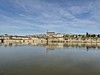
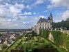
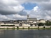
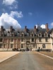
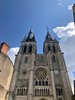
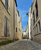
The above images may not be of the site on this page, but were taken nearby. They are loaded from Flickr so please click on them for image credits.
Click here to see more info for this site
Nearby sites
Click here to view sites on an interactive map of the areaKey: Red: member's photo, Blue: 3rd party photo, Yellow: other image, Green: no photo - please go there and take one, Grey: site destroyed
Download sites to:
KML (Google Earth)
GPX (GPS waypoints)
CSV (Garmin/Navman)
CSV (Excel)
To unlock full downloads you need to sign up as a Contributory Member. Otherwise downloads are limited to 50 sites.
Turn off the page maps and other distractions
Nearby sites listing. In the following links * = Image available
6.7km E 91° Menhir des Grotteaux Standing Stone (Menhir)
8.9km NNW 341° Menhir dit la Pierre du Diable Standing Stone (Menhir)
8.9km NNW 341° Nécropole de la Grand Mesle 2* Chambered Tomb
8.9km NNW 340° Nécropole de la Grand Mesle 1* Chambered Tomb
9.6km NNW 341° Menhir du Bois du petit Vitain Burial Chamber or Dolmen
9.7km N 357° Menhir de la Grande Pierre (Averdon)* Standing Stone (Menhir)
10.0km NNW 327° La Pierre Levée (Chapelle-Vendômoise)* Burial Chamber or Dolmen
10.4km NW 309° Dolmen de la Fontaine (Russy) Burial Chamber or Dolmen
12.7km NW 312° Dolmen de Bourges Burial Chamber or Dolmen
13.2km NW 307° Dolmen de la Carrière* Burial Chamber or Dolmen
13.4km NW 308° Dolmen de la Pie Burial Chamber or Dolmen
14.1km ENE 56° Souterrain de Saint-Dye Cave or Rock Shelter
14.2km WNW 302° Pierre Levée de la Glandée Burial Chamber or Dolmen
22.6km NNW 329° Dolmen de Cornevache Burial Chamber or Dolmen
23.5km NNE 18° Sixtre menhir Standing Stone (Menhir)
23.6km SSW 191° Dolmen dit de la Pierre de Minuit* Burial Chamber or Dolmen
24.1km SE 143° Les Montanjons tumuli Chambered Tomb
24.1km SE 143° Tertre tumulus Chambered Tomb
24.2km WSW 237° La Pierre David* Standing Stone (Menhir)
25.1km NW 306° Dolmen du Plateau de la Petite Beauce Burial Chamber or Dolmen
25.1km NW 306° Petit Fontenail polissoir* Polissoir
26.7km NW 306° Dolmen des Tatonneries Burial Chamber or Dolmen
26.8km NE 49° Dolmen du Ver Burial Chamber or Dolmen
27.8km ESE 110° les Châteliers Oppidum Ancient Village or Settlement
27.9km NE 43° Dolmen dit la Pierre du Vert-Galant Burial Chamber or Dolmen
View more nearby sites and additional images


 We would like to know more about this location. Please feel free to add a brief description and any relevant information in your own language.
 Wir möchten mehr über diese Stätte erfahren. Bitte zögern Sie nicht, eine kurze Beschreibung und relevante Informationen in Deutsch hinzuzufügen.
 Nous aimerions en savoir encore un peu sur les lieux. S'il vous plaît n'hesitez pas à ajouter une courte description et tous les renseignements pertinents dans votre propre langue.
 Quisieramos informarnos un poco más de las lugares. No dude en añadir una breve descripción y otros datos relevantes en su propio idioma.