 with our Megalithic Portal iPhone app")


<< Our Photo Pages >> Dolmen du Bois de Barde - Cist in France in Aquitaine:Dordogne (24)
Submitted by LaDragonne on Saturday, 10 December 2022 Page Views: 461
Neolithic and Bronze AgeSite Name: Dolmen du Bois de BardeCountry: France
NOTE: This site is 5.144 km away from the location you searched for.
Département: Aquitaine:Dordogne (24) Type: Cist
Nearest Town: Sarlat-la-Canéda Nearest Village: St Crépin et Carlucet
Latitude: 44.937830N Longitude: 1.284960E
Condition:
| 5 | Perfect |
| 4 | Almost Perfect |
| 3 | Reasonable but with some damage |
| 2 | Ruined but still recognisable as an ancient site |
| 1 | Pretty much destroyed, possibly visible as crop marks |
| 0 | No data. |
| -1 | Completely destroyed |
| 5 | Superb |
| 4 | Good |
| 3 | Ordinary |
| 2 | Not Good |
| 1 | Awful |
| 0 | No data. |
| 5 | Can be driven to, probably with disabled access |
| 4 | Short walk on a footpath |
| 3 | Requiring a bit more of a walk |
| 2 | A long walk |
| 1 | In the middle of nowhere, a nightmare to find |
| 0 | No data. |
| 5 | co-ordinates taken by GPS or official recorded co-ordinates |
| 4 | co-ordinates scaled from a detailed map |
| 3 | co-ordinates scaled from a bad map |
| 2 | co-ordinates of the nearest village |
| 1 | co-ordinates of the nearest town |
| 0 | no data |
Internal Links:
External Links:
")
Sépulture mégalithique d'1m sur 1m environ. Une seule dalle de chevet; les autres parois sont en pierres plates empilées.
À flanc de colline et orientée est.
L'accès se fait en prenant un chemin rural cadastré à partir du hameau de Langlade. Le dolmen sera à 20m sur la droite dans le bois.
You may be viewing yesterday's version of this page. To see the most up to date information please register for a free account.
Do not use the above information on other web sites or publications without permission of the contributor.
Nearby Images from Flickr
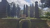
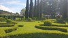
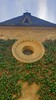
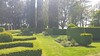
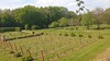
The above images may not be of the site on this page, but were taken nearby. They are loaded from Flickr so please click on them for image credits.
Click here to see more info for this site
Nearby sites
Click here to view sites on an interactive map of the areaKey: Red: member's photo, Blue: 3rd party photo, Yellow: other image, Green: no photo - please go there and take one, Grey: site destroyed
Download sites to:
KML (Google Earth)
GPX (GPS waypoints)
CSV (Garmin/Navman)
CSV (Excel)
To unlock full downloads you need to sign up as a Contributory Member. Otherwise downloads are limited to 50 sites.
Turn off the page maps and other distractions
Nearby sites listing. In the following links * = Image available
8.6km ESE 114° Dolmen de Malcepiot* Burial Chamber or Dolmen
9.3km ENE 70° Polissoirs de La Bague 2* Polissoir
9.3km ENE 70° Polissoirs de La Bague 1* Polissoir
10.0km ENE 73° Dolmen du Fraysset* Burial Chamber or Dolmen
11.1km WSW 243° La Croix Petite menhir* Standing Stone (Menhir)
11.6km SSW 213° Pierre du Diable (Vitrac)* Burial Chamber or Dolmen
11.7km WSW 256° Grotte de Puymartin Cave or Rock Shelter
13.0km WSW 255° Abri du Pas-Estrét Cave or Rock Shelter
13.6km E 101° Dolmen de Laval.* Burial Chamber or Dolmen
14.1km W 274° Abri de Laussel* Cave or Rock Shelter
14.4km W 272° Grotte de Commarque* Cave or Rock Shelter
14.5km SSW 192° Giverzac Dolmen* Burial Chamber or Dolmen
14.8km ESE 113° Dolmen de Cieurac Burial Chamber or Dolmen
14.8km SW 220° Grotte du Roc de Vezac Cave or Rock Shelter
14.8km W 273° Abri du Cap-Blanc* Cave or Rock Shelter
15.3km SW 226° Parc Archéologique de Beynac Museum
15.4km W 273° Abri de la Grèze Cave or Rock Shelter
15.4km SSW 198° Grotte du Pigeonnier Cave or Rock Shelter
15.5km NNW 327° Le Rigourdou* Cave or Rock Shelter
15.7km NW 325° Grotte de Lascaux* Cave or Rock Shelter
15.8km SSW 196° Grotte du Mammouth Cave or Rock Shelter
15.9km NW 324° Grotte de Lascaux 2* Cave or Rock Shelter
16.0km WNW 295° Abri Castanet Cave or Rock Shelter
16.0km SSW 200° Grotte de la Martine Cave or Rock Shelter
16.0km WNW 295° Abri Reverdit Cave or Rock Shelter
View more nearby sites and additional images


 We would like to know more about this location. Please feel free to add a brief description and any relevant information in your own language.
 Wir möchten mehr über diese Stätte erfahren. Bitte zögern Sie nicht, eine kurze Beschreibung und relevante Informationen in Deutsch hinzuzufügen.
 Nous aimerions en savoir encore un peu sur les lieux. S'il vous plaît n'hesitez pas à ajouter une courte description et tous les renseignements pertinents dans votre propre langue.
 Quisieramos informarnos un poco más de las lugares. No dude en añadir una breve descripción y otros datos relevantes en su propio idioma.