 with our Megalithic Portal iPhone app")


<< Text Pages >> Whinless Down Barrows - Round Barrow(s) in England in Kent
Submitted by coldrum on Sunday, 04 May 2008 Page Views: 5061
Neolithic and Bronze AgeSite Name: Whinless Down BarrowsCountry: England
NOTE: This site is 2.553 km away from the location you searched for.
County: Kent Type: Round Barrow(s)
Nearest Town: Dover
Map Ref: TR29514167
Latitude: 51.128299N Longitude: 1.278747E
Condition:
| 5 | Perfect |
| 4 | Almost Perfect |
| 3 | Reasonable but with some damage |
| 2 | Ruined but still recognisable as an ancient site |
| 1 | Pretty much destroyed, possibly visible as crop marks |
| 0 | No data. |
| -1 | Completely destroyed |
| 5 | Superb |
| 4 | Good |
| 3 | Ordinary |
| 2 | Not Good |
| 1 | Awful |
| 0 | No data. |
| 5 | Can be driven to, probably with disabled access |
| 4 | Short walk on a footpath |
| 3 | Requiring a bit more of a walk |
| 2 | A long walk |
| 1 | In the middle of nowhere, a nightmare to find |
| 0 | No data. |
| 5 | co-ordinates taken by GPS or official recorded co-ordinates |
| 4 | co-ordinates scaled from a detailed map |
| 3 | co-ordinates scaled from a bad map |
| 2 | co-ordinates of the nearest village |
| 1 | co-ordinates of the nearest town |
| 0 | no data |
Be the first person to rate this site - see the 'Contribute!' box in the right hand menu.
Internal Links:
External Links:
Round Barrows in Kent
From Exploring Kent's Past:
"On Whinless Down, a narrow winding ridge W of Dover, at a height of about 350ft OD, there are two pairs of conjoined bowl barrows in very mutilated condition. One was excavated in 1939 by Dover College Field Club and a sherd of a Bronze Age storage vessel was found which is now in Canterbury Royal Museum. It is not now known at Dover College which of the barrows was excavated. `A' measures 17.0m E-W by 7.0m transversely and is about 0.6m in height; there is no visible ditch. `B' measures 9.0m E-W by 6.0m transversely and is about 0.6m in height; there is no visible ditch. The N. half of both barrows has been destroyed during the construction of an old boundary bank. `C' is a shapeless mound measuring about 14.0m N-S by 12.0m transversely and 0.3m in height. It is slightly mutilated at the centre and has no visible ditch. `D' at TR 29414167, is also a shapeless mound measuring about 10.0m N-S by 8.0m transversely and 0.3m in height. It has been mutilated by recent trenching and has no visible ditch."
Exploring Kent's Past.
You may be viewing yesterday's version of this page. To see the most up to date information please register for a free account.
Do not use the above information on other web sites or publications without permission of the contributor.
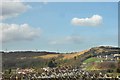
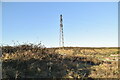
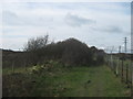
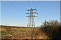
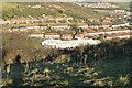
Nearby Images from Geograph Britain and Ireland:
©2008(licence)
©2023(licence)
©2011(licence)
©2023(licence)
©2023(licence)
The above images may not be of the site on this page, they are loaded from Geograph.
Please Submit an Image of this site or go out and take one for us!
Click here to see more info for this site
Nearby sites
Key: Red: member's photo, Blue: 3rd party photo, Yellow: other image, Green: no photo - please go there and take one, Grey: site destroyed
Download sites to:
KML (Google Earth)
GPX (GPS waypoints)
CSV (Garmin/Navman)
CSV (Excel)
To unlock full downloads you need to sign up as a Contributory Member. Otherwise downloads are limited to 50 sites.
Turn off the page maps and other distractions
Nearby sites listing. In the following links * = Image available
2.2km E 92° Lady Well (Dover) Holy Well or Sacred Spring (TR317417)
2.3km ESE 102° Dover Museum* Museum (TR318413)
2.7km N 354° Lousyberry Wood Tumuli* Barrow Cemetery (TR29114432)
3.0km E 88° Harold's Well Holy Well or Sacred Spring (TR325419)
3.1km E 90° Dover Castle* Hillfort (TR3262941822)
3.2km W 278° Moseling's Hole Denehole Ancient Mine, Quarry or other Industry (TR26324199)
3.4km NW 310° Minnis Barrows Round Barrow(s) (TR26834375)
3.8km NNW 328° Little Watersend Barrow Round Barrow(s) (TR27394477)
4.6km SW 230° Capel-le-Ferne Bowl Barrow* Round Barrow(s) (TR26113860)
5.0km NNW 334° Stonehall Deneholes Ancient Mine, Quarry or other Industry (TR27104603)
6.0km N 7° White Caps Barrow Round Barrow(s) (TR30034766)
6.7km WNW 293° St John's Well (Swingfield) Holy Well or Sacred Spring (TR23224401)
7.0km ENE 70° St. Margaret's at Cliffe Barrows Round Barrow(s) (TR360443)
7.4km ENE 70° Bay Hill Barrow Round Barrow(s) (TR36414449)
8.1km WSW 247° Sugerloaf Hill Holy Well Holy Well or Sacred Spring (TR222382)
8.2km W 278° Little Foxholt Barrows Round Barrow(s) (TR21284239)
8.6km WSW 247° Castle Hill Barrows Round Barrow(s) (TR21723798)
8.6km ENE 62° St Margaret's Bay Barrow Round Barrow(s) (TR36914609)
8.7km SW 231° Folkestone moot stones* Marker Stone (TR22963589)
8.8km NE 55° Ringwould Barrows* Round Barrow(s) (TR36474706)
8.9km ENE 58° Ringwould Barrow Round Barrow(s) (TR36834673)
8.9km WSW 248° Caesar's Camp (Folkstone)* Hillfort (TR214379)
9.3km NNW 332° Rubury Butts* Barrow Cemetery (TR24724962)
9.4km WSW 250° Cherry Garden Hill Barrow* Round Barrow(s) (TR20833801)
10.0km N 355° Nonington Barrow Cemetary Barrow Cemetery (TR28185160)
View more nearby sites and additional images


 We would like to know more about this location. Please feel free to add a brief description and any relevant information in your own language.
 Wir möchten mehr über diese Stätte erfahren. Bitte zögern Sie nicht, eine kurze Beschreibung und relevante Informationen in Deutsch hinzuzufügen.
 Nous aimerions en savoir encore un peu sur les lieux. S'il vous plaît n'hesitez pas à ajouter une courte description et tous les renseignements pertinents dans votre propre langue.
 Quisieramos informarnos un poco más de las lugares. No dude en añadir una breve descripción y otros datos relevantes en su propio idioma.