


<< Our Photo Pages >> Lousyberry Wood Tumuli - Barrow Cemetery in England in Kent
Submitted by coldrum on Sunday, 04 May 2008 Page Views: 5972
Neolithic and Bronze AgeSite Name: Lousyberry Wood TumuliCountry: England
NOTE: This site is 0.403 km away from the location you searched for.
County: Kent Type: Barrow Cemetery
Nearest Town: Temple Ewell
Map Ref: TR29114432
Latitude: 51.152249N Longitude: 1.274725E
Condition:
| 5 | Perfect |
| 4 | Almost Perfect |
| 3 | Reasonable but with some damage |
| 2 | Ruined but still recognisable as an ancient site |
| 1 | Pretty much destroyed, possibly visible as crop marks |
| 0 | No data. |
| -1 | Completely destroyed |
| 5 | Superb |
| 4 | Good |
| 3 | Ordinary |
| 2 | Not Good |
| 1 | Awful |
| 0 | No data. |
| 5 | Can be driven to, probably with disabled access |
| 4 | Short walk on a footpath |
| 3 | Requiring a bit more of a walk |
| 2 | A long walk |
| 1 | In the middle of nowhere, a nightmare to find |
| 0 | No data. |
| 5 | co-ordinates taken by GPS or official recorded co-ordinates |
| 4 | co-ordinates scaled from a detailed map |
| 3 | co-ordinates scaled from a bad map |
| 2 | co-ordinates of the nearest village |
| 1 | co-ordinates of the nearest town |
| 0 | no data |
Be the first person to rate this site - see the 'Contribute!' box in the right hand menu.
Internal Links:
External Links:
I have visited· I would like to visit
Brian_Eyes visited on 29th Dec 2017 - their rating: Cond: 2 Amb: 4 Access: 4 Possibly important to note that Kent Archaeology dates these barrows to the Anglo-Saxon period so not prehistoric.
I had my chauffeur waiting so I couldn't explore properly, in my short visit it was difficult to count the barrows as it looked like some may have had trenches cut through the top of them, dividing them in two. also trenches to the side of them and what looked like half of one (or two) barrows had been cut away revealing what might possibly be a layer of chalk rubble used in the construction of the barrow (or it might just occur naturally there).
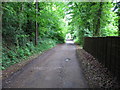
The location is atmospheric, high on a hill with wind whistling though the trees and intimations of mortality despite a nearby house and some rubbish strewn around.
")
From Exploring Kent's Past:
"There are three tumuli in Lousyberry Wood, about half a mile east of Ewell, near Dover which are probably the "several tumuli" referred to by Hasted , "some of which were lately opened, and in each of them was found a skeleton, a sword about three feet long and two inches broad, and the head of a spear".
They all bear traces of having been opened, and have trees growing upon them, but otherwise they are in fair condition. There are no visible ditches. `A': TR 29064428. Measures 17.0m N-S by 15.0m transversely and is 1.7m in maximum height. There is a large shallow depression in the centre. `B': TR 29144435. Measures 10.0m NE-SW by 9.0m transversely and is 0.7m high. `C': TR 29164436. Measures 14.0m NE-SW by 11.0m transversely and is 1.0m high. There are traces of excavation in the SW quadrant."
Exploring Kent's Past.
You may be viewing yesterday's version of this page. To see the most up to date information please register for a free account.
")
")
")
Do not use the above information on other web sites or publications without permission of the contributor.
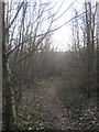
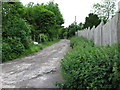
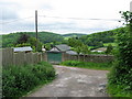
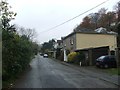
Nearby Images from Geograph Britain and Ireland:
©2011(licence)
©2009(licence)
©2009(licence)
©2014(licence)
©2009(licence)
The above images may not be of the site on this page, they are loaded from Geograph.
Please Submit an Image of this site or go out and take one for us!
Click here to see more info for this site
Nearby sites
Key: Red: member's photo, Blue: 3rd party photo, Yellow: other image, Green: no photo - please go there and take one, Grey: site destroyed
Download sites to:
KML (Google Earth)
GPX (GPS waypoints)
CSV (Garmin/Navman)
CSV (Excel)
To unlock full downloads you need to sign up as a Contributory Member. Otherwise downloads are limited to 50 sites.
Turn off the page maps and other distractions
Nearby sites listing. In the following links * = Image available
1.8km WNW 287° Little Watersend Barrow Round Barrow(s) (TR27394477)
2.3km WSW 258° Minnis Barrows Round Barrow(s) (TR26834375)
2.6km NW 313° Stonehall Deneholes Ancient Mine, Quarry or other Industry (TR27104603)
2.7km S 174° Whinless Down Barrows Round Barrow(s) (TR29514167)
3.5km NNE 18° White Caps Barrow Round Barrow(s) (TR30034766)
3.6km SW 233° Moseling's Hole Denehole Ancient Mine, Quarry or other Industry (TR26324199)
3.7km SE 138° Lady Well (Dover) Holy Well or Sacred Spring (TR317417)
4.0km SE 141° Dover Museum* Museum (TR318413)
4.2km SE 128° Harold's Well Holy Well or Sacred Spring (TR325419)
4.3km SE 128° Dover Castle* Hillfort (TR3262941822)
5.9km W 270° St John's Well (Swingfield) Holy Well or Sacred Spring (TR23224401)
6.4km SSW 210° Capel-le-Ferne Bowl Barrow* Round Barrow(s) (TR26113860)
6.9km E 93° St. Margaret's at Cliffe Barrows Round Barrow(s) (TR360443)
6.9km NW 323° Rubury Butts* Barrow Cemetery (TR24724962)
7.3km E 91° Bay Hill Barrow Round Barrow(s) (TR36414449)
7.3km N 355° Nonington Barrow Cemetary Barrow Cemetery (TR28185160)
7.8km ENE 72° Ringwould Barrows* Round Barrow(s) (TR36474706)
8.0km E 80° St Margaret's Bay Barrow Round Barrow(s) (TR36914609)
8.0km WSW 259° Little Foxholt Barrows Round Barrow(s) (TR21284239)
8.1km ENE 75° Ringwould Barrow Round Barrow(s) (TR36834673)
8.3km N 2° Eastry Barrow* Round Barrow(s) (TR28965259)
8.6km N 3° Shingleton Barrows* Round Barrow(s) (TR29185290)
9.2km SW 231° Sugerloaf Hill Holy Well Holy Well or Sacred Spring (TR222382)
9.4km NW 313° Barham Downs Barrows Round Barrow(s) (TR21995047)
9.5km ENE 70° The Blue Well Holy Well or Sacred Spring (TR379480)
View more nearby sites and additional images


 We would like to know more about this location. Please feel free to add a brief description and any relevant information in your own language.
 Wir möchten mehr über diese Stätte erfahren. Bitte zögern Sie nicht, eine kurze Beschreibung und relevante Informationen in Deutsch hinzuzufügen.
 Nous aimerions en savoir encore un peu sur les lieux. S'il vous plaît n'hesitez pas à ajouter une courte description et tous les renseignements pertinents dans votre propre langue.
 Quisieramos informarnos un poco más de las lugares. No dude en añadir una breve descripción y otros datos relevantes en su propio idioma.