

<< Text Pages >> Tumulus d'Angerville - Round Barrow(s) in France in Normandie:Eure (27)
Submitted by holger_rix on Saturday, 16 April 2016 Page Views: 996
Neolithic and Bronze AgeSite Name: Tumulus d'Angerville Alternative Name: Tumulus du Bois de la LuneCountry: France
NOTE: This site is 1.557 km away from the location you searched for.
Département: Normandie:Eure (27) Type: Round Barrow(s)
Nearest Town: Évreux Nearest Village: Angerville-la-Campagne
Latitude: 48.987200N Longitude: 1.158000E
Condition:
| 5 | Perfect |
| 4 | Almost Perfect |
| 3 | Reasonable but with some damage |
| 2 | Ruined but still recognisable as an ancient site |
| 1 | Pretty much destroyed, possibly visible as crop marks |
| 0 | No data. |
| -1 | Completely destroyed |
| 5 | Superb |
| 4 | Good |
| 3 | Ordinary |
| 2 | Not Good |
| 1 | Awful |
| 0 | No data. |
| 5 | Can be driven to, probably with disabled access |
| 4 | Short walk on a footpath |
| 3 | Requiring a bit more of a walk |
| 2 | A long walk |
| 1 | In the middle of nowhere, a nightmare to find |
| 0 | No data. |
| 5 | co-ordinates taken by GPS or official recorded co-ordinates |
| 4 | co-ordinates scaled from a detailed map |
| 3 | co-ordinates scaled from a bad map |
| 2 | co-ordinates of the nearest village |
| 1 | co-ordinates of the nearest town |
| 0 | no data |
Be the first person to rate this site - see the 'Contribute!' box in the right hand menu.
Internal Links:
External Links:
Round Barrow(s) in Normandie:Eure (27)
Angerville-la-Campagne, Évreux, Eure, Normandie
Source: Wikipedia article
Sites mégalithiques de l'Eure
Picture:
www.t4t35.fr
You may be viewing yesterday's version of this page. To see the most up to date information please register for a free account.
Do not use the above information on other web sites or publications without permission of the contributor.
Nearby Images from Flickr
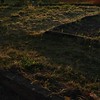


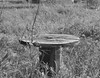
The above images may not be of the site on this page, but were taken nearby. They are loaded from Flickr so please click on them for image credits.
Click here to see more info for this site
Nearby sites
Click here to view sites on an interactive map of the areaKey: Red: member's photo, Blue: 3rd party photo, Yellow: other image, Green: no photo - please go there and take one, Grey: site destroyed
Download sites to:
KML (Google Earth)
GPX (GPS waypoints)
CSV (Garmin/Navman)
CSV (Excel)
To unlock full downloads you need to sign up as a Contributory Member. Otherwise downloads are limited to 50 sites.
Turn off the page maps and other distractions
Nearby sites listing. In the following links * = Image available
4.1km N 352° Musée de l'Ancien-Evêché* Museum
6.1km SW 222° Fosse funéraire des Bruyères* Passage Grave
6.2km SW 223° Alignement des Bruyères* Stone Row / Alignment
7.2km WSW 248° Dolmen de l'Hôtel-Dieu* Burial Chamber or Dolmen
7.9km SW 231° La Pierre Courcoulée (Ventes)* Burial Chamber or Dolmen
12.2km E 91° Menhir dit le Caillou de Gargantua Standing Stone (Menhir)
12.6km SSW 211° Dolmen dit la Pierre Lée Burial Chamber or Dolmen
16.9km ENE 62° Houlbec-Cocherel burial chamber Burial Chamber or Dolmen
18.7km N 8° Dolmen de la Croix (Acquigny) Burial Chamber or Dolmen
20.2km E 96° Pierre Frite de Breuilpont Standing Stone (Menhir)
21.8km N 6° Allée Couverte de Pinterville Passage Grave
22.2km ESE 113° Garennes-sur-Eure Menhir* Standing Stone (Menhir)
22.5km SE 138° Dolmen dit Gravier de Gargantua 1 Burial Chamber or Dolmen
22.5km SE 138° Dolmen dit Gravier de Gargantua 2 Burial Chamber or Dolmen
22.9km N 349° Dolmen de La Croix Blanche (Eure)* Burial Chamber or Dolmen
23.6km SE 141° Fort Harrouard* Ancient Village or Settlement
23.8km NNE 31° Aubevoye Dolmen Burial Chamber or Dolmen
23.9km SE 142° Dolmen de la Ferme Brûlée* Burial Chamber or Dolmen
24.3km NNE 13° Monolithe de la Croix Roger Ancient Cross
24.3km SSW 192° Acon burial chamber Burial Chamber or Dolmen
24.3km S 180° Dolmen Le Menillet Burial Chamber or Dolmen
24.4km SW 215° Pierre de la Goue* Standing Stone (Menhir)
24.5km NE 55° St-Pierre-d'Autils grotte sepulchral Cave or Rock Shelter
25.1km NE 54° Trou aux Anglais (St-Pierre-d'Autils) Ancient Village or Settlement
25.2km S 190° Nécropole Dolménique des Prés d'Acon Burial Chamber or Dolmen
View more nearby sites and additional images


 We would like to know more about this location. Please feel free to add a brief description and any relevant information in your own language.
 Wir möchten mehr über diese Stätte erfahren. Bitte zögern Sie nicht, eine kurze Beschreibung und relevante Informationen in Deutsch hinzuzufügen.
 Nous aimerions en savoir encore un peu sur les lieux. S'il vous plaît n'hesitez pas à ajouter une courte description et tous les renseignements pertinents dans votre propre langue.
 Quisieramos informarnos un poco más de las lugares. No dude en añadir una breve descripción y otros datos relevantes en su propio idioma.